Beschreibung
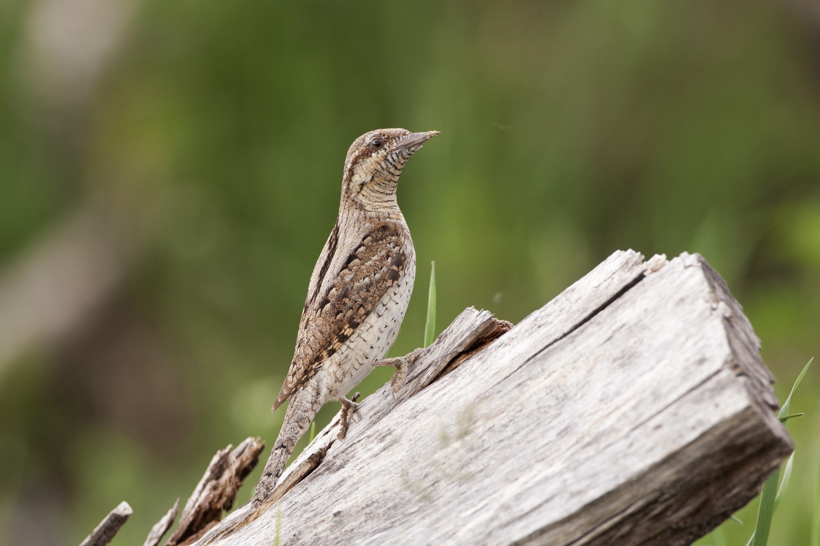
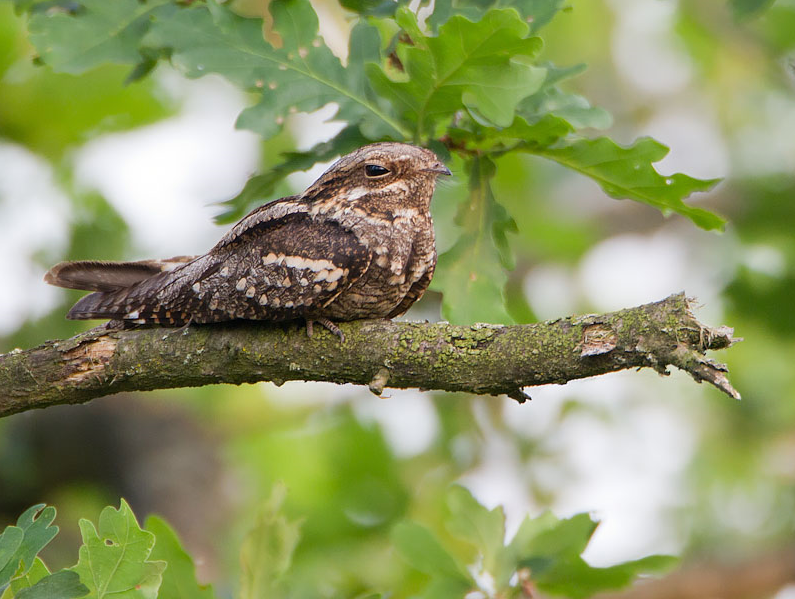
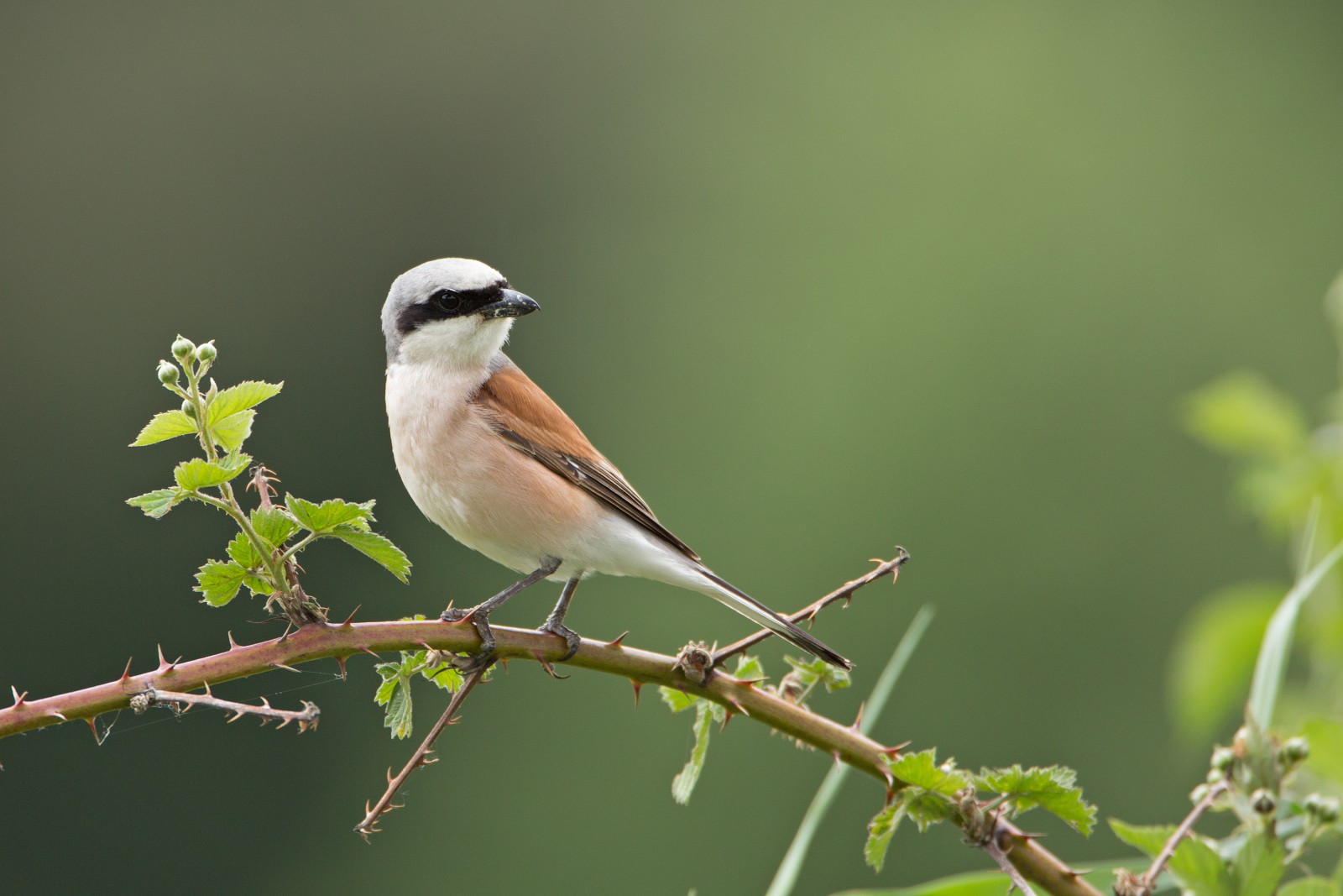
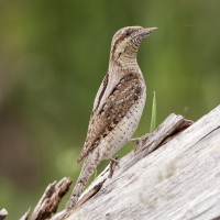
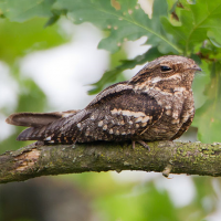
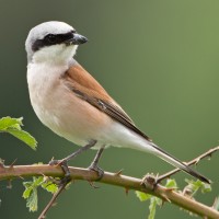
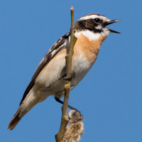
The Longeyroux bog is rich in biodiversity. Because of the altitude (more than 900 meters here), the cool and humid climate and the presence of a waterproof granite layer, the conditions are perfect for forming peat. A very slow process of about two centimetres per century. This bog is very specific ecosystem and a paradise for hundreds of rare species. Among the birds you can see here are Wendehals, Ziegenmelker, Braunkehlchen, Schwarzspecht, Neuntöter, Wespenbussard and Schlangenadler. Apart from the birding, it's an attractive area for hiking.
_________________________
Français: La tourbière de Longeyroux est riche en biodiversité. En raison de l'altitude (plus de 900 mètres ici), du climat frais et humide et de la présence d'une couche de granit imperméable, les conditions sont parfaites pour former de la tourbe. Un processus très lent d'environ deux centimètres par siècle. Cette tourbière est un écosystème très spécifique et un paradis pour des centaines d'espèces rares. Parmi les oiseaux que vous pouvez voir ici sont Wendehals, Ziegenmelker, Braunkehlchen, Schwarzspecht, Neuntöter, Wespenbussard et Schlangenadler. Hormis l'observation des oiseaux, c'est une région attrayante pour la randonnée.
Details
Zugang
The area is located in Upper Corrèze, 1 hour from Tulle, by RN 89 or by the A89, towards Clermont Ferrand, exit 23 Meymac. There is a parking overlooking the bog on the edge of the D109 (See the P on the map). From the parking lot there starts an educational boardwalk trail of 1 km. But you can also make a bigger loop of 9 km (Le sentier de la bruyère or the Heather Trail), signposted by pink markers. Both trails are shown on the map.
_________________________
Français: Le domaine est situé en Haute Corrèze, à 1 heure de Tulle, par la RN 89 ou par l'A89, direction Clermont Ferrand, sortie 23 Meymac. Il y a un parking donnant sur la tourbière en bordure de la D109 (Voir le P sur la carte). Du parking commence un sentier pédestre éducatif de 1 km. Mais vous pouvez aussi faire une boucle plus large de 9 km (Le sentier de la bruyère), balisée par des balises roses. Les deux sentiers sont indiqués sur la carte.

 ) Tragen Sie die Vogelnamen in Ihrer Sprache ein. Sie werden automatisch für andere Nutzer übersetzt!