-Oerdblinkert, Ameland, Friesland (1).JPG)
-Oerdblinkert, Ameland, Friesland (3).JPG)
Descripción
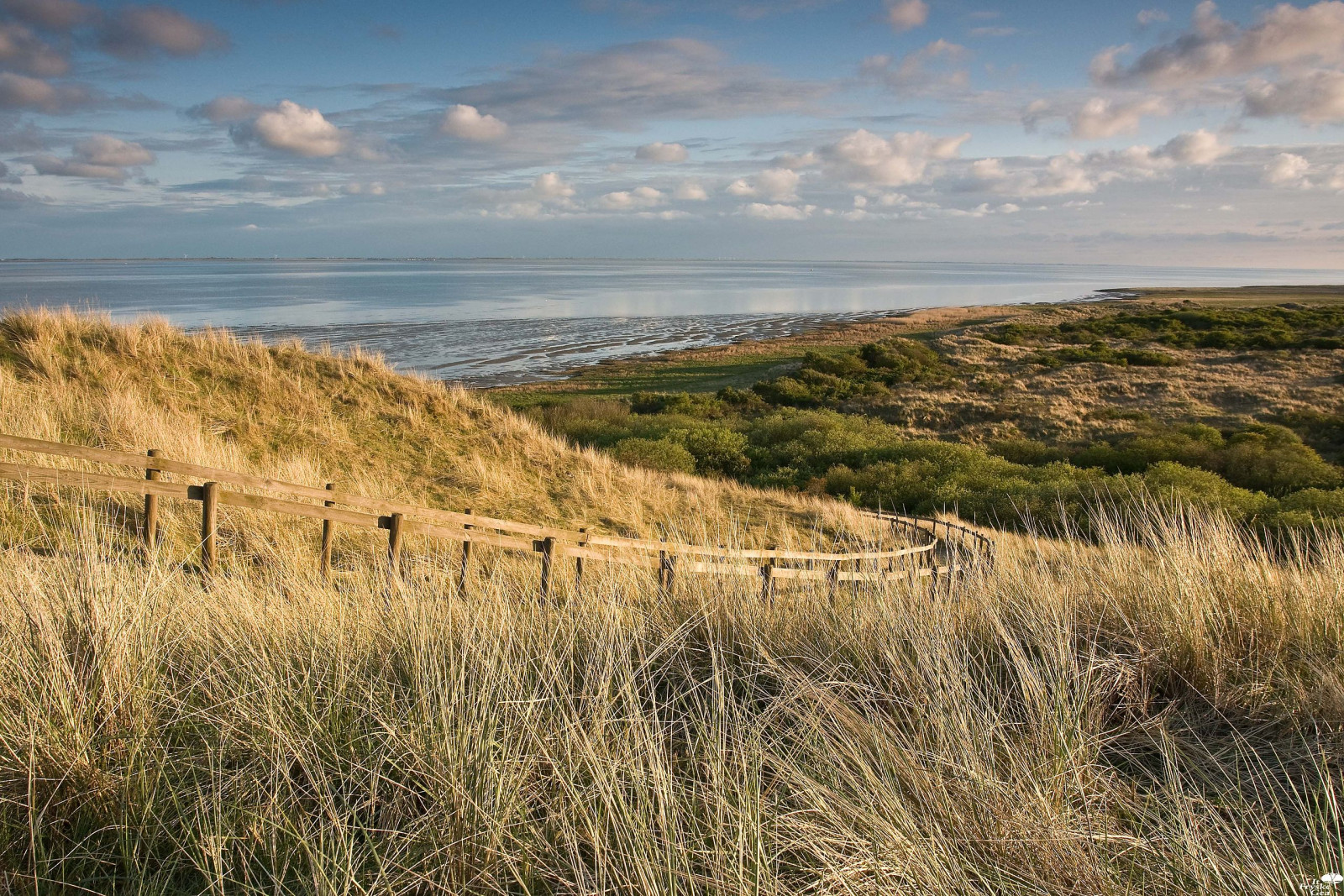
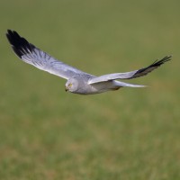
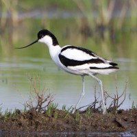
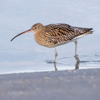
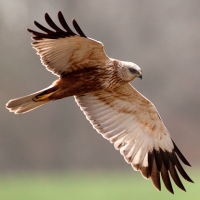
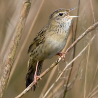
The Oerd is a relatively extensive nature reserve on the east side of the Dutch Wadden Sea island of Ameland. It is an old and overgrown dune complex, of which the Oerdblinkert with 24 meters is the highest dune on the island. At the foot of this is a hide, at the top is an information panel and an orientation table. The landscape consists of old high dunes and moist dune valleys where the seawater flows in and out freely through channels. Many types of birds, both migratory and breeding birds. In the eastern part of the old dunes is a huge Gaviota argéntea europea colony with about 3,000 pairs. The Gaviota Cana also has some breeding colonies there. Other breeding birds include Aguilucho pálido, Zarapito Real, Avoceta Común, Charrán Común, Collalba Gris and Buscarla Pintoja.
_________________________
Nederlands: Het Oerd is een relatief omvangrijk natuurgebied aan de oostzijde van het Nederlandse waddeneiland Ameland. Het is een oud en begroeid duinencomplex, waarvan de Oerdblinkert met 24 meter het hoogste duin van het eiland is. Aan de voet hiervan staat een schuilhut, op de top staat een informatiepaneel en een oriëntatietafel. Dit is een goede plek om kiekendieven te zien jagen. Met wat geluk heb je ook kans om hier een velduil te zien. Het landschap bestaat uit oude hoge duinen, kwelders en vochtige duinvalleien waar het zeewater via geulen vrij in- en uitstroomt. Veel soorten vogels, zowel trekvogels als broedvogels. In het oostelijke gedeelte van de oude duinen zit een enorme zilvermeeuwkolonie met zo'n 3000 paren. Ook de stormmeeuw heeft er enkele broedkolonies. Andere broedvogels zijn onder meer de blauwe en bruine kiekendief, wulp, kluut, visdief, tapuit en sprinkhaanzanger.
Detalles
Accesso
Only accessible by bike or on foot. On the map you see a circular walk of 4 km through the Oerd area wich also passes the Oerdblinkert.
_________________________
Nederlands: Alleen bereikbaar met de fiets of lopend. Op de kaart zie je een rondwandeling van 4 km door het gebied die ook langs de Oerdblinkert loopt.
 ) insertar los nombres de aves en tu propio idioma. ¡Los nombres de las aves serán traducidos automáticamente para otros usuarios!