Beschreibung
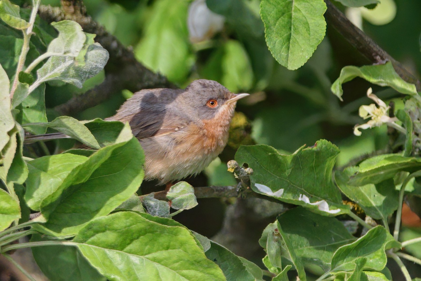
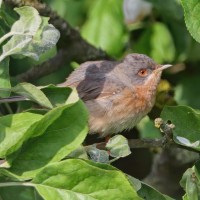
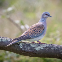
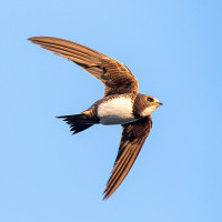
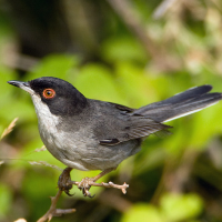
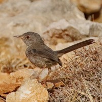
The Lacona Peninsula is characterised by wooded and open areas as well as coastal habitats. Thanks to the different types of vegetation, a wide variety of bird species from different habitats can be observed here. In addition, several hiking trails invite you to hike and linger. If you are looking for the typical warblers such as Samtkopf-Grasmücke, Sardengrasmücke and Ligurien-Bartgrasmücke, you will definitely find them here.
_________________________
Italiano: Penisola situata nella parte meridionale dell'Isola d'Elba. Il territorio si distingue per l'alternanza di boschi e aree aperte, incorniciati dallo splendido litorale.
La Penisola di Lacona è caratterizzata da aree boschive, spazi aperti e habitat costieri. Grazie alla varietà della vegetazione, qui è possibile osservare una grande diversità di specie ornitologiche provenienti da ambienti differenti. Inoltre, numerosi sentieri escursionistici invitano a camminare e a godersi la natura circostante.
Details
Zugang
The Lacona peninsula is located in the southern side of Elba Island, south of the village of Lacona. The best way to access the peninsula is on foot. Some hiking trails are also accessible by bicycle, but not all of them. The trail that is shown on the map is about 3 km one way. You can park in the village or a the small parking spot at the beginning of the trail. Press P on the map for directions to the parking spot.
_________________________
Italiano: La penisola di Lacona si trova sul versante meridionale dell'Isola d'Elba, a sud dell'omonimo abitato di Lacona. Il modo migliore per esplorare la penisola è a piedi. Alcuni sentieri sono accessibili anche in bicicletta, ma non tutti. L'itinerario indicato sulla mappa è lungo circa 3 km (sola andata). È possibile parcheggiare in paese o nel piccolo spiazzo all'inizio del sentiero. Clicca sulla 'P' nella mappa per ottenere le indicazioni stradali per il parcheggio.
 ) Tragen Sie die Vogelnamen in Ihrer Sprache ein. Sie werden automatisch für andere Nutzer übersetzt!