Beschreibung
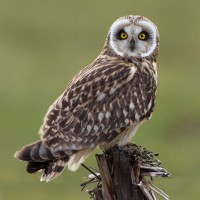
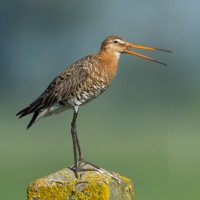
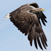
At the center of the site is a number of large lakes, once used as gravel pits. Just to the East is Swineham Point overlooking saltmarsh, reedbeds and Wareham Channel. The large area of water meadows are prone to flooding following long periods of rain, especially in Winter. The old gravel pits can hold Graugans, Kanadagans, Pfeifente, Schnatterente, Krickente, Löffelente, Reiherente, Bläßhuhn, Zwergtaucher, Haubentaucher, Spießente, Tafelente, Bergente, Rothalstaucher, Ohrentaucher and the occasional Sterntaucher. At low tide Wareham Channel holds feeding Alpenstrandläufer, Großer Brachvogel, Rotschenkel, Austernfischer, Kiebitzregenpfeifer, Grünschenkel, Säbelschnäbler and Uferschnepfe many of which use the water meadows as a high tide roost. Check all Gull (Laridae) flocks carefully for more unusual species such as Mittelmeermöwe and Ringschnabelmöwe. The Wareham Channel is known for both Fischadler and Seeadler since the recent reintroductions in Poole Harbour and the Isle of Wight.
Details
Zugang
The A35 main road from Poole (just to the North East) and Bere Regis (far to the West) is North of the site, leave A35 at Bakers Arms Roundabout signed Wareham/Sandfoot/Swanage A351. Follow signs to Wareham on A351, at Saxon Roundabout (on Northern edge of Wareham) take exit on to B3075 (to town centre), at traffic lights turn Left into East Street and then first Left into Morton's Lane. In Morton's Lane take first Left into Howard's Lane, car park (Fee Payable - 4 hours maximum stay) is just on the Left. There is also a 1 or 2 car parking spot on Bestwell Road near rugby club (Press STAR on map).
BE AWARE, some roads are PRIVATE ROADS, but have pedestrian access.
Terrain und Habitat
Wald , Feuchtgebiet , See , Strand , Schlammflächen , Landwirtschaft , Stadt/Dorf , Schilfflächen , Meer , Fluss , Vereinzelte Bäume und BüscheBedingungen
Flach , Sumpfig , Rutschig , Hochwasser möglich , Offene LandschaftRundweg
JaIst ein Spektiv nützlich?
JaGute Beobachtungszeit
GanzjährigBeste Beobachtungszeit
Winter , Frühjahrszug , Frühjahr , Herbst , HerbstzugRoute
asphaltierte Straße , Normaler Weg , unbefestigte Straße , Schmaler PfadSchwierigkeitsgrad der Tour
EinfachErreichbarkeit
zu Fuß , Fahrrad , AutoBeobachtungshütten oder -türme
NeinZusätzliche Informationen
The total walking route indicated on the map is about 9 km, but also possible to split in two.
.jpg)
 ) Tragen Sie die Vogelnamen in Ihrer Sprache ein. Sie werden automatisch für andere Nutzer übersetzt!