
.jpg)
Descripción
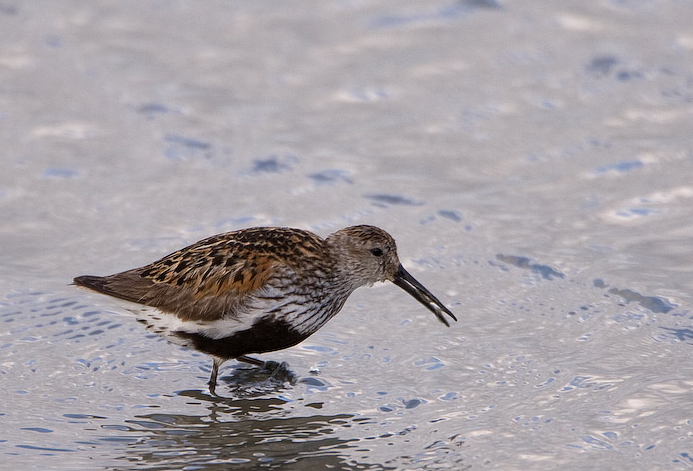
The Torpoint Peninsula area can be walked on footpaths through farmland/woodland and along roads with and without footpaths. It includes Wilcove Lake (small estuary), Jupiter Point (Royal Navy Seamanship School), the town of Torpoint itself and open farmland with a possibility of Escribano Soteño and Espátula Común throughout the walk.
Detalles
Accesso
The town of Torpoint is on the west bank of the River Tamar (at this point called the Hamoaze) reached by Pedestrian/Car ferry from The City of Plymouth. On leaving ferry continue on A374, which slowly climbs out of the town, when it flattens out turn left onto Trevol Road signposted HMS Raleigh (Naval Camp), continue on this road and look for a pull in on right just as naval camp ends (signed Horson Cemetery). Park here and continue on foot following the map. The total length of the route shown on the map is about 12 km.
Terreno y habitat
Bosque , Árboles y arbustos dispersos , Pradera , Río , Ciudad/Pueblo , Agricultura , Pisos de barro , PlayaCondiciones
Montañoso , Rocoso , Paisaje abierto , Nivel del agua alto probable , Pantanoso , ResbaladizoCamino circular
Sí¿Se necesita telescopio?
SíBuena época para el avistamiento de aves
Todo el añoMejor momento para visitar
Invierno , Verano , Migración de primavera , Primavera , Otoño , Migración de otoñoRuta
Camino pavimentado , Camino ancho , Camino estrechoCamino difícil de andar
Caminata mediaAccesible vía
A pie , Bicicleta , CocheEscondite de observación / plataforma
NoInformación extra
Pay attention to STAR ICONS in village of Wilcove.


.jpg)


 ) insertar los nombres de aves en tu propio idioma. ¡Los nombres de las aves serán traducidos automáticamente para otros usuarios!