
Charger images
Les formats d'image autorisés sont de type jpeg, png ou gif
La taille maximale du fichier doit être de 20MB
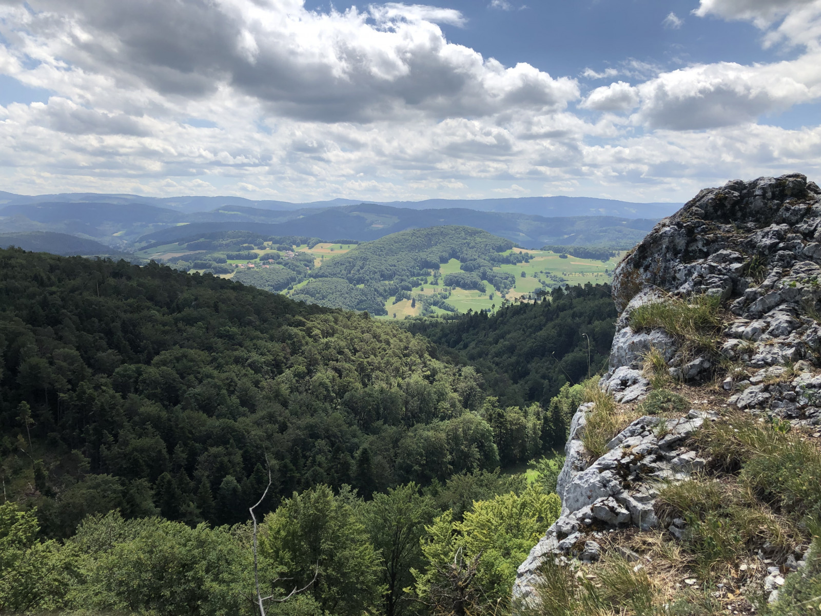
The 2 km Raemel ridge rises to 832 m, the highest point of the Alsatian Jura, reached by a scenic border trail with fine views of the Swiss Jura.
The northernmost folds of the Jura extend into the far south of Alsace, near the town of Ferrette. This area is marked by two parallel limestone ridges running from west to east - the only major limestone formations in the region - reaching heights of 680 m at Kastelberg and 812 m at Glaserberg. These ridges are the source of two rivers that have shaped the surrounding terrain: the Largue and the Ill.
The Alsatian Jura experiences a clearly alpine-type climate and retains a remarkably intact natural environment. Forests dominated by beech and fir, along with oaks, maples, lime trees and whitebeams, combine with cliffs, grasslands, calcareous meadows and streams — including the Lucelle, noted for its outstanding ecological quality — to create a rich patchwork of habitats that strongly supports biodiversity.
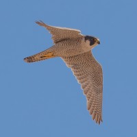
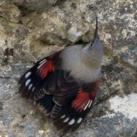
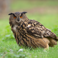
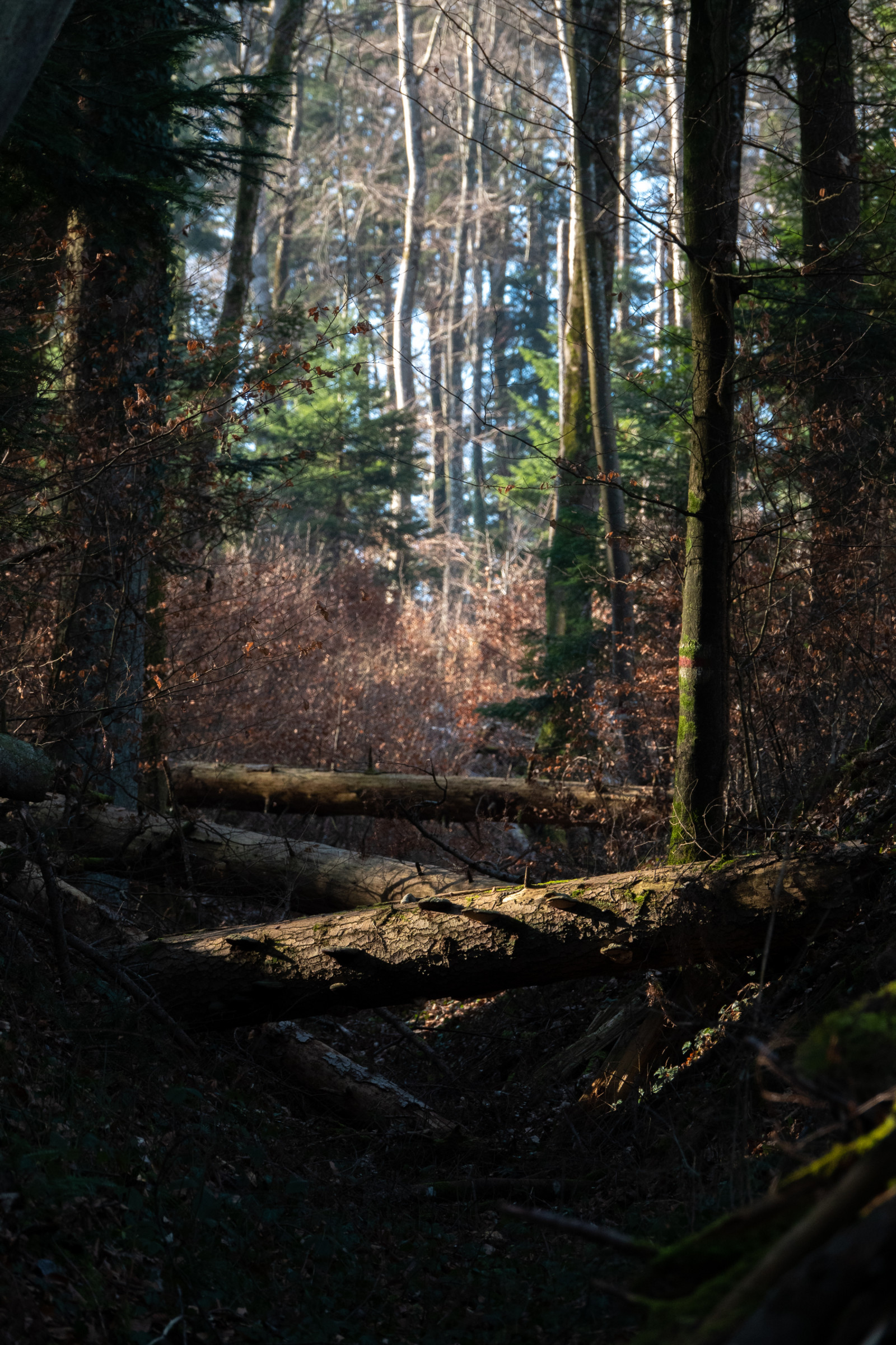
The trail leading to the Raemmel ridge, south of Wolschwiller, follows the French–Swiss border and passes through the only area in Alsace where a stable population of Pouillot de Bonelli can be found. The south-facing cliffs overlooking Switzerland provide nesting sites for Faucon pèlerin and Grand-duc d'Europe, and are also frequented by Tichodrome échelette toward the end of winter.
Wolschwiller can be reached easily by road from the main transport routes of southern Alsace. From Mulhouse, take the A36 motorway toward Belfort, exit at Altkirch, then follow the D432 toward Ferrette. Continue on the D473 in the direction of Wolschwiller. The village is also accessible from Switzerland via Porrentruy, crossing the border and following local roads toward Ferrette and Wolschwiller. Press P on the map for directions to a parking spot. The circular walking route shown on the map is about 8 km.
 ) Insérez les noms d'oiseau dans votre langue. Ils seront automatiquement traduits pour les autres usagers !
Votre feedback sera transmis à l’auteur.rice de cette zone et à l’équipe éditoriale de Birdingplaces, qui l’utiliseront pour améliorer la qualité des informations. (Vous souhaitez publier un commentaire visible en bas de page ? Fermez cette fenêtre et choisissez l’Option 1 : « Publier un commentaire, un conseil ou une observation ».)
Veuillez fournir des suggestions d'améliorations ou d'ajouts au texte de ce site ornithologique.
Veuillez fournir vos suggestions d'améliorations ou d'ajouts à la carte.
Veuillez fournir des suggestions d'améliorations ou d'ajouts à la liste des oiseaux.
Cliquez sur l'icône de l'oiseau () Insérez les noms d'oiseau dans votre langue. Ils seront automatiquement traduits pour les autres usagers !