Charger images
Les formats d'image autorisés sont de type jpeg, png ou gif
La taille maximale du fichier doit être de 20MB
The Weisendorfer Weiher offer a mix of open water and reed habitat, attracting various waterbirds and providing seasonal interest for birdwatchers.
The Weisendorfer Weiher, located in a quiet agricultural landscape, consist of several fish ponds bordered by reed beds, wet meadows, and scattered trees. The area is managed primarily for aquaculture but also serves as a habitat for a variety of bird species throughout the year. Its relatively undisturbed character and mosaic of wetland habitats make it suitable for breeding, feeding, and resting birds.
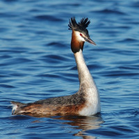
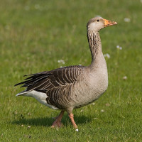
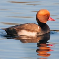
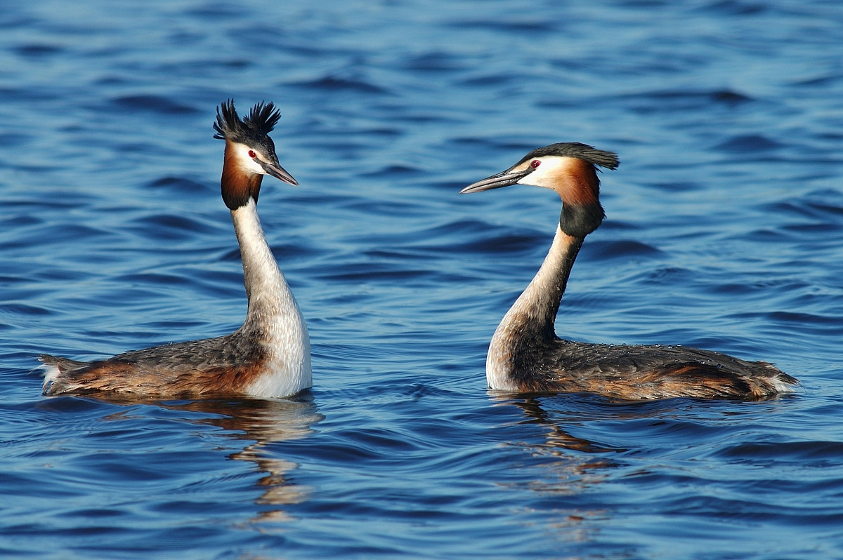
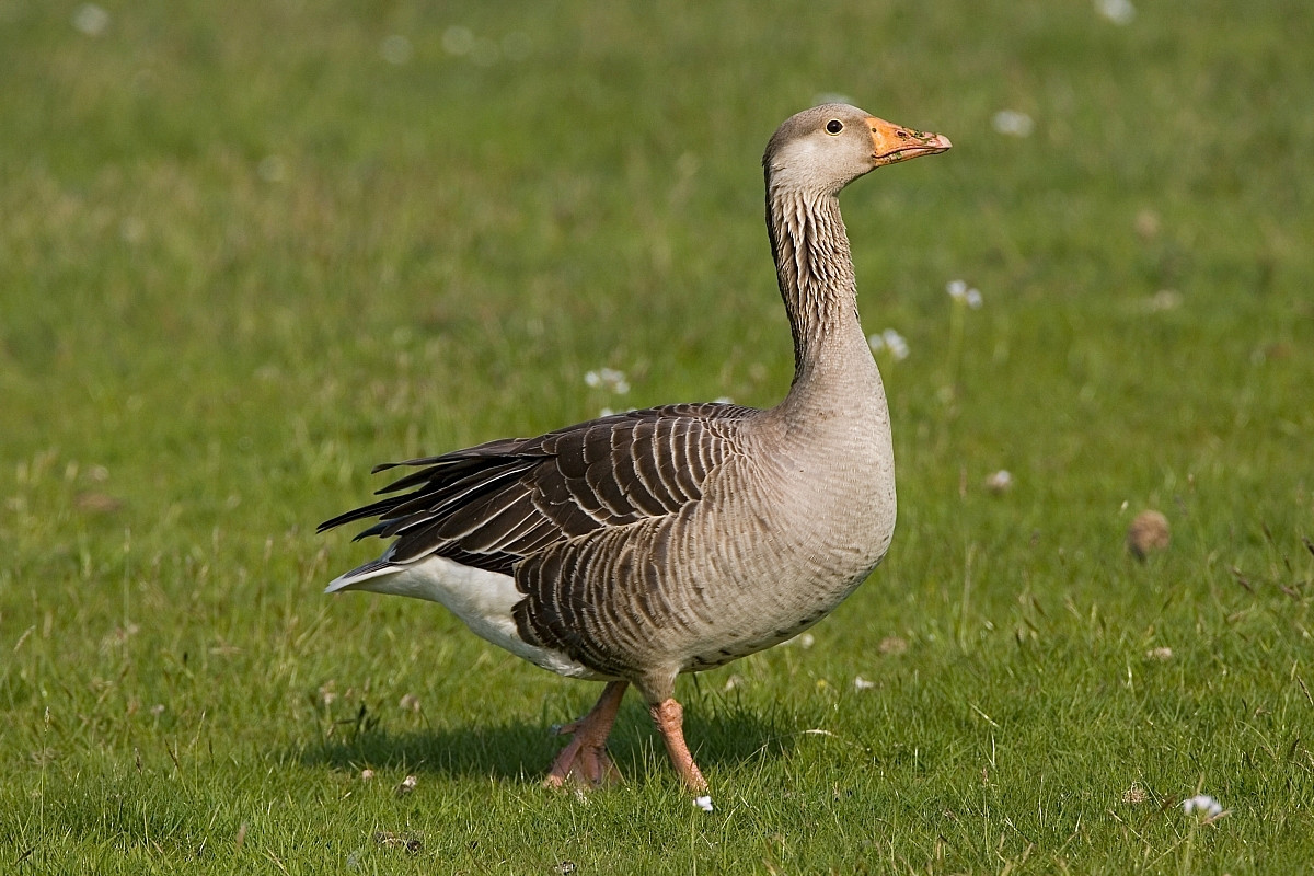
Common waterbirds such as Canard colvert, Foulque macroule, and Oie cendrée are regularly seen, along with Grèbe huppé and Héron cendré. In spring and autumn, the ponds attract migrating ducks and waders, while songbirds use the surrounding hedgerows and meadows. The reed beds provide cover for species like various warblers and Gallinule poule-d'eau during the breeding season.
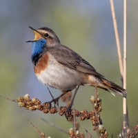
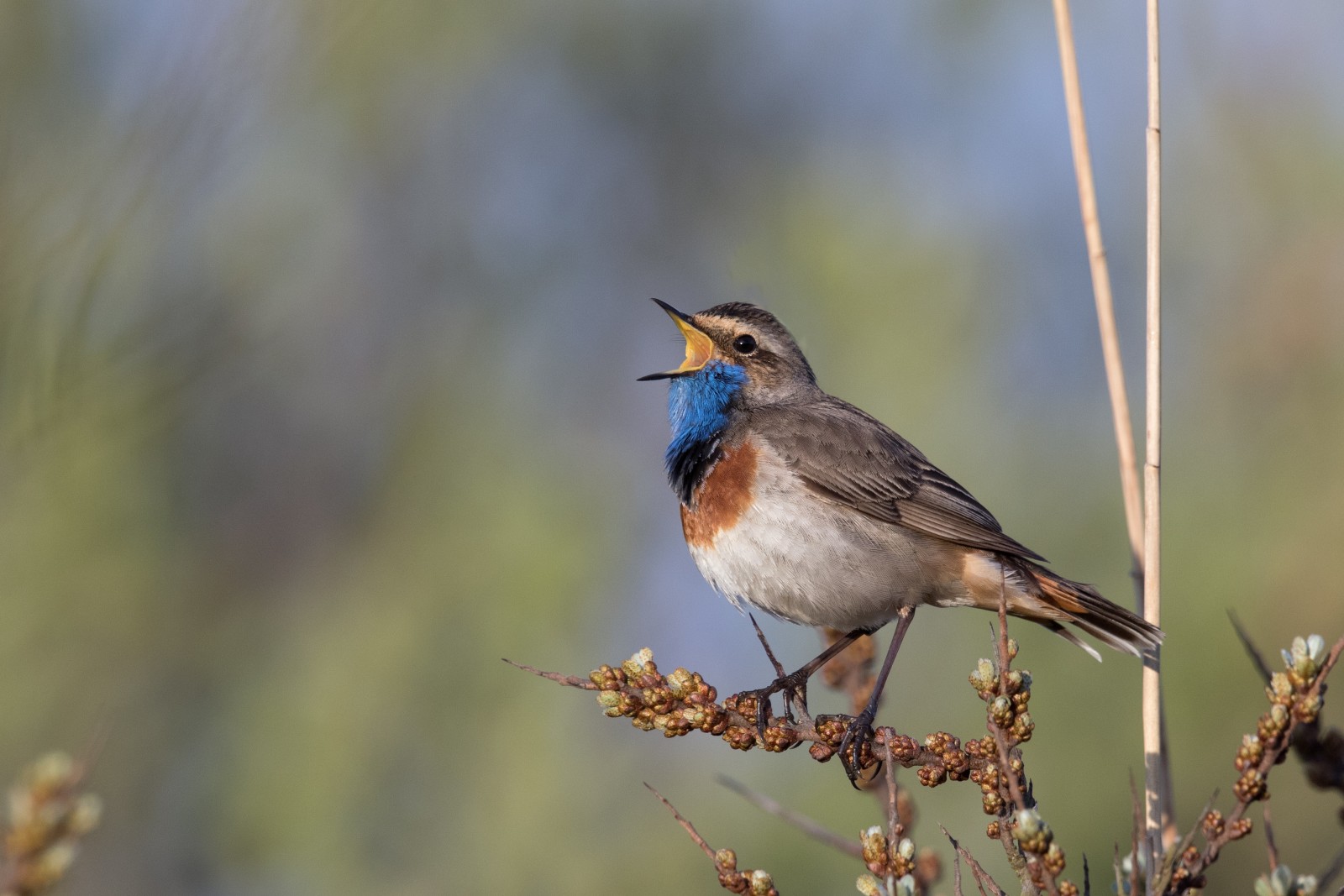
Though not a major hotspot, the Weisendorf ponds occasionally host rare or locally uncommon bird species. Sightings have included Cigogne noire, Aigrette garzette, and Sarcelle d'été during migration periods. In some years, Grèbe jougris or Marouette ponctuée have been reported. The mix of habitats also makes it a potential site for species like the Gorgebleue à miroir or Busard des roseaux, though these are not regularly observed.
The site is appreciated for its peaceful setting and moderate bird diversity, offering opportunities for observation without heavy disturbance.
The Weisendorfer Weiher are located directly north of the village of Weisendorf. The area is accessible by car or bicycle from nearby towns such as Neustadt an der Aisch or Diespeck. Parking is available in or near the village of Weisendorf. Press P on the map for directions to a parking.
From the parking, the ponds can be reached on foot via agricultural and forest tracks. There are no formal observation hides, but several paths offer good views of the water bodies and surrounding vegetation. The area is best explored quietly and respectfully, as it is actively used for fish farming. The circular walking route shown on the map is about 1,7 km.
 ) Insérez les noms d'oiseau dans votre langue. Ils seront automatiquement traduits pour les autres usagers !
Votre feedback sera transmis à l’auteur.rice de cette zone et à l’équipe éditoriale de Birdingplaces, qui l’utiliseront pour améliorer la qualité des informations. (Vous souhaitez publier un commentaire visible en bas de page ? Fermez cette fenêtre et choisissez l’Option 1 : « Publier un commentaire, un conseil ou une observation ».)
Veuillez fournir des suggestions d'améliorations ou d'ajouts au texte de ce site ornithologique.
Veuillez fournir vos suggestions d'améliorations ou d'ajouts à la carte.
Veuillez fournir des suggestions d'améliorations ou d'ajouts à la liste des oiseaux.
Cliquez sur l'icône de l'oiseau () Insérez les noms d'oiseau dans votre langue. Ils seront automatiquement traduits pour les autres usagers !