Charger images
Les formats d'image autorisés sont de type jpeg, png ou gif
La taille maximale du fichier doit être de 20MB

A rare humid lowland forest between the provinces of Ferrara and Bologna, classified as a biotope of significant vegetational interest.
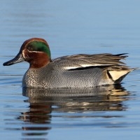
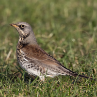
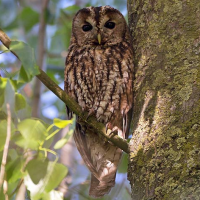
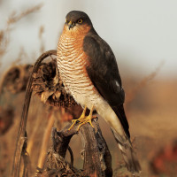
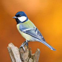
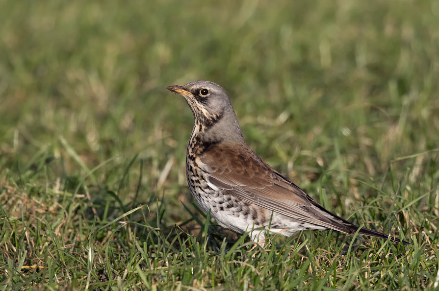
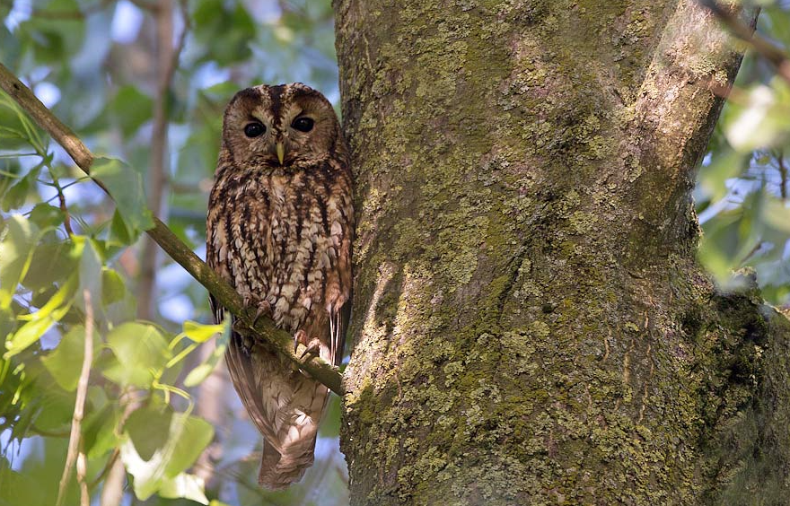
The Bosco della Panfilia is a typical and rare 81 hectare example of a humid lowland forest. Birds are the main fauna of the forest, both sedentary and migratory species. Among the nesting species are: Mésange bleue, Mésange charbonnière, Troglodyte mignon, Pie-grièche écorcheur, Alouette des champs, Huppe fasciée, Loriot d'Europe, Coucou gris, Pic vert, Pic épeiche, Torcol fourmilier and others. Linked to the humid environment there are Bouscarle de Cetti, Rousserolle turdoïde, Cisticole des joncs, Martin-pêcheur d'Europe, Gallinule poule-d'eau, Bihoreau gris, Canard colvert, Héron cendré, Foulque macroule, Blongios nain, Sarcelle d'hiver, Grande Aigrette and Aigrette garzette. Among the birds of prey there are Chouette hulotte, Effraie des clochers, Chevêche d'Athéna, Hibou moyen-duc, Buse variable, Faucon crécerelle, Épervier d'Europe, Milan noir.
_________________________
Italiano: Il Bosco della Panfilia è un raro e tipico esempio di foresta planiziale di 81ha tra le province di Ferrara e Bologna, classificato come biotopo di rilevante interesse vegetazionale. Gli uccelli sono la fauna principale del bosco, sia specie stanziali che migratorie e nidificanti.
Bosco della Panfilia can be visited all year round, but spring and autumn are best. The main entrance is along the road that runs alongside the Cavo Napoleonico, about 3 km from Sant'Agostino. Parking is near the main entrance. Press P on the map for directions. The circular walking route shown on the map is about 5 km.
_________________________
Italiano: Il bosco è visitabile in ogni stagione, ma è preferibile nei mesi primaverili e autunnali. L'entrata principale è lungo la strada che fiancheggia il Cavo Napoleonico, a circa 3km da Sant'Agostino. Il parcheggio è nei pressi dell'entrata principale. Premi P sulla mappa per le indicazioni stradali per raggiungere il parcheggio. Il percorso circolare mostrato sulla mappa è lungo circa 5 km.
 ) Insérez les noms d'oiseau dans votre langue. Ils seront automatiquement traduits pour les autres usagers !
Votre feedback sera transmis à l’auteur.rice de cette zone et à l’équipe éditoriale de Birdingplaces, qui l’utiliseront pour améliorer la qualité des informations. (Vous souhaitez publier un commentaire visible en bas de page ? Fermez cette fenêtre et choisissez l’Option 1 : « Publier un commentaire, un conseil ou une observation ».)
Veuillez fournir des suggestions d'améliorations ou d'ajouts au texte de ce site ornithologique.
Veuillez fournir vos suggestions d'améliorations ou d'ajouts à la carte.
Veuillez fournir des suggestions d'améliorations ou d'ajouts à la liste des oiseaux.
Cliquez sur l'icône de l'oiseau () Insérez les noms d'oiseau dans votre langue. Ils seront automatiquement traduits pour les autres usagers !