Charger images
Les formats d'image autorisés sont de type jpeg, png ou gif
La taille maximale du fichier doit être de 20MB
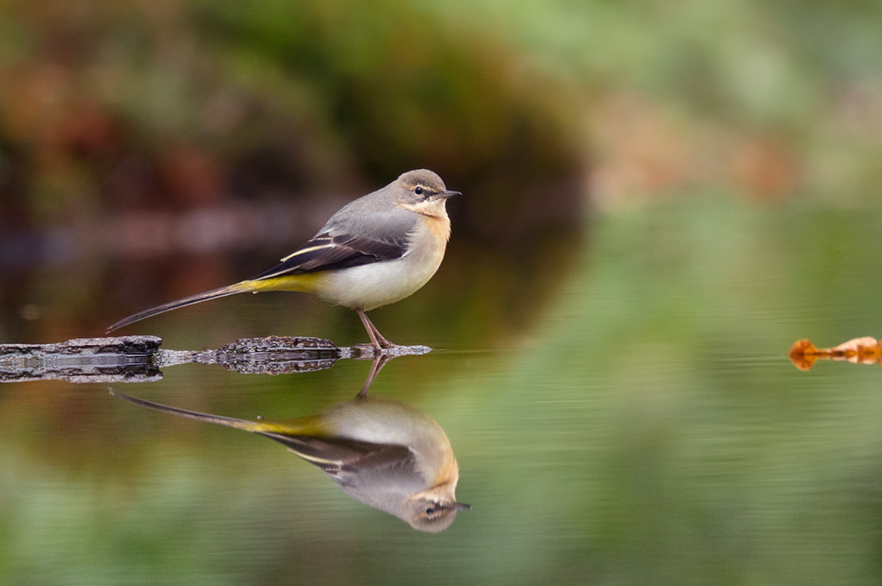
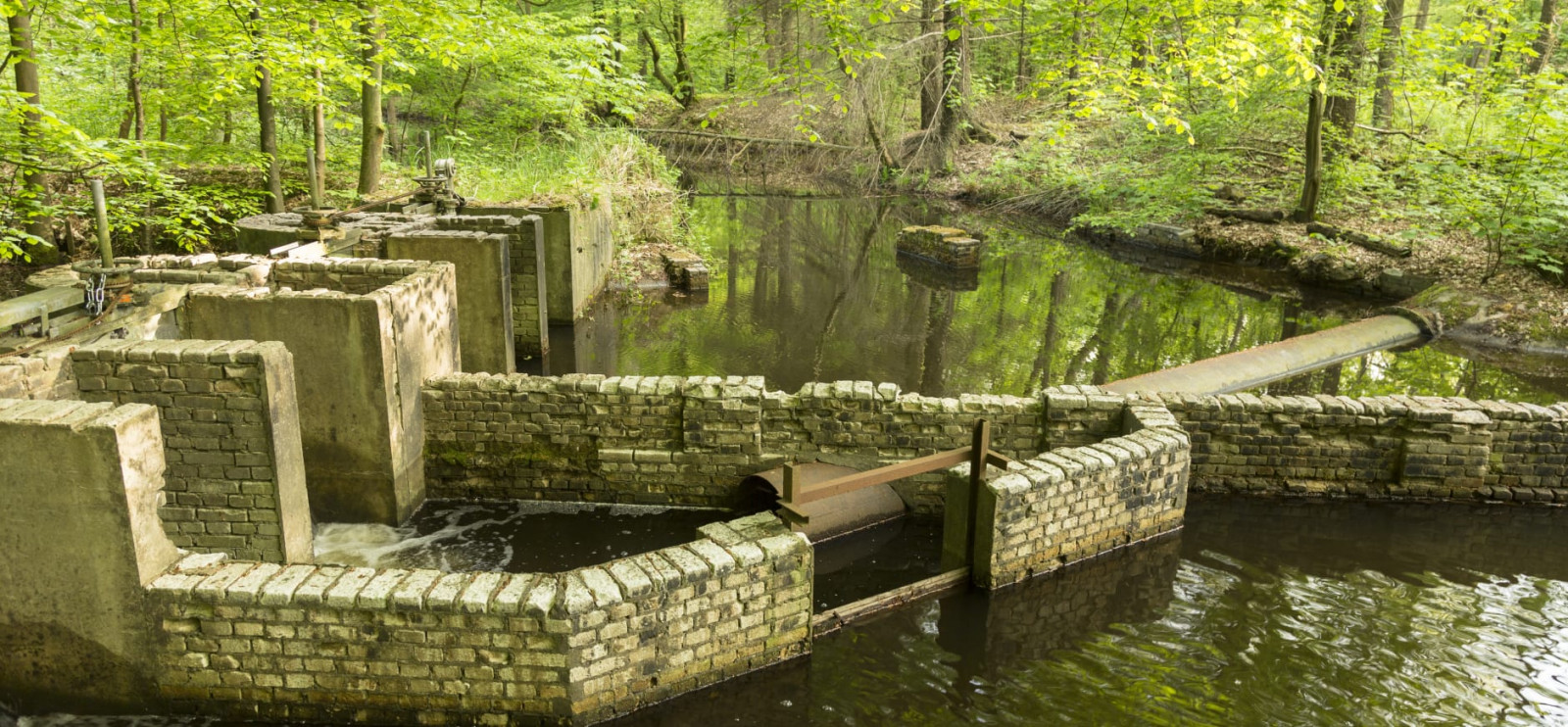
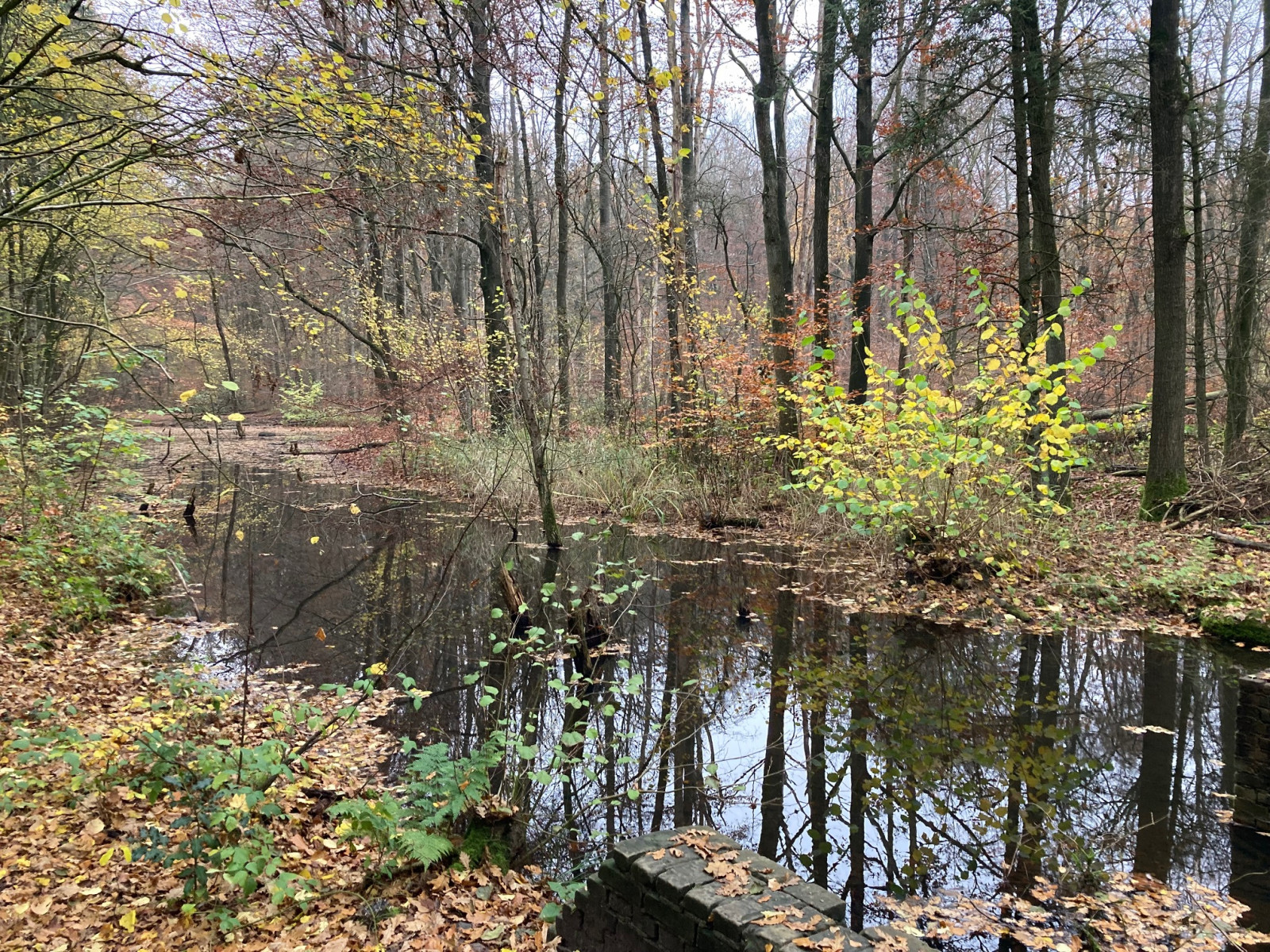
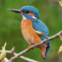
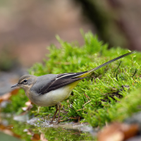
Forest full of overgrown scale models of hydraulic engineering studies. The wet forest with all its water attracts Martin-pêcheur d'Europe and Bergeronnette des ruisseaux.
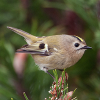
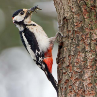
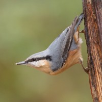
The forest of Waterloopbos is a former site for hydrological research. The area is characterized by remnants and ruins of laboratory buildings. After it lost its function as a site for large-scale test installations of flood defenses and dams, a beautiful wet forest developed. A visit is a nice combination of a cultural-historical walk and bird watching. Just make sure you get there before it gets crowded to see the most birds. Martin-pêcheur d'Europe and Bergeronnette des ruisseaux are regularly seen at the pools, ditches or along the artificial basins. Other birds that you can see here are Pic épeiche, Sittelle torchepot, Roitelet huppé, Tarin des aulnes, Grimpereau des jardins, Mésange boréale, Fauvette à tête noire and Gros-bec casse-noyaux.
_________________________
Nederlands: Het Waterloopbos is een voormalig terrein voor waterloopkundig onderzoek. Het gebied wordt gekenmerkt door restanten en ruïnes van bouwsels van het laboratorium. Nadat het zijn functie als plek voor grootschalige proefopstellingen van waterkeringen en dammen verloor ontwikkelde er zich een prachtig moerasbos. Het bos maakt deel uit maakt van het 1000 hectare grote Voorsterbos en is sinds 2002 eigendom van Natuurmonumenten. Mooie combinatie van een cultuurhistorische wandeling en vogels kijken. Zorg wel dat je er bent voordat het druk wordt anders is het aantal vogels dat je ziet laag. Regelmatig wordt er bij de poelen, sloten of langs de kunstmatige bekkens Martin-pêcheur d'Europe of Bergeronnette des ruisseaux gezien. Andere vogels die je in het bos kunt zien zijn Pic épeiche, Sittelle torchepot, Roitelet huppé, Tarin des aulnes, Grimpereau des jardins, Mésange boréale, Fauvette à tête noire en Gros-bec casse-noyaux.
The Waterloopbos is freely accessible from sunrise to sunset. Marked hiking trails lead you past the models of waterworks that lie like ruins in the forest. Easily accessible with a large car park and several signposted walking routes. The Waterloopbosroute indicated on the map below is 3 km long and marked in the area with white arrows. Note: The Waterloopbos is a popular area that attracts many visitors. To see many birds, it is therefore best to explore the forest early in the day.
_________________________
Nederlands: Het Waterloopbos is vrij toegankelijk van zonsopgang tot zonsondergang. Gemarkeerde wandelroutes leiden je langs de modellen van waterwerken die als ruïnes in het bos liggen. Gemakkelijk toegankelijk met grote parkeerplaats en dus diverse bewegwijzerde routes. De Waterloopbosroute die is aangegeven op de kaart beneden is 3 km lang en in het gebied gemarkeerd met witte pijltjes. Let op: Het Waterloopbos is een populair gebied dat veel bezoekers trekt. Om veel vogels te zien, kun je daarom het bos het best vroeg op de dag verkennen.
You can combine a visit to the Waterloopbos with the adjacent Voorsterbos, also described on Birdingplaces.
_________________________
Nederlands: Je kunt een bezoek aan het Waterloopbos combineren met het ernaast gelegen Voorsterbos, ook beschreven op Birdingplaces.
 ) Insérez les noms d'oiseau dans votre langue. Ils seront automatiquement traduits pour les autres usagers !
Votre feedback sera transmis à l’auteur.rice de cette zone et à l’équipe éditoriale de Birdingplaces, qui l’utiliseront pour améliorer la qualité des informations. (Vous souhaitez publier un commentaire visible en bas de page ? Fermez cette fenêtre et choisissez l’Option 1 : « Publier un commentaire, un conseil ou une observation ».)
Veuillez fournir des suggestions d'améliorations ou d'ajouts au texte de ce site ornithologique.
Veuillez fournir vos suggestions d'améliorations ou d'ajouts à la carte.
Veuillez fournir des suggestions d'améliorations ou d'ajouts à la liste des oiseaux.
Cliquez sur l'icône de l'oiseau () Insérez les noms d'oiseau dans votre langue. Ils seront automatiquement traduits pour les autres usagers !