Charger images
Les formats d'image autorisés sont de type jpeg, png ou gif
La taille maximale du fichier doit être de 20MB
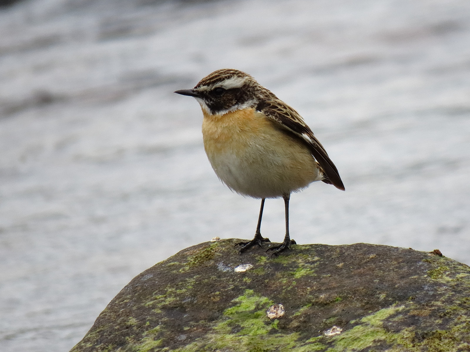
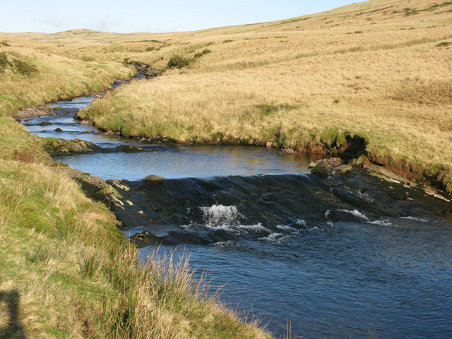
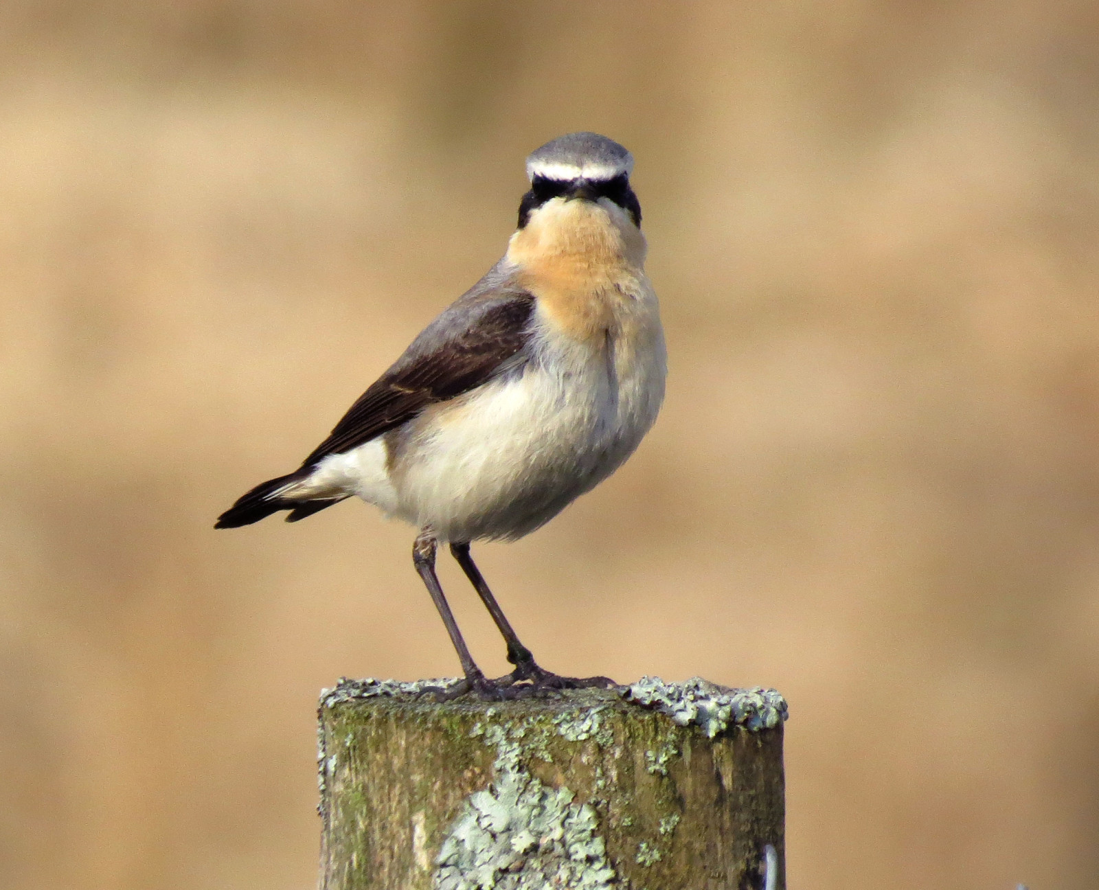
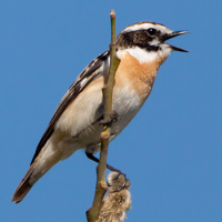
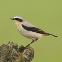
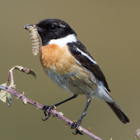
A rural road follows the course of the river Llia, a small stream. Tarier des prés, Tarier pâtre, and Traquet motteux are often seen in breeding season.
This rural road called Sarn Helen runs parallel to the Afon Llia (river Llia) for approximately 2 miles before descending steeply into a beautiful valley and ultimately crossing another small stream, the Afon Senni.
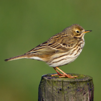
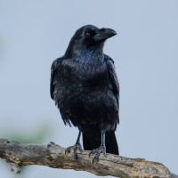
Because of its rural location, rough moorland terrain, altitude of ~400m and proximity to the stream, it is favoured by several species such as Traquet motteux, Tarier des prés, Tarier pâtre, Pipit farlouse, Milan royal and Grand Corbeau. As you descend into the Senni Valley you are more likely to see Rougequeue à front blanc, Gobemouche noir, Bouvreuil pivoine and Bergeronnette des ruisseaux.
There is parking at various points along the route (shown on the map) but it is narrow in places so make sure your vehicle is off the road. Any point along the road could be productive but the section between the 2 cattle grids is usually good for the limited number of species that favour this environment. I have seen Chevalier guignette on the stream as well as Cincle plongeur.
The total route is 3 miles (4.8km) and estimated to take ~1hour 15 minutes to walk one way. Please be aware that the descent into the Senni Valley is steep and would require a good level of fitness to climb back on the reverse route: taking a car or bicycle would be less effort!
The spring and early summer are the best time to visit, although raptors and corvids are probably present at any time.
The River Llia (Afon Llia) is located in Brecon Beacons National Park. There are no known buses (there may be local, community transport), so a private vehicle is required. Press a P on the map for directions.
There is no obvious circular trail, but it may be possible to complete a circuit via local footpaths. However, this is a remote area, so careful planning, care and fitness would be required.
This is an 'average' walk apart from the steep road from the Senni Valley, should you choose to walk back up.
Like all upland areas, the weather in the Brecon Beacons is very changeable - plan accordingly!
 ) Insérez les noms d'oiseau dans votre langue. Ils seront automatiquement traduits pour les autres usagers !
Votre feedback sera transmis à l’auteur.rice de cette zone et à l’équipe éditoriale de Birdingplaces, qui l’utiliseront pour améliorer la qualité des informations. (Vous souhaitez publier un commentaire visible en bas de page ? Fermez cette fenêtre et choisissez l’Option 1 : « Publier un commentaire, un conseil ou une observation ».)
Veuillez fournir des suggestions d'améliorations ou d'ajouts au texte de ce site ornithologique.
Veuillez fournir vos suggestions d'améliorations ou d'ajouts à la carte.
Veuillez fournir des suggestions d'améliorations ou d'ajouts à la liste des oiseaux.
Cliquez sur l'icône de l'oiseau () Insérez les noms d'oiseau dans votre langue. Ils seront automatiquement traduits pour les autres usagers !