Charger images
Les formats d'image autorisés sont de type jpeg, png ou gif
La taille maximale du fichier doit être de 20MB
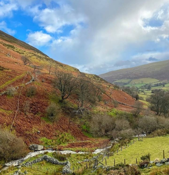
8,000 hectare National Nature Reserve and Site of Special Scientific Interest. Mostly mountainous with rare blanket bog habitat.
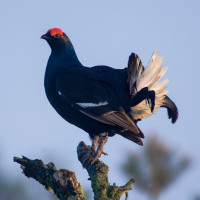
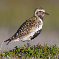
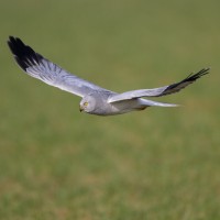
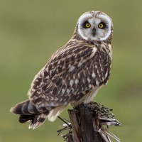
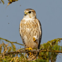
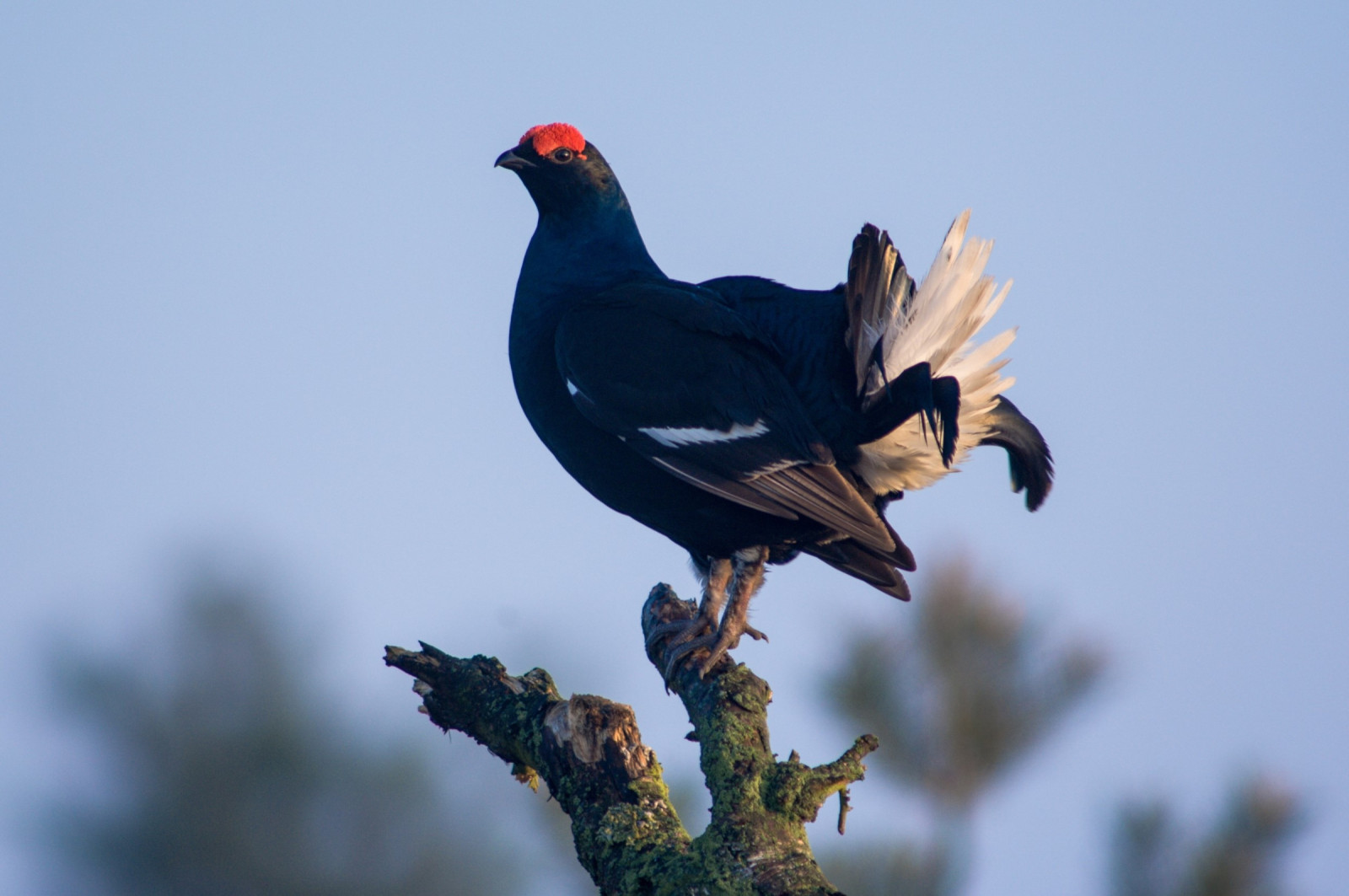
The Berwyn mountains is an isolated and sparsely populated area of moorland in the northeast of Wales. The area supports substantial populations of upland birds including raptors such as Busard Saint-Martin, Faucon émerillon, Faucon pèlerin, Hibou des marais, Tarier pâtre, Tarier des prés, Pluvier doré, Bécassine des marais, Courlis cendré, Vanneau huppé, Merle à plastron, Lagopède d'Écosse, Tétras lyre and more. The Berwyn mountains National Nature Reserve also harbours polecat and otter.
Berwyn mountains has several access points:
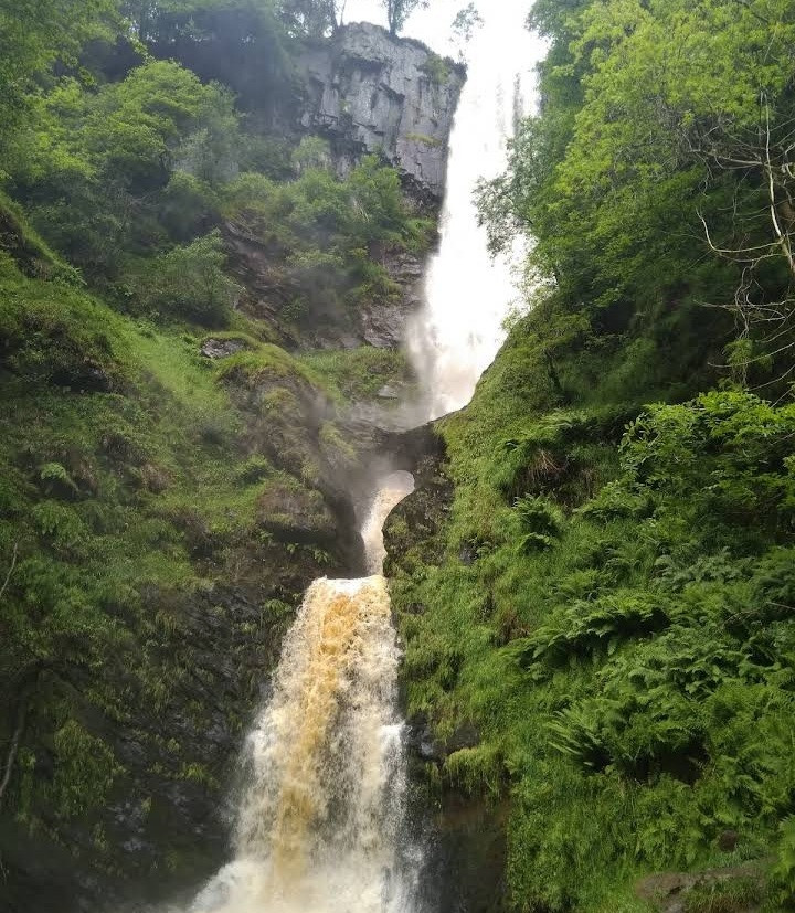
1. Pistyll Ryayader waterfall. From Welshpool take the A490 which passes through Llanfyllin and then look out for a right hand-turn onto the B4391, which will take you to the small village of Llanrhaeadr-ym-Mochnant. From the village take the turn signed to the Waterfall and continue up a steep and very narrow lane with occasional passing places until you reach the car park at the end of the road. There are a café and public toilets. Cars can be parked adjacent to the café on a 'pay and display' basis.
2. Llandrillo; From Bala take the A494 towards Corwen and then turn right almost immediately onto the B4401 towards the village of Llandrillo. In Llandrillo turn right just after the humpback bridge into Heol Y Berwyn (Berwyn Street) and park as soon as you can. From here you can walk up the hill and into Y Berwyn National Nature Reserve. Do not attempt to take your car any further up the hill as the road soon becomes a very rough and rutted track.
3. Hendwr; From Bala take the A494 towards Corwen and then turn right almost immediately onto the B4401 towards Llandrillo. Continue through Llandrillo on the B4401 towards Corwen, and after approximately 1.5km (one mile) you will see a sign on the left-hand side of the road for Hendwr Caravan Site. Turn right immediately opposite the entrance to the caravan site. There is a post box on the right hand side of the lane as you turn, and this is a useful landmark. Continue up the hill for approximately 3/4km (half a mile). There is a parking area from which you can then walk up onto the mountain.
The walking route shown from Llandrillo is 12 km/7.5 miles, the route from Pistyll Rhaeadr is 6.5 km/4 miles. It is best not to stray off the recognised paths. To reach the highest areas, wear stout boots, waterproof clothing, carry food, water, map, compass, charged mobile phone, and check the local weather forescast.
 ) Insérez les noms d'oiseau dans votre langue. Ils seront automatiquement traduits pour les autres usagers !
Votre feedback sera transmis à l’auteur.rice de cette zone et à l’équipe éditoriale de Birdingplaces, qui l’utiliseront pour améliorer la qualité des informations. (Vous souhaitez publier un commentaire visible en bas de page ? Fermez cette fenêtre et choisissez l’Option 1 : « Publier un commentaire, un conseil ou une observation ».)
Veuillez fournir des suggestions d'améliorations ou d'ajouts au texte de ce site ornithologique.
Veuillez fournir vos suggestions d'améliorations ou d'ajouts à la carte.
Veuillez fournir des suggestions d'améliorations ou d'ajouts à la liste des oiseaux.
Cliquez sur l'icône de l'oiseau () Insérez les noms d'oiseau dans votre langue. Ils seront automatiquement traduits pour les autres usagers !