Charger images
Les formats d'image autorisés sont de type jpeg, png ou gif
La taille maximale du fichier doit être de 20MB
Haweswater is wild and wonderful, best explored with sturdy boots, a backpack and a map.
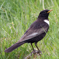
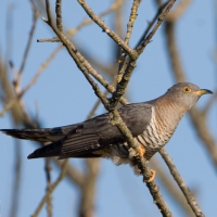
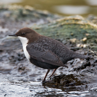
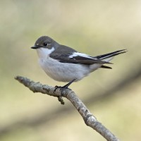
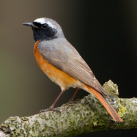
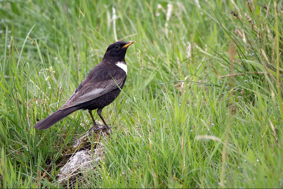
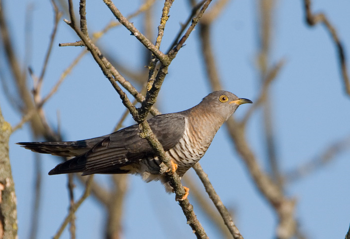
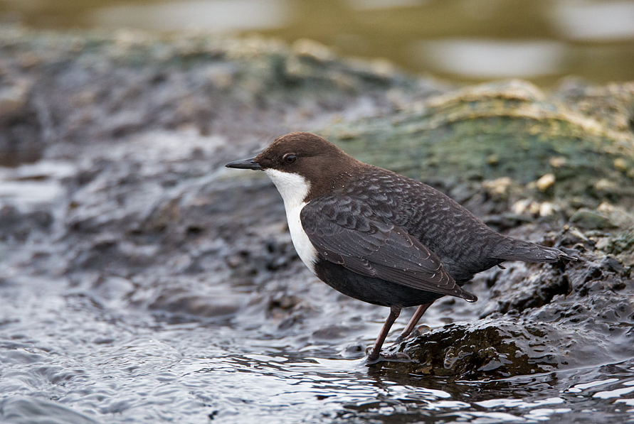
Haweswater is a RSPB managed site owned by water company United Utilities. It stretches across 30 sq km of rushing streams, ancient oak woodland, valley mires, wildflower meadows and dramatic mountains in the Eastern Lake District National Park. It is home to Gobemouche noir, Rougequeue à front blanc, Cincle plongeur, Coucou gris, Traquet motteux, Merle à plastron, Faucon pèlerin, Pouillot siffleur, Pipit des arbres, Chevalier guignette, Bécassine des marais, Tarier des prés, Buse variable, Grand Corbeau, Tarier pâtre, Chouette hulotte, Pic vert, Sittelle torchepot, Sizerin cabaret, Tarin des aulnes, Harle bièvre and Goéland cendré. Until a few years ago, it was also home to Aigle royal, and there is the hope that some day they may return.
A car park is situated at Mardale Head at the top of Haweswater reservoir and it is open at all times. A donation cairn, to support the RSPB’s work at Haweswater, is situated in the car park, with a suggested donation of £2. Please note that only cash donations can be made in the cairn as the lack of mobile phone reception means card payments aren't possible. The grid reference for this car park is NY469108. Click on the P in the map for directions or coordinates.
Haweswater’s rugged landscape can be discovered through a variety of hiking trails. On the map is shown a 16 km circular walk around the reservoir, but there are many other options. Haweswater does not have a visitor centre, public toilets, public hides or a cafe. Please also bear in mind that the upland landscape here is incredibly steep and rugged, with very uneven terrain, so the paths can be demanding.
For a more strenuous but very rewarding option, hike up the Long Stile ridge to High Street - at 828 m altitude, the highest High Street in Britain by far, and the only one with no shops (!!) - and then walk north along this ancient Roman road, and back down via Kidsty Pike. As well as superb views, the flat, open top here can attract Pluvier guignard on spring passage in May, and the crags on the way up are excellent for Merle à plastron.
Since 2012, the RSPB has been running two farms to showcase how sustainable farming can work hand-in-hand with conservation to benefit wildlife, water and people. To keep the landscape rich and healthy, RSPB ensures the right levels of grazing by cattle, sheep and ponies. Trees and alpine flowers are grown from local seed in the on-site nursery, then planted out onto the fells to help restore a diverse mosaic of habitats.
 ) Insérez les noms d'oiseau dans votre langue. Ils seront automatiquement traduits pour les autres usagers !
Votre feedback sera transmis à l’auteur.rice de cette zone et à l’équipe éditoriale de Birdingplaces, qui l’utiliseront pour améliorer la qualité des informations. (Vous souhaitez publier un commentaire visible en bas de page ? Fermez cette fenêtre et choisissez l’Option 1 : « Publier un commentaire, un conseil ou une observation ».)
Veuillez fournir des suggestions d'améliorations ou d'ajouts au texte de ce site ornithologique.
Veuillez fournir vos suggestions d'améliorations ou d'ajouts à la carte.
Veuillez fournir des suggestions d'améliorations ou d'ajouts à la liste des oiseaux.
Cliquez sur l'icône de l'oiseau () Insérez les noms d'oiseau dans votre langue. Ils seront automatiquement traduits pour les autres usagers !