
 Costa Rica.JPG)
Charger images
Les formats d'image autorisés sont de type jpeg, png ou gif
La taille maximale du fichier doit être de 20MB
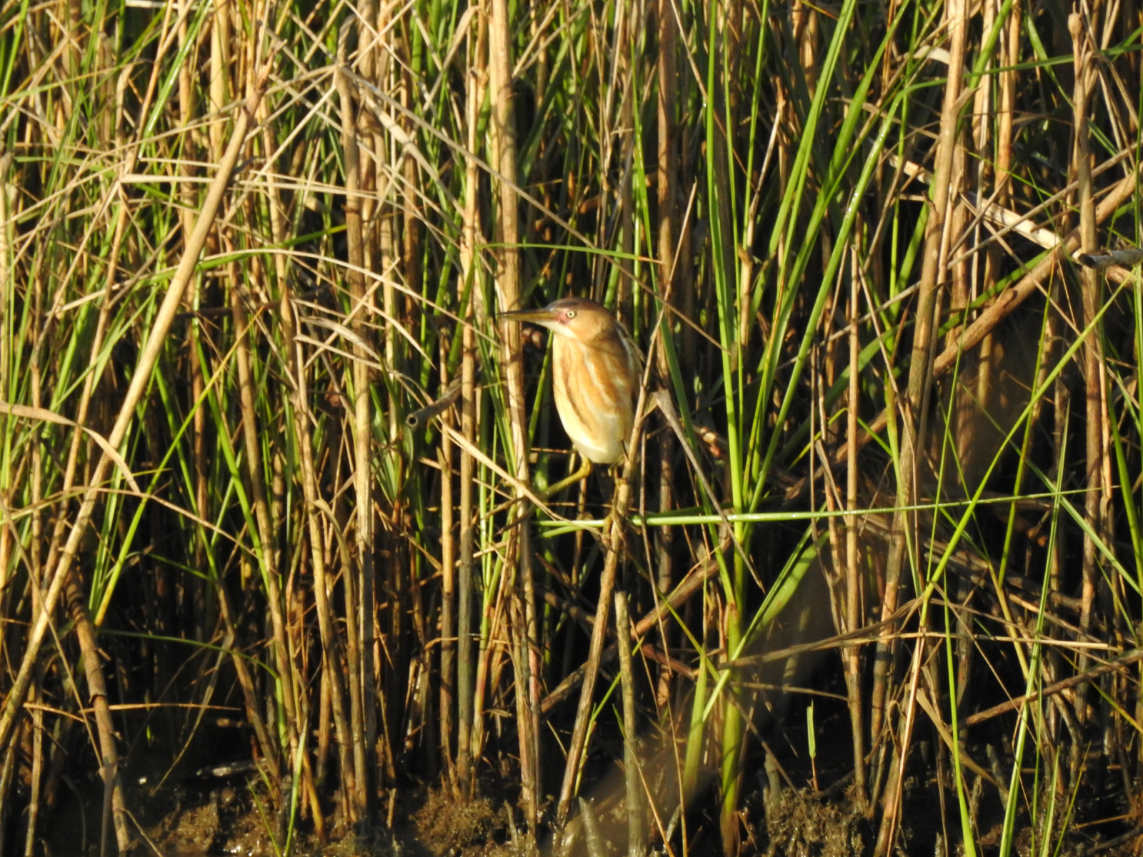
One mile out and back trail. Fresh and intermediate marsh habitat that historically has hosted 225 species.
The Blue Goose Trail is a one mile out and back trail in Sabine National Wildlife Refuge. The trail parallels Shell Canal and includes open marsh viewing as well as scattered small stands of shrubs and trees. It begins with open marsh and ends with good views of marsh and Calcasieu Lake.
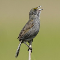
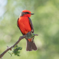
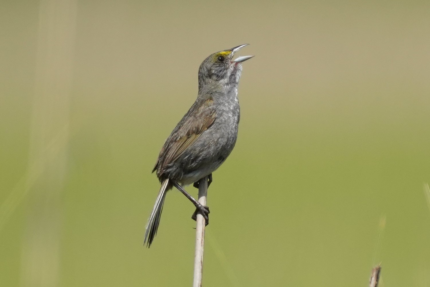
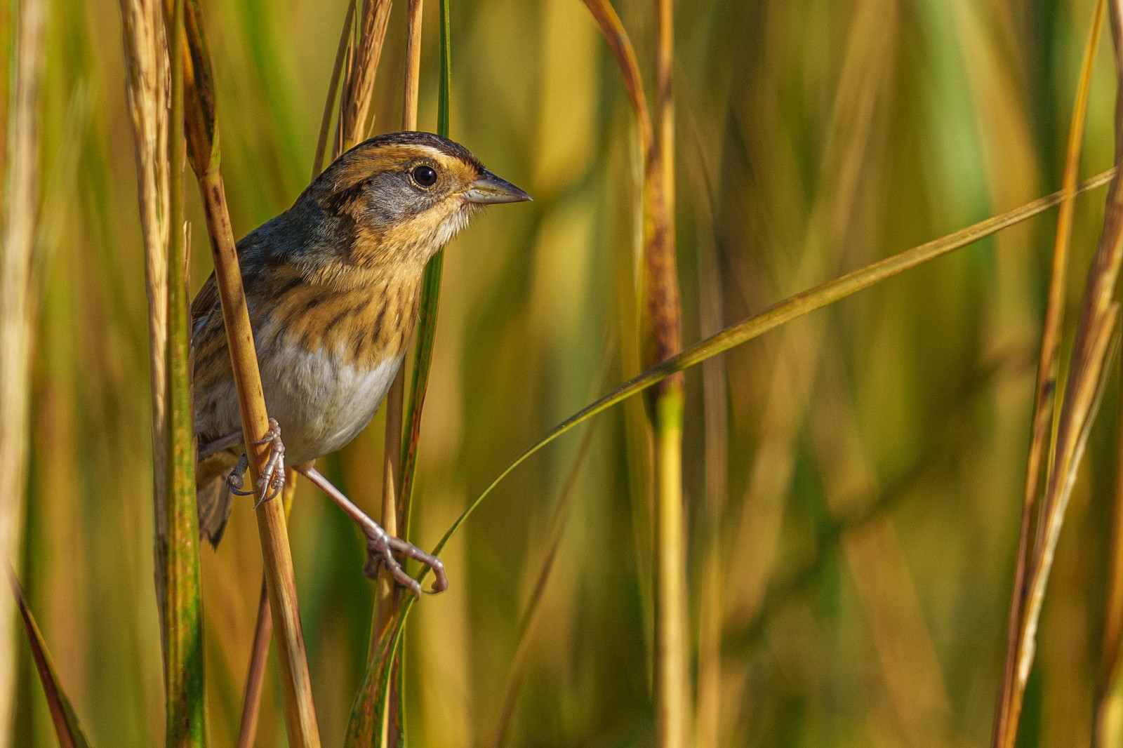
The wooded and shrubby habitats have produced 27 warbler species and 14 sparrow species, especially in spring and fall. Seaside Sparrow may be found year round. Lingering migrants often are around all winter. Eastern Phoebe and Vermilion Flycatcher may be present in winter. Eastern Kingbird is frequent in summer.
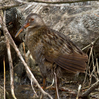
Marsh and lake can have up to 18 species of ducks and geese in winter. Other specialties include 23 species of shorebirds and 16 species of gulls and terns. Clapper Rail, Willet, Laughing Gull, Forster's Tern are frequently seen. Both Double-crested Cormorant and Neotropic Cormorant are present. Roseate Spoonbill can be observed most likely October through March.
Aside from the bird and habitat variety the accessible paved trail, adequate parking and comfort station make this an easy stop for almost any birder.
The Blue Goose Trail is located 7.5 miles south of Hackberry, Louisiana on LA 27. The location is well marked and has adequate paved parking. There is no public transportation and is best accessed by motor vehicle. Press P on the map for directions.
The trail is flat, paved and accessible. Vehicles, including bicycles, are not allowed on the trail but the short easy walk encourages frequent pauses and observe carefully. Allow 30 minutes to an hour on average for a visit.
This trail is located on the Creole Nature Trail All-American Road, a 180 mile loop through Calcasieu and Cameron Parishes that encompasses Lousiana's richest birding areas. It probably should be included as part of a longer trip that includes the coast and inland prairies. There are multiple good sites and this area produces more rarities than any other part of Louisiana.
 ) Insérez les noms d'oiseau dans votre langue. Ils seront automatiquement traduits pour les autres usagers !
Votre feedback sera transmis à l’auteur.rice de cette zone et à l’équipe éditoriale de Birdingplaces, qui l’utiliseront pour améliorer la qualité des informations. (Vous souhaitez publier un commentaire visible en bas de page ? Fermez cette fenêtre et choisissez l’Option 1 : « Publier un commentaire, un conseil ou une observation ».)
Veuillez fournir des suggestions d'améliorations ou d'ajouts au texte de ce site ornithologique.
Veuillez fournir vos suggestions d'améliorations ou d'ajouts à la carte.
Veuillez fournir des suggestions d'améliorations ou d'ajouts à la liste des oiseaux.
Cliquez sur l'icône de l'oiseau () Insérez les noms d'oiseau dans votre langue. Ils seront automatiquement traduits pour les autres usagers !