Charger images
Les formats d'image autorisés sont de type jpeg, png ou gif
La taille maximale du fichier doit être de 20MB

State park with a mix of river, marsh, and forest landscapes. More than 250 bird species have been recorded.
Carolina Beach State Park is a coastal state park that covers 761 acres of maritime forest, wetlands, and riverfront terrain, and is especially known for its population of Venus flytraps, which grow naturally in only a few places in the world. The park sits along the Cape Fear River and the Intracoastal Waterway, giving it a mix of river, marsh, and forest landscapes. Nearly 9 miles of trails offer easy access to all habitats.
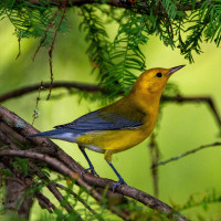
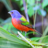
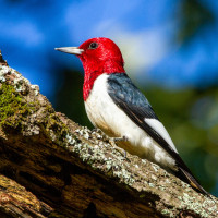
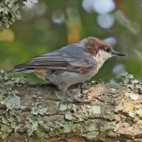
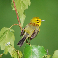
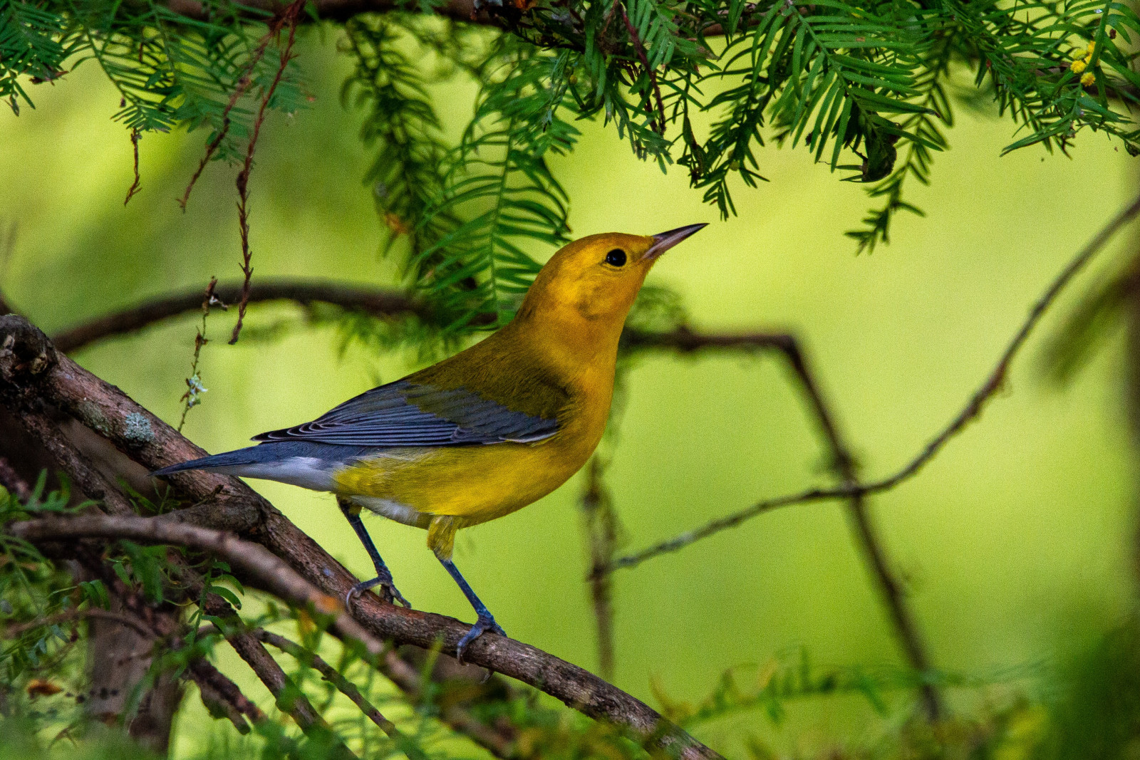
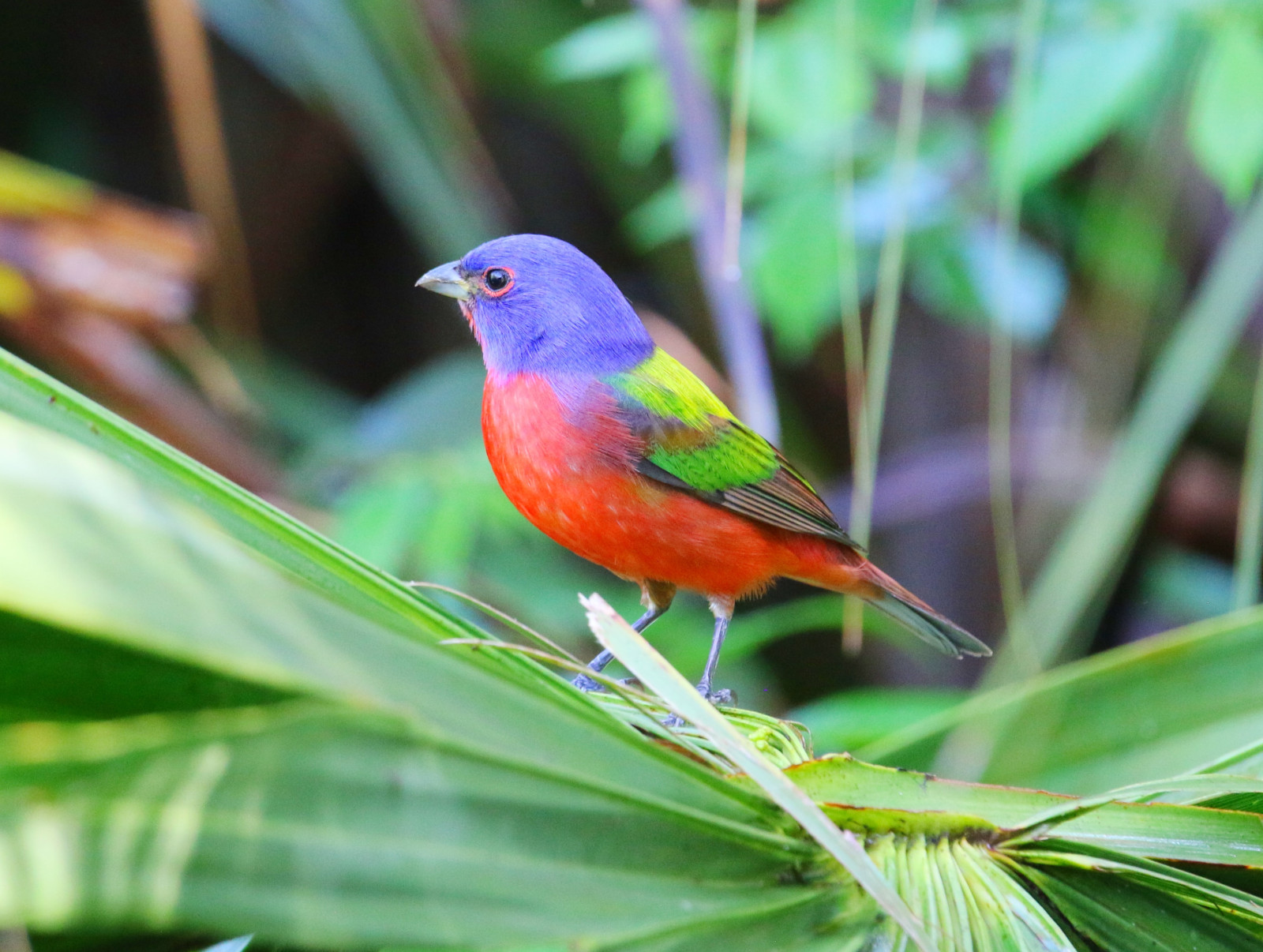
More than 250 bird species have been recorded. Bordering the Cape Fear River, this park is situated on dunes and ridges typical of barrier islands and includes within its boundaries wooded sites of longleaf pine and turkey oak, as well as open grassy areas. Its coastal location and variety of vegetation make it a magnet for birds in all seasons. The open pine forest offers great birding for woodpeckers, grassland sparrows and numerous warblers. Prothonotary Warbler and Painted Bunting arrive in spring. Other birds that can be spotted include American Oystercatcher, Red-headed Woodpecker, Brown-headed Nuthatch, Brown Pelican and Summer Tanager. Fall migration can be spectacular, and winter brings waterfowl of all kinds.
Carolina Beach State Park is located on Pleasure Island just south of Wilmington. From Wilmington, it is about 12 miles south, typically a 20–25 minute drive. Press P on the map for directions to the parking near the visitor center. There is no fee to enter the park for regular day visits. Park gates typically open 7:00 AM to 9:00 PM in summer and close earlier in winter. The visitor center is usually open during daytime, often 9:00 AM to 5:00 PM.
Nearly 9 miles of trails wind through a variety of distinct habitats at Carolina Beach State Park. Relatively flat and easy to walk, the trails are impeccably marked and maintained, featuring boardwalks and small bridges in low areas. The circular trail shown on the map is about 3,5 mile.
 ) Insérez les noms d'oiseau dans votre langue. Ils seront automatiquement traduits pour les autres usagers !
Votre feedback sera transmis à l’auteur.rice de cette zone et à l’équipe éditoriale de Birdingplaces, qui l’utiliseront pour améliorer la qualité des informations. (Vous souhaitez publier un commentaire visible en bas de page ? Fermez cette fenêtre et choisissez l’Option 1 : « Publier un commentaire, un conseil ou une observation ».)
Veuillez fournir des suggestions d'améliorations ou d'ajouts au texte de ce site ornithologique.
Veuillez fournir vos suggestions d'améliorations ou d'ajouts à la carte.
Veuillez fournir des suggestions d'améliorations ou d'ajouts à la liste des oiseaux.
Cliquez sur l'icône de l'oiseau () Insérez les noms d'oiseau dans votre langue. Ils seront automatiquement traduits pour les autres usagers !