


Charger images
Les formats d'image autorisés sont de type jpeg, png ou gif
La taille maximale du fichier doit être de 20MB

Nature reserve of more than 8,300 acres of volcanic terrain, offering a mix of rocky glades, dense forests, and Mina Sauk Falls, Missouri’s tallest waterfall.
Taum Sauk Mountain State Park is in the St. Francois Mountains of southeastern Missouri. The park sprawls across more than 8,300 acres of volcanic terrain, offering a mix of rocky glades, dense forests, and dramatic overlooks. It’s home to the highest point in the state, Taum Sauk Mountain, which rises to 1,772 feet (540 meters) above sea level. A historic fire lookout is perched at Missouri’s highest point. The Taum Sauk Lookout Tower is a 72‑foot steel tower with a wooden cab at the top. One of the other standout features is Mina Sauk Falls, Missouri’s tallest waterfall, which cascades down a rocky bluff during wet weather. The falls are accessible via a scenic three-mile (5 km) loop trail.
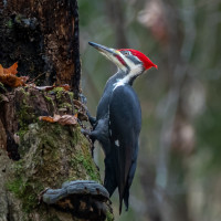
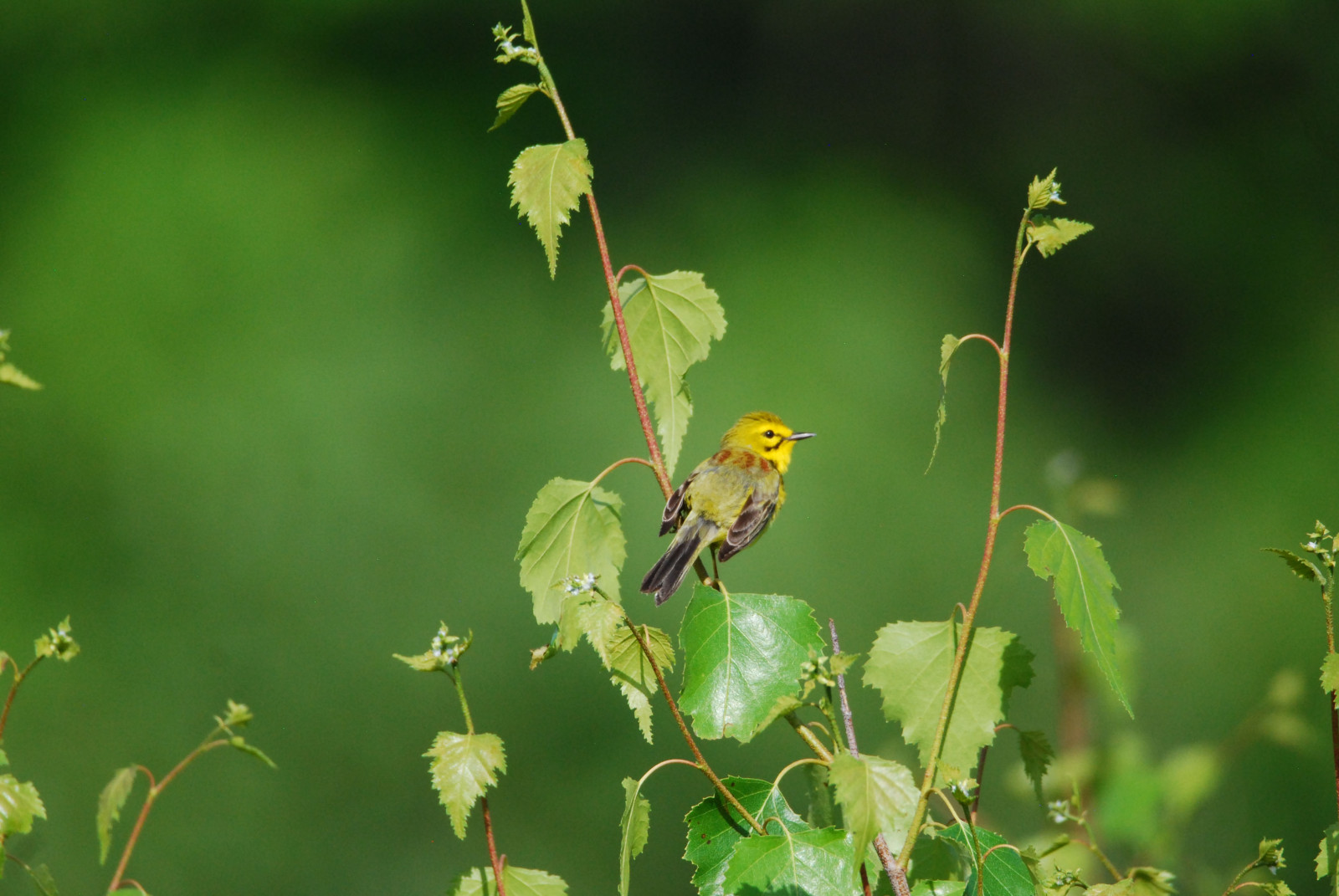
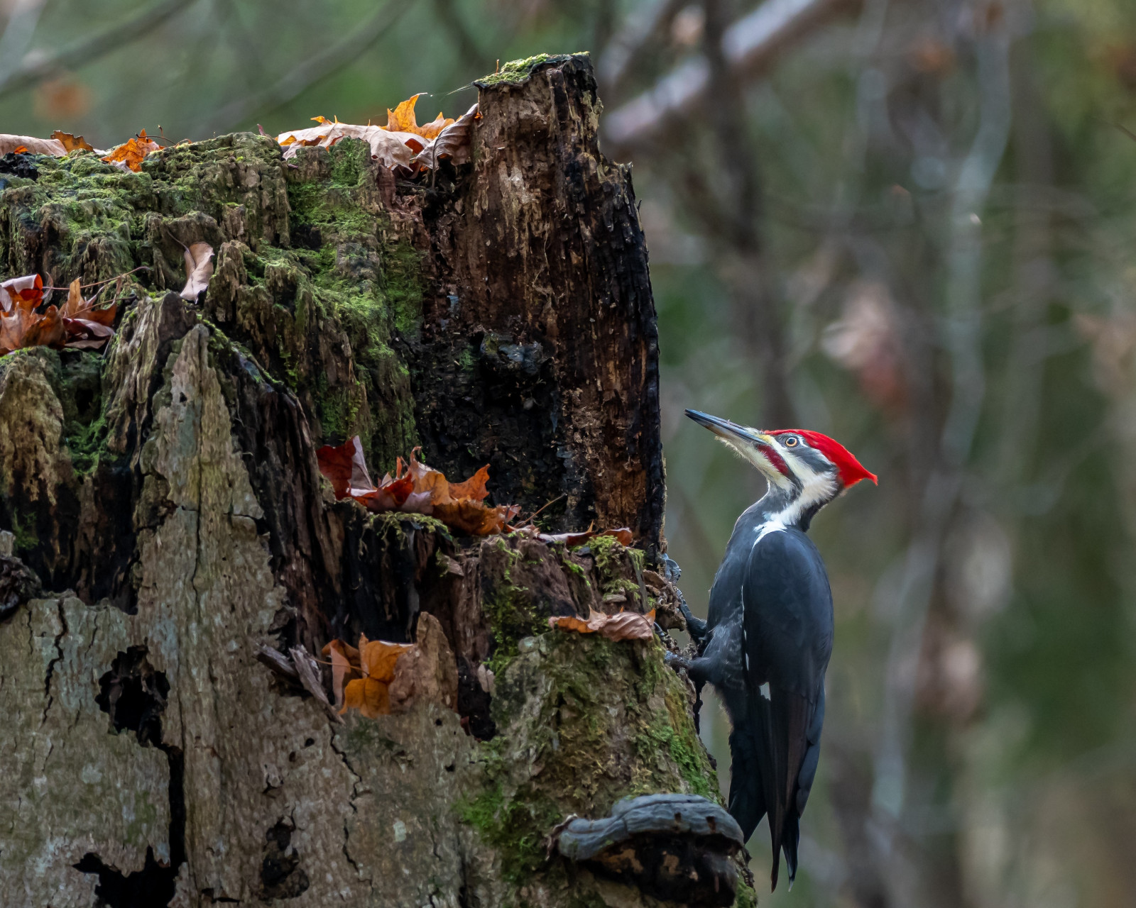
Taum Sauk Mountain State Park has oak-hickory upland forest, glades, savannas, flatwoods and bottomland forest, as well as aquatic habitats. These varied habitats attract many different species of birds. The Mina Sauk Falls Trail is very nice for birding. It winds through upland forest and glades, where you can encounter woodland songbirds like Summer Tanager, Scarlet Tanager, Ovenbird and Wood Thrush in summer. Pileated Woodpecker and other woodpeckers can be seen year round. The glades, with their open rocky expanses, are good for Prairie Warbler and Field Sparrow. During migration, the trail can be alive with warblers, vireos, and thrushes.
Taum Sauk Mountain State Park lies in the rugged St. Francois Mountains of southeastern Missouri, about 90 miles south of St. Louis. From St. Louis take I‑55 south to US‑67 at Festus. Follow US‑67 south to MO‑21 at Farmington. Continue south on MO‑21 through Ironton. About 5 miles south of Ironton, turn right (west) onto Route CC. The park entrance is about 3 miles along CC, clearly signed. From Ironton head south on MO‑21 for 5.6 miles, then turn right onto Route CC. Drive 3.1 miles to the park entrance, then follow the park road about 1 mile to the trailhead and highpoint parking. Press P on the map for directions.
Taum Sauk Mountain State Park is free to visit. Like all Missouri state parks, there’s no entrance fee for day use, hiking, or climbing the lookout tower. There’s a small campground with basic sites, a picnic area and toilets. From the parking you can make a three-mile (5 km) loop to the waterfall.
 ) Insérez les noms d'oiseau dans votre langue. Ils seront automatiquement traduits pour les autres usagers !
Votre feedback sera transmis à l’auteur.rice de cette zone et à l’équipe éditoriale de Birdingplaces, qui l’utiliseront pour améliorer la qualité des informations. (Vous souhaitez publier un commentaire visible en bas de page ? Fermez cette fenêtre et choisissez l’Option 1 : « Publier un commentaire, un conseil ou une observation ».)
Veuillez fournir des suggestions d'améliorations ou d'ajouts au texte de ce site ornithologique.
Veuillez fournir vos suggestions d'améliorations ou d'ajouts à la carte.
Veuillez fournir des suggestions d'améliorations ou d'ajouts à la liste des oiseaux.
Cliquez sur l'icône de l'oiseau () Insérez les noms d'oiseau dans votre langue. Ils seront automatiquement traduits pour les autres usagers !