
Descrizione
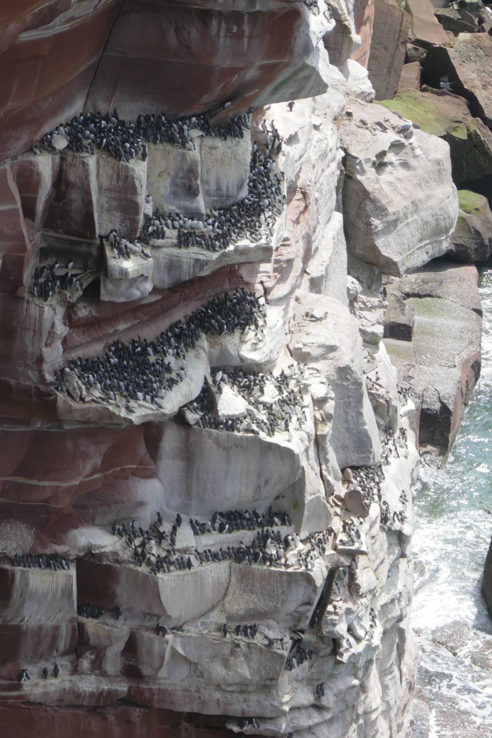
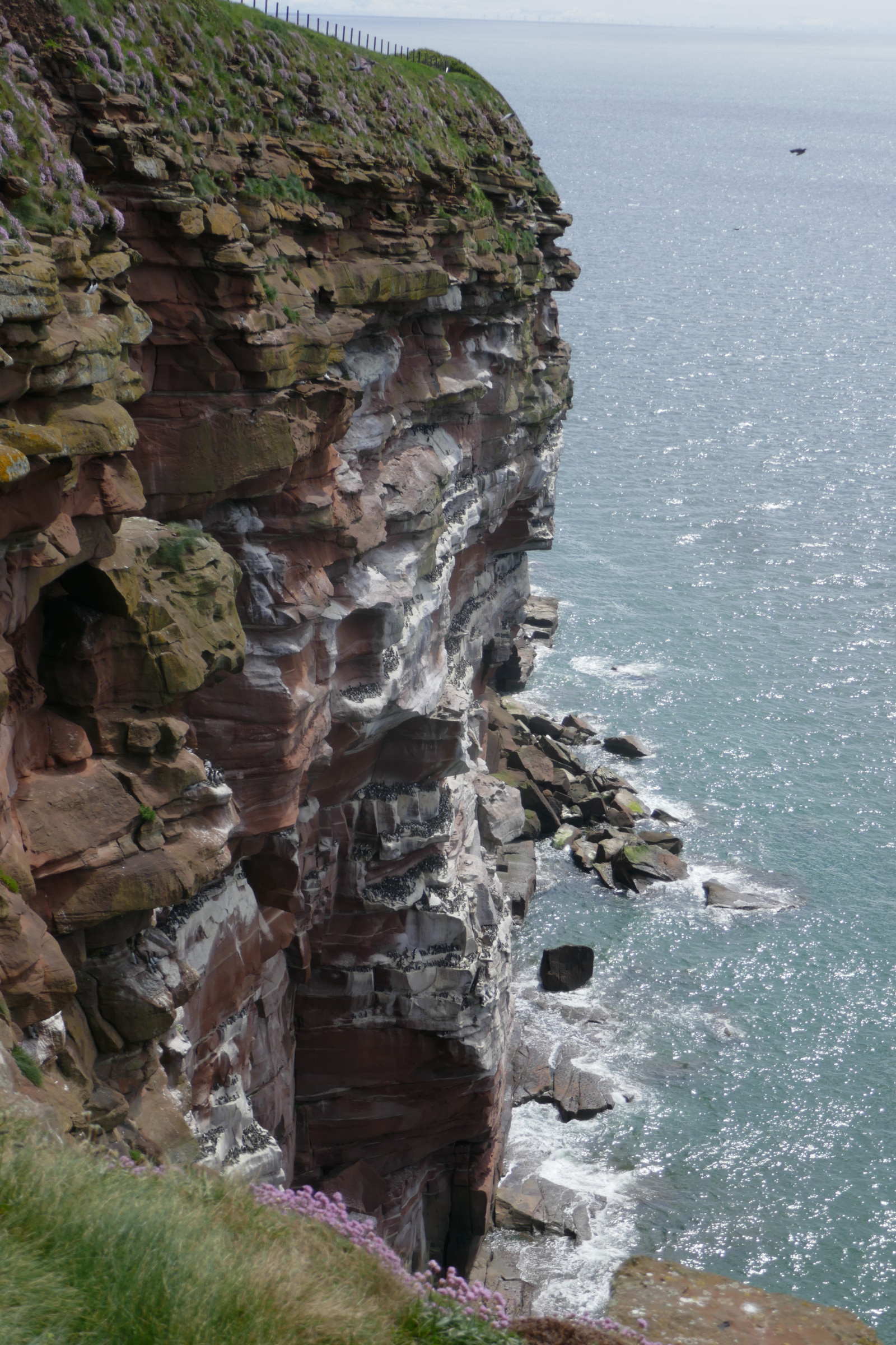
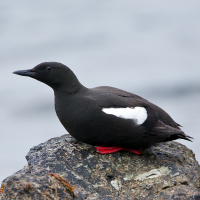
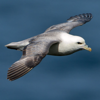
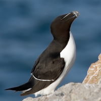
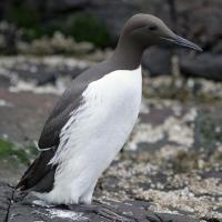
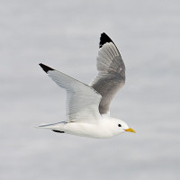
St Bees Head is a headland on the North West coast of Cumbria and is named after the nearby village of St Bees. St Bees Head, supports north-west England's only cliff-nesting seabird colony. Red sandstone cliffs stacked with nesting seabirds like Uria nera, Uria, Gazza marina, Gabbiano tridattilo, Pulcinella di mare and Fulmaro. Three viewing points give you great views of the colony and on a clear day you can see the Isle of Man across the sea.
Dettagli
Accesso
St Bees Head is situated between Whitehaven and St. Bees in west Cumbria and lies on the long-distance footpath of the Cumbria Coastal Way. The closest parking is near the farm Tarnflat Hall. You can also park in Whitehaven at Haig pit and take the Cumbria Coastal Way to the head. The path follows the edge of the cliffs, which rise to 90 metres above sea level. You can also park in Sandwith and follow the farm track straight to the head. Or park in St Bees village in the shore-front car park. Access to the reserve is via the path over the metal footbridge at the north end of the promenade. Click on a P in the map for directions to a parking. By train: St Bees station is 0.75 mile (1.25 km) from the reserve.
Notification from the RSPB May 2026: Please be aware that due to landslips the public footpath from St Bees (Council run Capark) to Fleswick bay has been shut.
Terreno e habitat
Canyon/scogliera , MareCaratteristiche dell’area
Paesaggio apertoPercorso ad anello
SiÈ utile un cannocchiale?
Può essere utileBuona stagione per il BW
Primavera , Estate , AutunnoMiglior periodo per visitare
Primavera , EstatePercorso
Sentiero strettoGrado di difficoltà del percorso a piedi
Difficoltà mediaModalità di accesso
A piediCapanno/torretta di osservazione
NoInformazioni aggiuntive
Photo St Bees Head by Dougsim, CC BY-SA 3.0, https://creativecommons.org/licenses/by-sa/3.0, via Wikimedia Commons
 ) per inserire i nomi delle specie nella tua lingua. I nomi delle specie verranno automaticamente tradotti per gli altri utenti!