Description
Lake Serranella (a Regional Nature Reserve and WWF Oasis) is considered one of the best spots in Abruzzo for birdwatching. Its strategic location near the Adriatic coast and the confluence of the Sangro and Aventino rivers make it a vital stopover for numerous migratory birds. The reserve covers about 300 hectares and features dedicated observation structures, such as strategically placed bird blinds, allowing visitors to watch the birdlife without disturbing it.
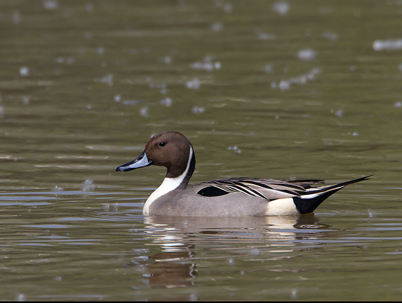
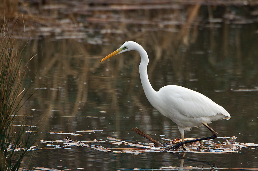
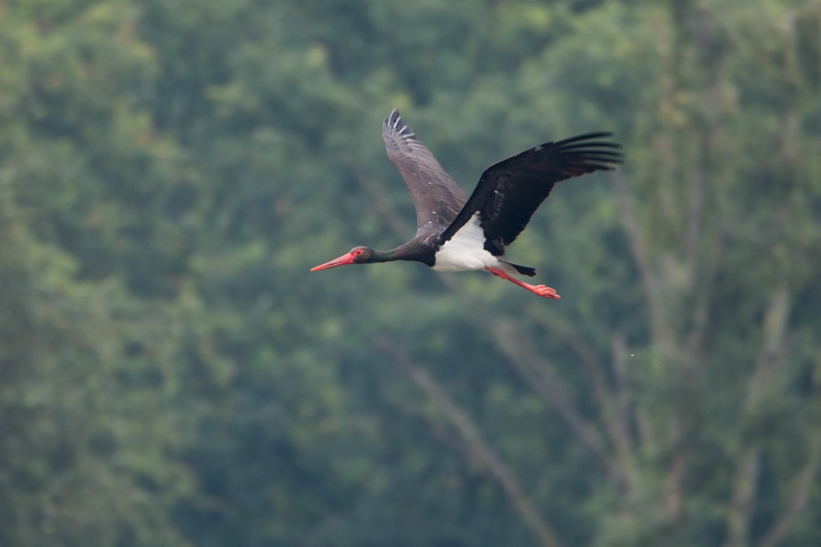
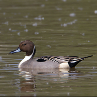
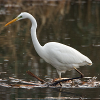
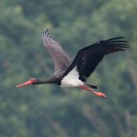
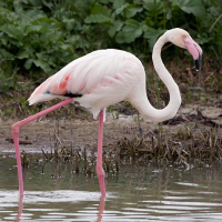
Numerous species have been recorded in the area, most notably: the патка ластовичарка (the Reserve's symbol), голема бела чапја, црн штрк, розев фламинго, орел рибар, сив жерав, and голем корморан.
Spring and autumn (during migration) are the peak periods, when it's possible to spot many passage bird species that use the lake as a stopover during their long journeys. In winter, you can observe overwintering species. Dawn and dusk, when bird activity is most intense, are the best times.
_________________________
Italiano: Il Lago di Serranella (una Riserva Naturale Regionale e Oasi WWF) è considerato uno dei posti migliori in Abruzzo per il birdwatching. La sua posizione strategica vicino alla costa adriatica e la confluenza dei fiumi Sangro e Aventino lo rendono un punto di sosta fondamentale per molteplici uccelli migratori. La riserva si estende per circa 300 ettari ed è dotata di strutture specifiche per l'osservazione come capanni di avvistamento posizionati strategicamente per osservare l'avifauna senza disturbarla.
La primavera e l'autunno (durante le migrazioni) sono i periodi di picco, in cui è possibile avvistare molte specie di passaggio che sfruttano il lago come area di sosta durante i lunghi viaggi. In inverno si possono osservare le specie svernanti. L'alba e il tramonto, quando l'attività degli uccelli è più intensa, sono i momenti migliori.
Details
Access
Lago di Serranella is located 12 km south of the town of Lanciano. Route via A14 (Recommended): take the A1/E35 heading south, then continue on the Perugia-Bettolle link road and the SS77 (Val di Chienti) until you reach the Adriatic coast. Merge onto the A14 toward Bari and take the Val di Sangro exit. Follow the SS652 (Fondovalle Sangro) toward Casoli until you see the signs for the reserve in Località Brecciaio.
_________________________
Italiano: Percorso via A14 (Consigliato): prendi la A1/E35 verso sud, poi prosegui sul raccordo Perugia-Bettolle e la SS77 (Val di Chienti) fino a raggiungere la costa adriatica. Immettiti sulla A14 in direzione Bari e prendi l'uscita Val di Sangro. Segui la SS652 (Fondovalle Sangro) in direzione Casoli fino alle indicazioni per la riserva in Località Brecciaio.
Terrain and Habitat
Wetland , Lake , Scattered trees and bushesConditions
FlatCircular trail
NoIs a telescope useful?
Can be usefulGood birding season
Spring , Autumn , WinterBest time to visit
Spring migration , Autumn migrationRoute
Unpaved roadDifficulty walking trail
EasyAccessible by
FootBirdwatching hide / platform
YesExtra info
There are 5 trails, including the Lanche Path (approx. 2 km) which follows the confluence of the rivers, the Riverbed Path (Percorso del Greto), and the Vegetable Gardens Path (Percorso degli Orti).
The Visitor Center is located in Località Brecciaio (Sant'Eusanio del Sangro); it provides up-to-date information and serves as a key reference point for trails and birdwatching.
_________________________
Italiano: Ci sono 5 sentieri, tra cui il Percorso delle Lanche (circa 2 km) che segue la confluenza dei fiumi, il Percorso del Greto e il Percorso degli Orti. Il centro Visite è situato in Località Brecciaio (Sant'Eusanio del Sangro), offre informazioni aggiornate e punto di riferimento per sentieri e birdwatching.
Il centro Visite è situato in Località Brecciaio (Sant'Eusanio del Sangro), offre informazioni aggiornate e punto di riferimento per sentieri e birdwatching.

 ) to insert bird names in your own language. The birdnames will automatically be translated for other users!