Beschrijving
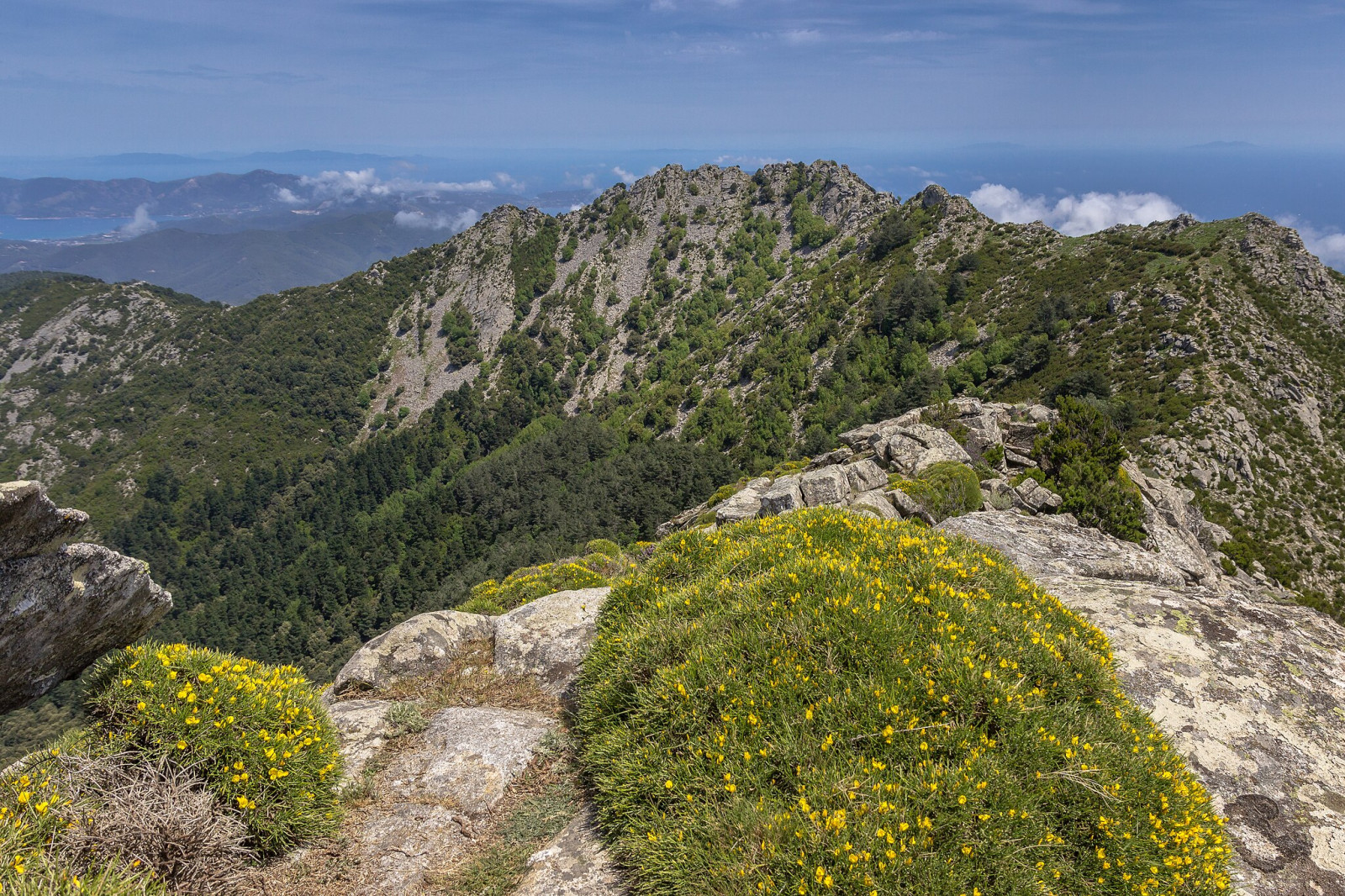
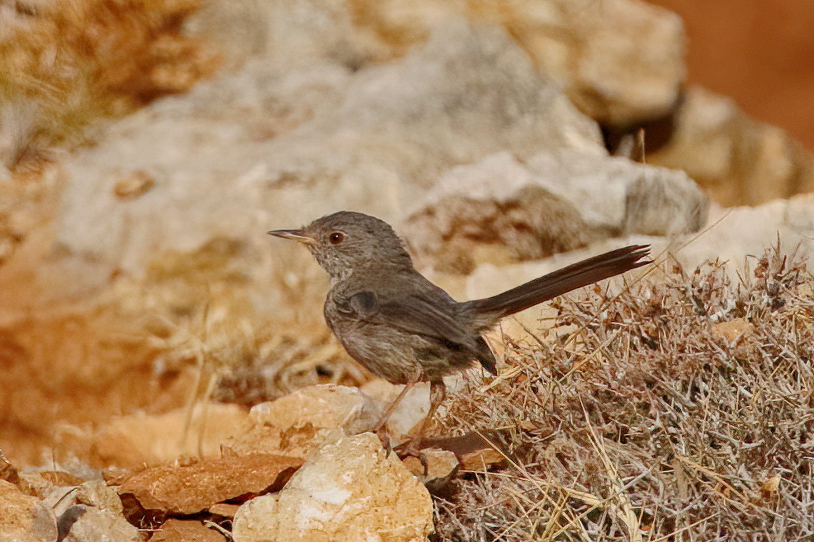
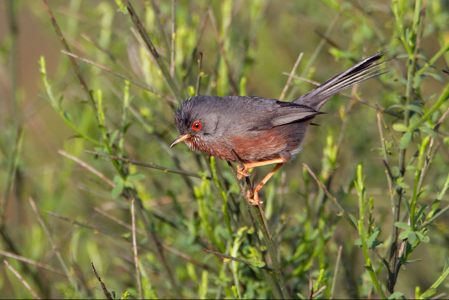
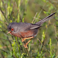
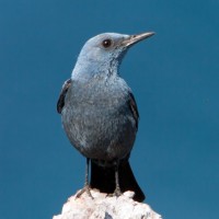
Monte Capanne is the highest peak on Elba, at 1,019 meters above sea level. It is located in the western part of the island within the Arcipelago Toscano National Park. A unique observation point on Elba with alpine characteristics. Many rare and partly endemic species can be observed here. For example Baardgrasmus, Moltoni's Baardgrasmus, Provençaalse Grasmus, Sardijnse Grasmus, Kleine Zwartkop, Blauwe Rotslijster, Mediterrane Vliegenvanger and Corsicaanse Citroensijs.
_________________________
Italiano: La montagna più alta dell'Isola d'Elba. Qui si possono incontrare uccelli di montagna e specie corse.
Il Monte Capanne è la vetta più alta dell'Elba, situata a 1.019 metri sul livello del mare. Si trova nella parte occidentale dell'isola, all'interno del Parco Nazionale dell'Arcipelago Toscano. Rappresenta un punto di osservazione unico sull'Elba, caratterizzato da tratti tipicamente alpini.
Details
Toegang
Monte Capanne is located in the western part of Elba Island, within the municipality of Marciana. There are various hiking trails that lead up the mountain to the mountain station. The trail indicated on the map is about 4 km. It is also possible to take a traditional cable car. The cable car operates daily from April to October. Round-trip tickets cost € 20 for adults (2025). The departure station (1) sits at 375 meters above sea level, just outside Marciana, with free parking nearby. Once you reach the top station (2) at 950 meters, a short trail leads to the summit at 1,019 meters. Press a P on the map for directions to a parking.
_________________________
Italiano: Il Monte Capanne si trova nella parte occidentale dell'Isola d'Elba, nel comune di Marciana. Diversi sentieri escursionistici conducono su per la montagna fino alla stazione a monte. Il percorso indicato sulla mappa è lungo circa 4 km. È anche possibile utilizzare una tradizionale cabinovia, attiva tutti i giorni da aprile a ottobre. Nel 2025, il costo del biglietto di andata e ritorno per adulti era di 20 €. La stazione di partenza (1) si trova a 375 metri sul livello del mare, appena fuori Marciana, con un parcheggio gratuito nelle vicinanze. Una volta raggiunta la stazione a monte (2) a 950 metri, un breve sentiero conduce alla vetta a 1.019 metri. Clicca sulla 'P' nella mappa per le indicazioni stradali verso il parcheggio.

 ) om vogelnamen snel in te voeren via een aanklikbare lijst.