
Beschrijving
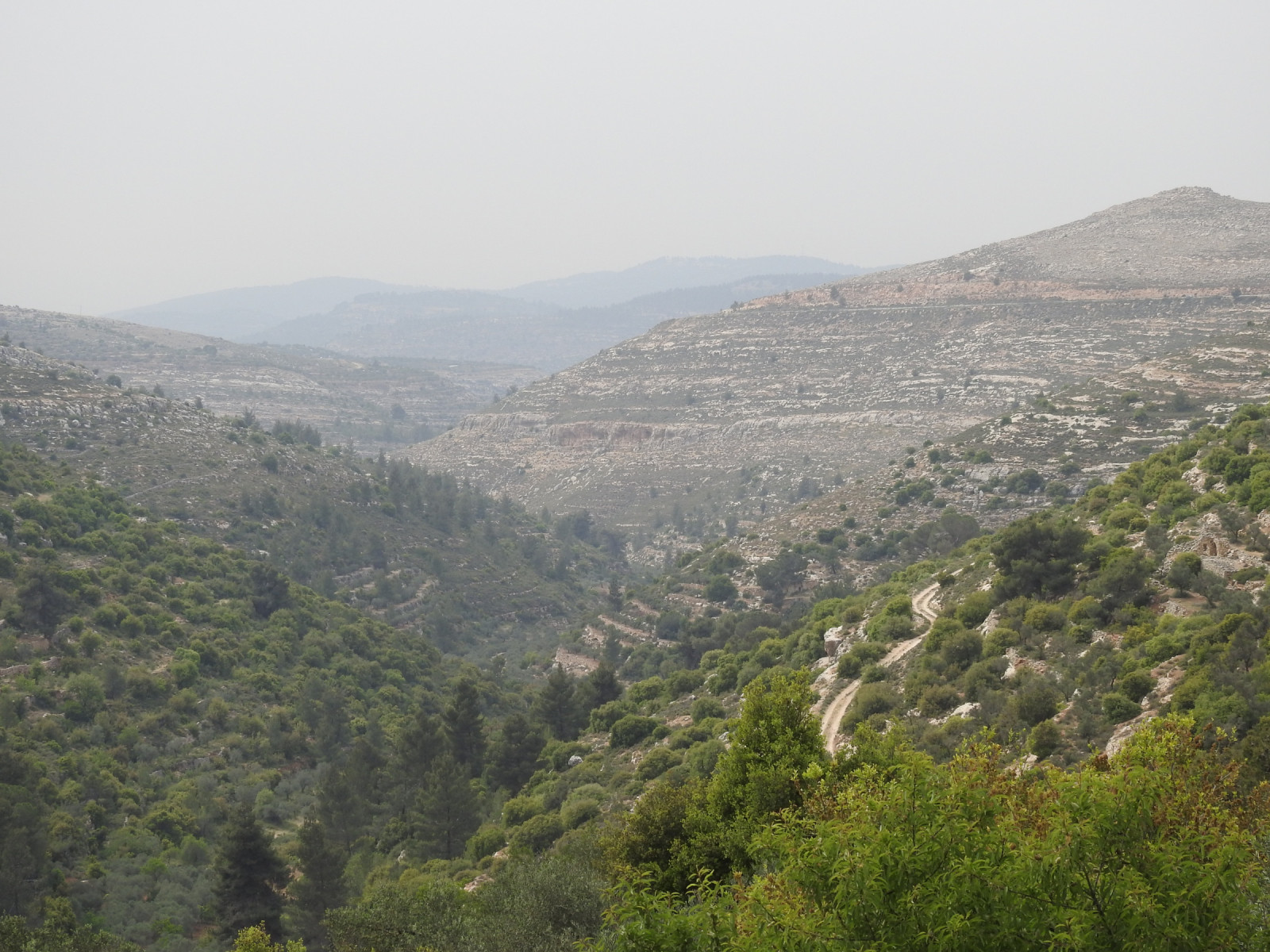
Al Makhrour Valley is a lush, narrow valley characterized by traditional stone terraces, olive groves, vineyards, orchards, and patches of Mediterranean scrub and woodland. Seasonal springs and irrigated farmland create a green corridor that contrasts strongly with the surrounding dry hills and urban areas, making the valley an important refuge for wildlife.
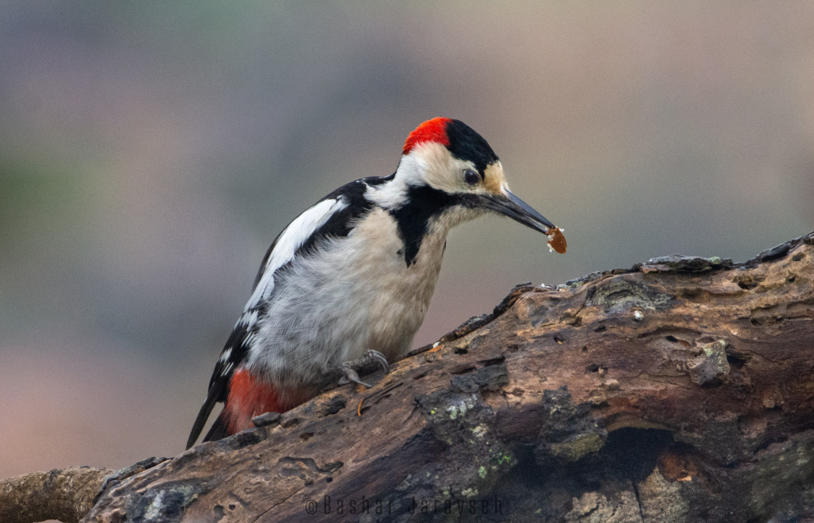
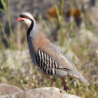
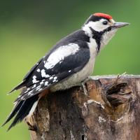
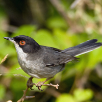
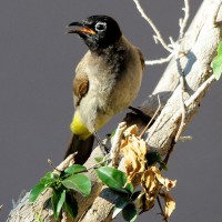
The mix of open farmland, dense vegetation, rocky slopes, and water sources supports a rich variety of resident and migratory species. Common birds include Palestijnse Honingzuiger, Aziatische Steenpatrijs, Kleine Zwartkop, Arabische Buulbuul, Winterkoning, Merel, Syrische Bonte Specht, and Gaai. Raptors such as Torenvalk, Arendbuizerd, and Slangenarend breed in the valley and are frequently seen there.
During spring and autumn migration, the valley attracts many passerines using it as a stopover site, in addition to migratory soaring birds passing overhead. While winter brings species such as Zanglijster, Grijze Gors, and Vink. The combination of rich fauna, flowing water, traditional agriculture, and quiet rural scenery makes Al Makhrour one of the most pleasant and accessible birding locations in the Bethlehem area.
Details
Toegang
Al Makhrour Valley lies immediately west of Bethlehem, extending toward the village of Battir and the western Bethlehem countryside. The valley can be accessed from the western outskirts of Beit Jala. Informal parking is available near agricultural access roads along the upper edges of the valley. There is no direct public transport into the valley.
The valley is best explored on foot. A network of dirt paths and walking trails follows the valley floor and agricultural terraces, allowing slow-paced birding through a variety of habitats. Car access is limited to the valley edges and some agricultural access roads. Several walking options are available. A popular route is a ~5 km hiking trail leading to Battir, a UNESCO World Heritage Site well worth visiting. This trail runs along the valley floor and gradually ascends toward Battir near the end. It is recommended to arrange transport to the trail start and a pickup in Battir (or vice versa). Allow 2–4 hours for a relaxed walk and birding session if exploring the full length of the valley. It is also possible to reach Battir by car via an unpaved road running above the valley along the surrounding hills; however, some sections can be challenging, especially in winter. Alternatively, visitors can park along the main access roads and explore shorter walks on smaller trails around the agricultural areas. Several possible walking routes are shown on the map.
Terrein en leefgebied
Bos , Landbouw , BergOmstandigheden
Rotsachtig , HeuvelachtigRondlopende wandeling mogelijk?
JaTelescoop meenemen?
NeeWanneer hier vogels kijken?
Het hele jaarToptijd voor dit gebied
Winter , LenteRoute
Smal pad , Onverharde weg , Breed padZwaarte wandeling
GemiddeldToegankelijk via
Te voetVogelkijkhut aanwezig?
NeeExtra info
The valley is greenest and most active for birds in spring (Feb - May), when water is flowing and vegetation is dense. Early morning is best for bird activity. Visitors should respect private agricultural land and avoid disturbing farmers or leaving marked trails.
A bird ringing station (see star on the map) operates nearby on the Talitha Kumi School campus, run by the Environmental Education Center. The site also includes a botanical garden. Visits to the ringing station and garden are possible but must be arranged in advance by contacting the Environmental Education Center (https://www.eecp.org/). To schedule a visit, e-mail them at info@eecp.org or call at +972 2 276 5574.

 ) om vogelnamen snel in te voeren via een aanklikbare lijst.