Beschrijving
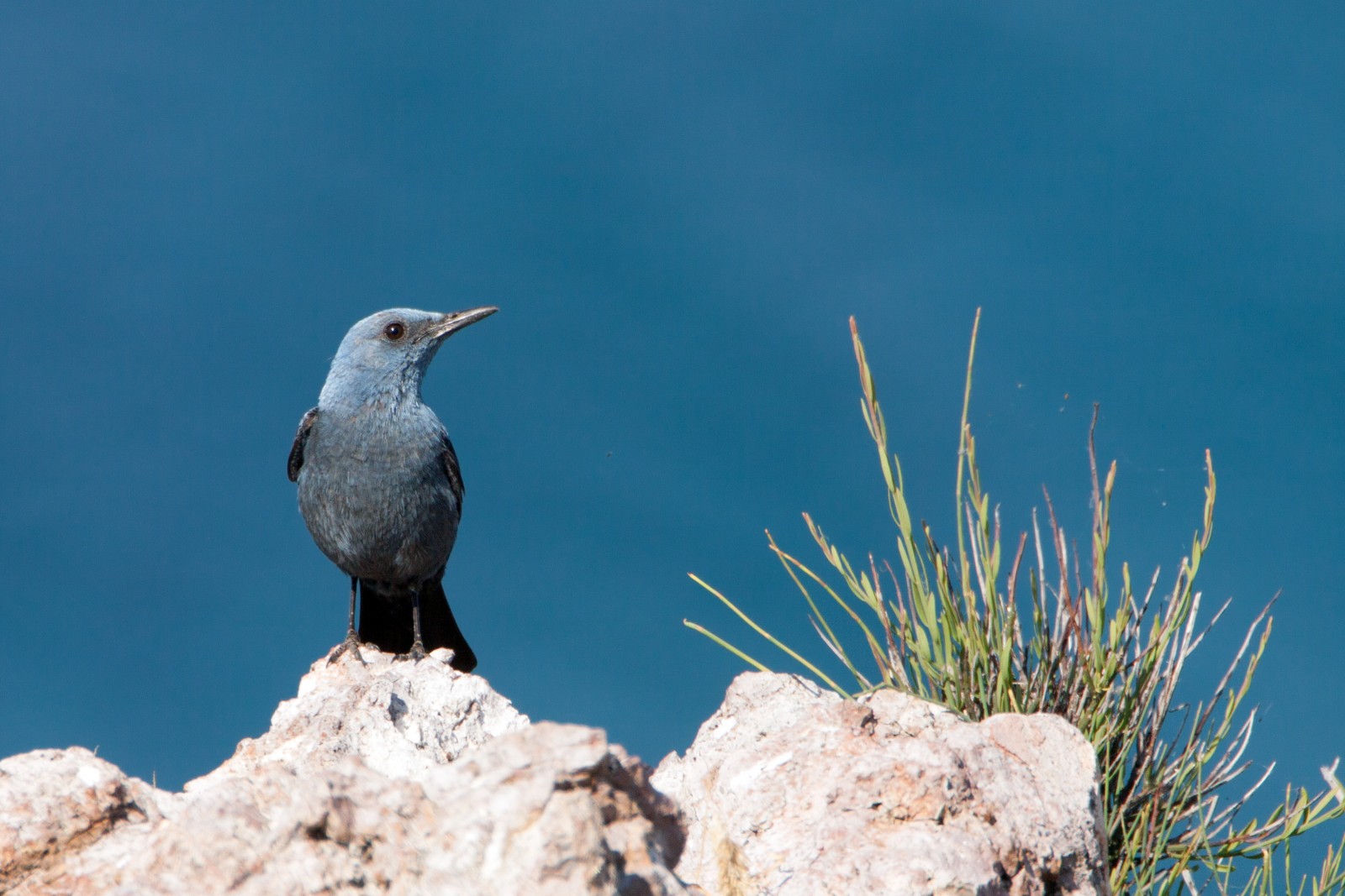
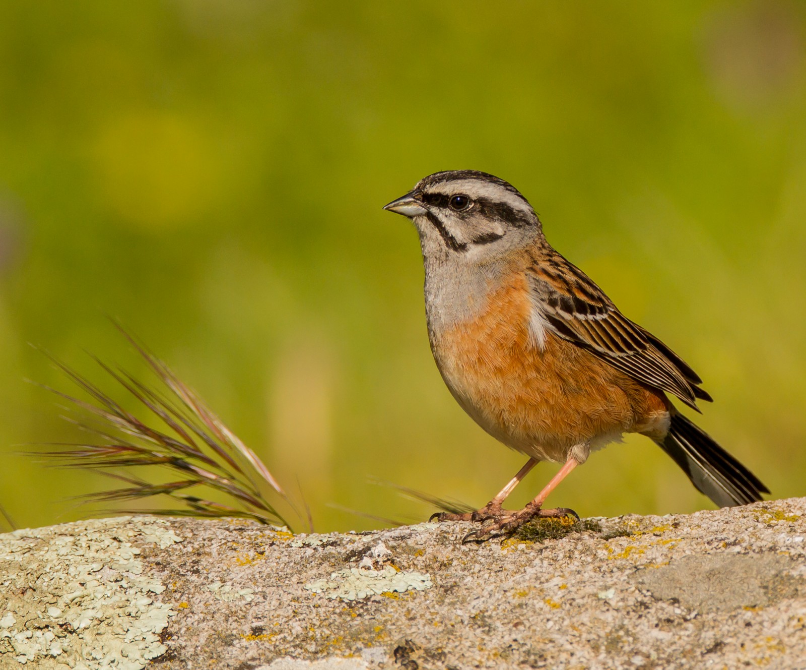
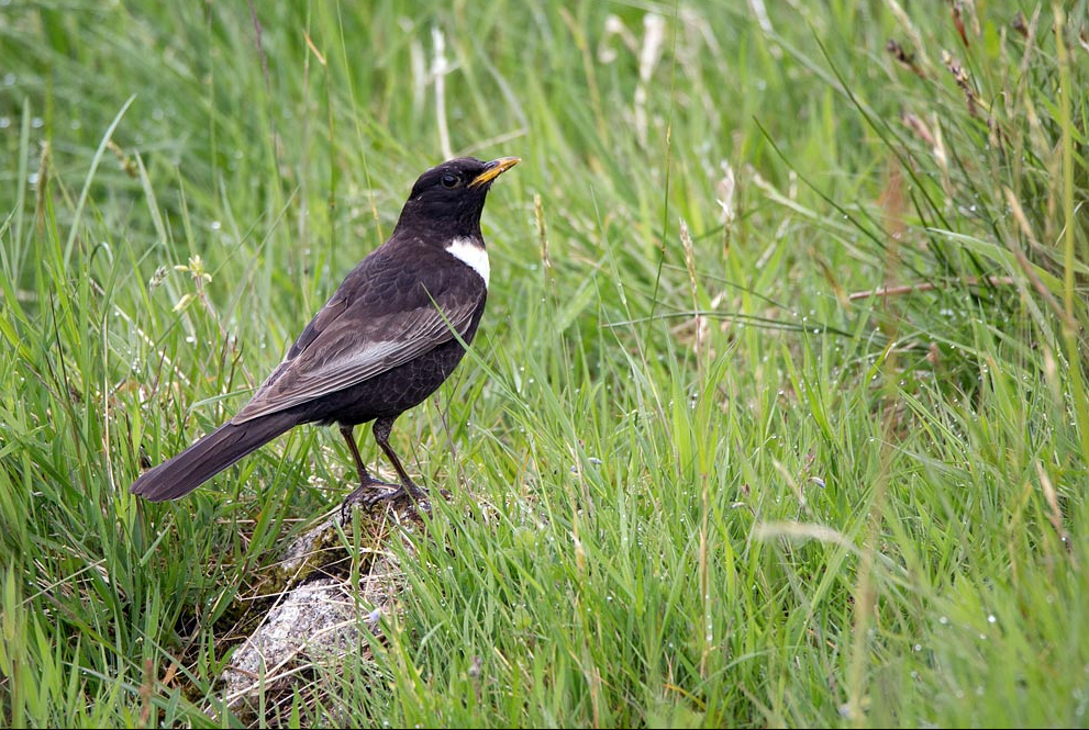
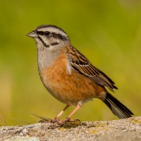
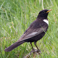
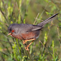
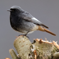
The Fóia viewpoint, in the Monchique mountains, is the highest point in the Algarve at 902 meters above sea level. From this location, on clear days, you can see a large expanse of the Algarve all the way to the coast, covering an area from Cabo São Vicente in Sagres, Faro, and as far north as the Serra da Arrábida. A breathtaking landscape. Very scrubby, sandy paths, no trees, plenty of big rocks not to mention the pylons etc. and it can get quite windy but this doesn't put off the likes of Grijze Gors , Blauwe Rotslijster , Graspieper , Boomleeuwerik , endless Roodborsttapuit , Provençaalse Grasmus , Zwarte Kraai , Vink , Koolmees , Kleine Zwartkop , Beflijster , Merel , Roodborst , Winterkoning , and Zwarte Roodstaart.
_________________________
Português: O miradouro da Fóia, na serra de Monchique, é o ponto mais alto do Algarve, a 902 metros acima do nível do mar. Deste local, em dias claros, avista-se uma vasta extensão do Algarve até à costa, abrangendo uma área que vai do Cabo de São Vicente, em Sagres, Faro, e tão a norte quanto a Serra da Arrábida. Uma paisagem de tirar o fôlego. Caminhos muito arbustivos, arenosos, sem árvores, com muitas pedras grandes, sem falar nos postes, etc. e pode ventar bastante, mas isso não desanima gente como Grijze Gors , Blauwe Rotslijster , Graspieper , Boomleeuwerik , interminável Roodborsttapuit , Provençaalse Grasmus , Zwarte Kraai , Vink , Koolmees , Kleine Zwartkop , Beflijster , Merel , Roodborst , Winterkoning , Zwarte Roodstaart.
Details
Toegang
Miradouro da Fóia is located west of the village of Monchique. The site is right at the top of the mountain so a car is necessary. Plenty of free parking, good road up but windy.
There is a paved road right to the summit which is topped by several telecommunication facilities including the Radar Station Number 1 of the Portuguese Air Force. On a clear day the Atlantic Ocean is visible. There's good parking, a large cafe with customer toilets, and a separate large community craft centre. Press p on the map for directions.
_________________________
Português: O Miradouro da Fóia situa-se a oeste da vila de Monchique. O local fica mesmo no topo da montanha, pelo que é necessário um carro. Existe bastante estacionamento gratuito, a estrada de acesso é boa, mas sinuosa. Existe uma estrada asfaltada que leva diretamente ao cume, onde se encontram várias instalações de telecomunicações, incluindo a Estação de Radar n.º 1 da Força Aérea Portuguesa. Num dia claro, é possível avistar o Oceano Atlântico. Existe um bom estacionamento, um café amplo com casas de banho para clientes e um grande centro comunitário de artesanato.
 ) om vogelnamen snel in te voeren via een aanklikbare lijst.