Opis
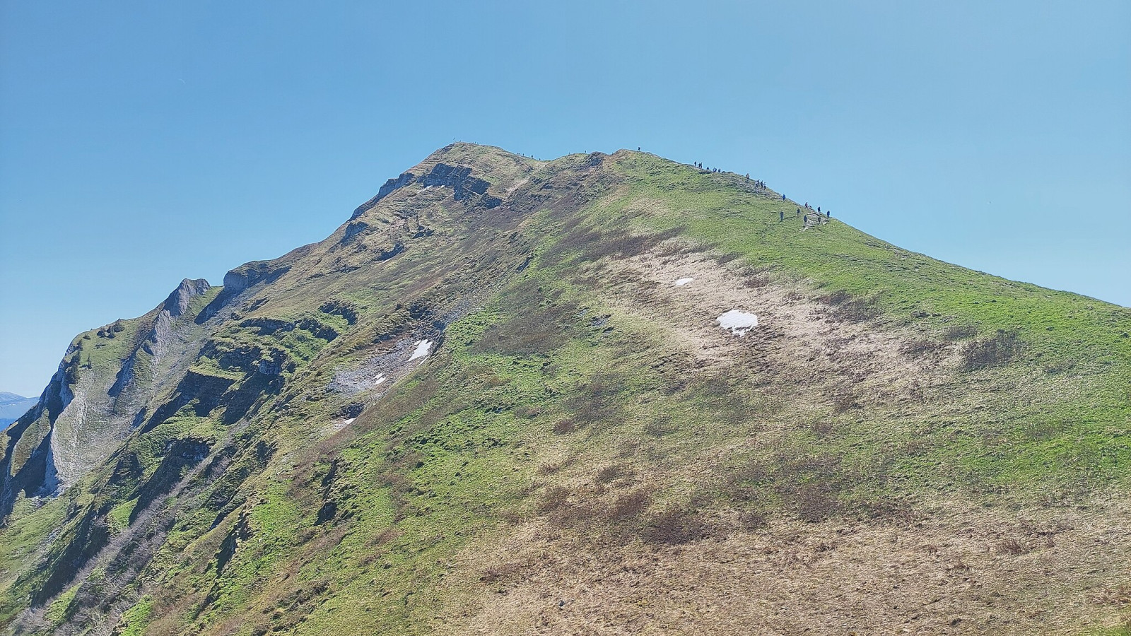
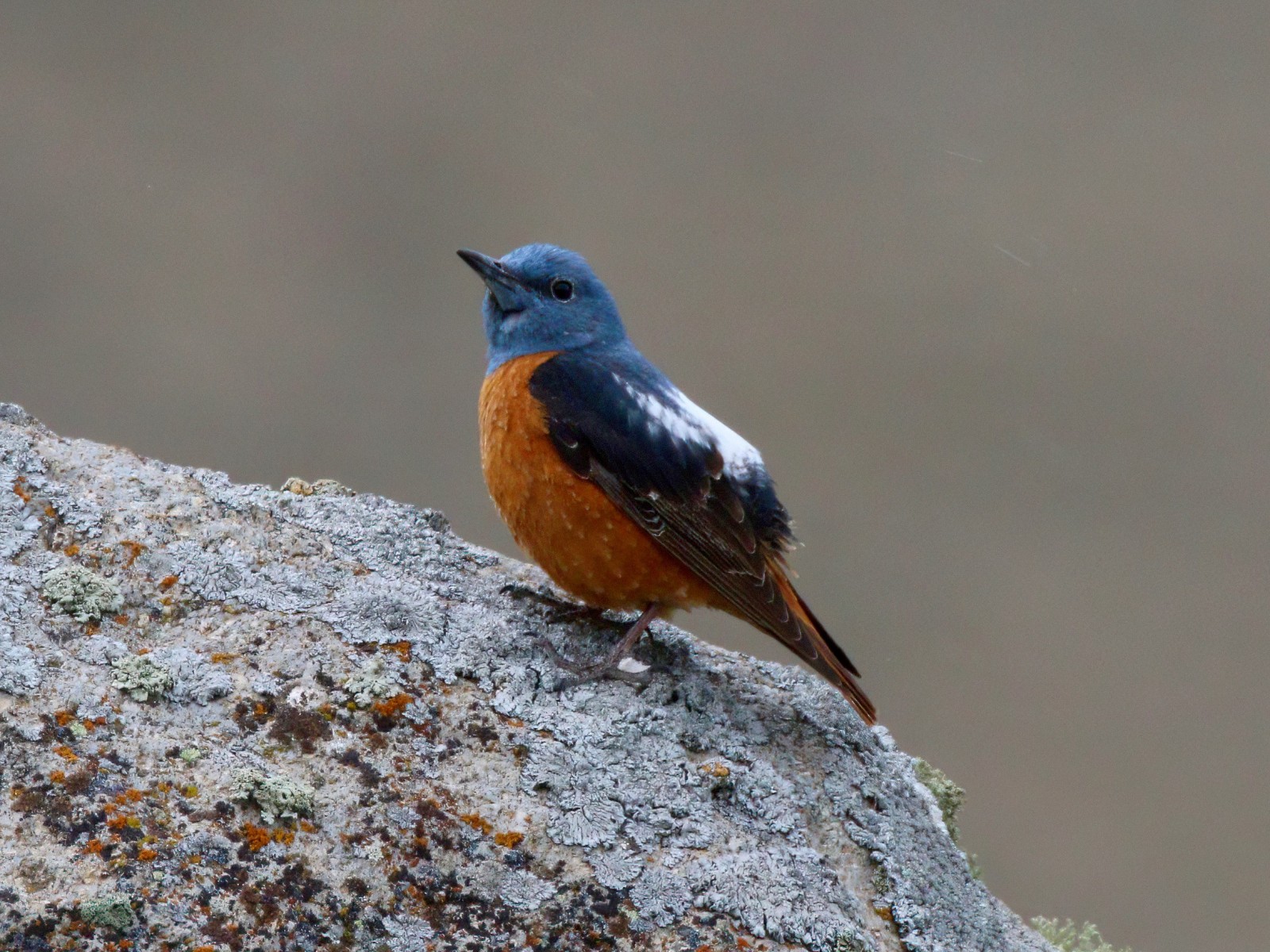
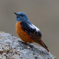
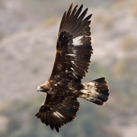
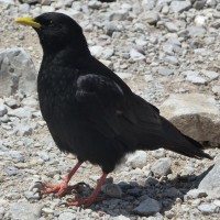
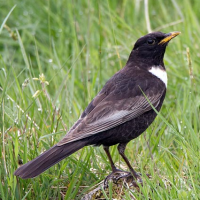
The Kanisfluh mountain is 2044 m high. As for alpine regions in general the mountain is a "good-weather"-destination. Do not bother going there even in mixed weather conditions. Kanisfluh is famous for its breeding population of nagórnik (they show a strong preferences for S and SW exposed treeless stony slopes as breedings habitat). Expect to see the first juveniles hopping around beginning of July earliest. At this time birds are easier to see since adults are very active feeding. Still searching the birds are facilitated using a scope (on a tripod).
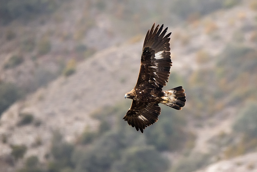
Also other alpine bird species can be seen as to name wieszczek, drozd obrożny, osetnik, and świstunka górska. Other species are probably rather rare and unlikely to be seen (but not impossible including cietrzew, there also claims of góropatwa skalna etc.). With luck you might also see orzeł przedni. A speciality of the mountain range is a population of Alpine Ibex (often very high up along the moutain ridge).
There is also a high diversity in other plants and animals (as e.g. butterflies) since this is a limestone mountain area ("Vorarlberg Limestone Alps").
Szczegóły
Dostęp
The Kanisfluh is located in the Bregenzerwald region between the villages of Mellau and Au. Access by foot (an 4 h 30 min hours hike, length total 12.05 km, up 1296 m and down 723 m) with starting point from public parking area in Au. Also you can start from the other side (W point) to where you can get also by bus: www.vmobíl.at with Linie 850 und 840 or you take the bus back to Au from Mellau (near Hotel "Sonne" in the center of Mellau). For details check also https://www.au-schoppernau.at/aktivitaet/au-schoppernau-kanisfluh/ since you can take the cable railway ("Roßstellealpe" as summit station) from Mellau (1 and 2 on the map) down or up depending on direction.
If you come (close) to the "Alpenhof Edelweiss" (at least on weekends a public restaurant/cafe) from directon Au then you see a stony, more or less treeless slope on you righ-hand side - this is the area where the nagórnik usually breed (I assume at max 2-3 pairs).
There is also a parking lot some distance S of the "Alpenhof Edelweiss" - you cannot and should not go beyond. Coming from Au in direction Damüls (193) you take after 4.1 km a hard right turn with signs "Alpenhof Edelweiss". This is a gravel road and partially quite steep. Be aware that this road can be blocked by snow well into May (depending on the snow situation the previous winter season). To my knowledge this road is open to public (if otherwise please do not enter and put a comment below). Going up this forest road can be interesting too, before you come towards the more open area near the parking lot.
If coming along the trail from Au I would think up to Kanisalpe contains the most interesting part of the route. At the very beginning, check for pluszcz along the river.

 ) aby wstawić nazwy ptaków w swoim języku ojczystym. Nazwy ptaków zostaną automatycznie przetłumaczone dla innych użytkowników!