
Opis
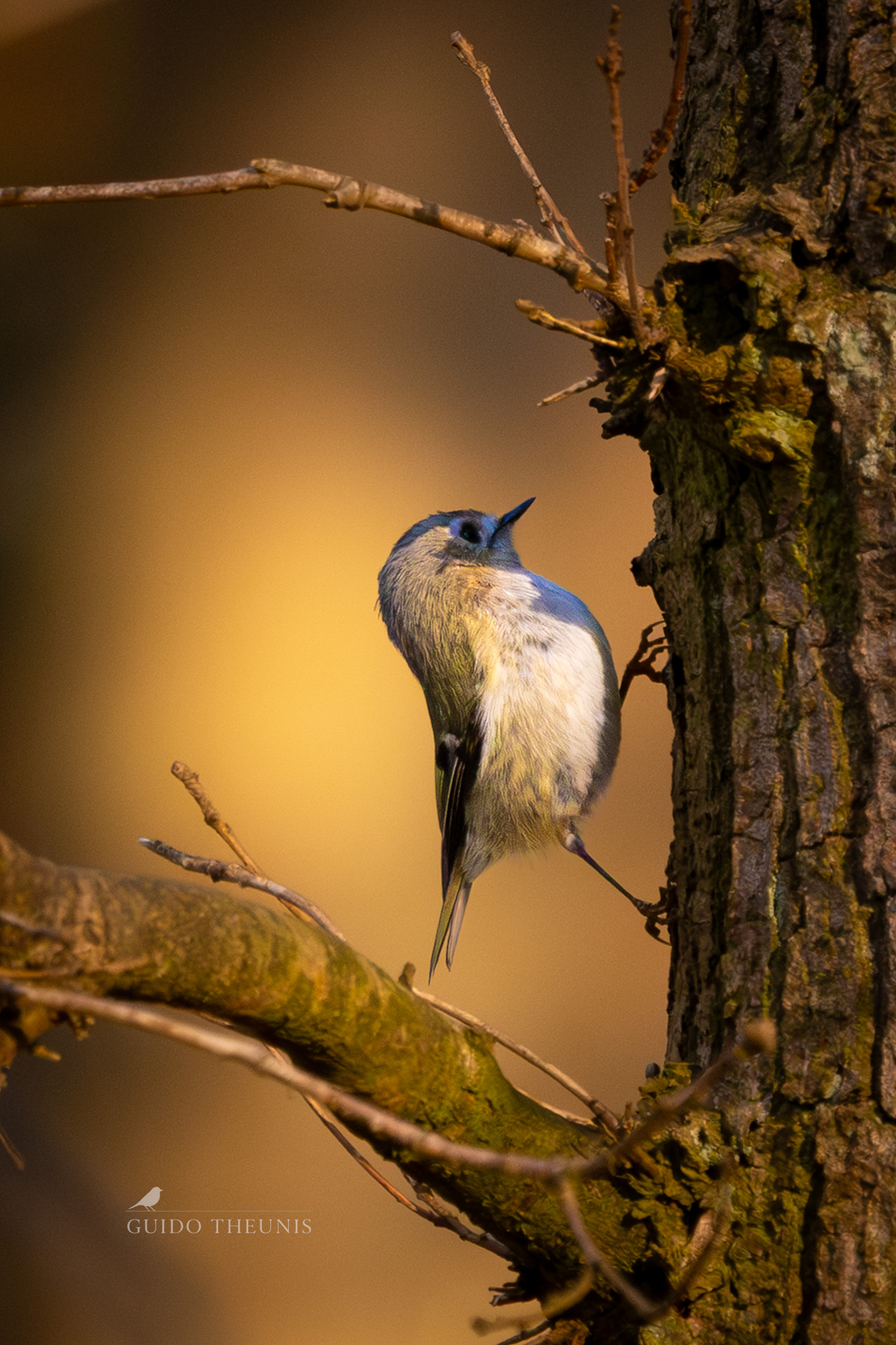
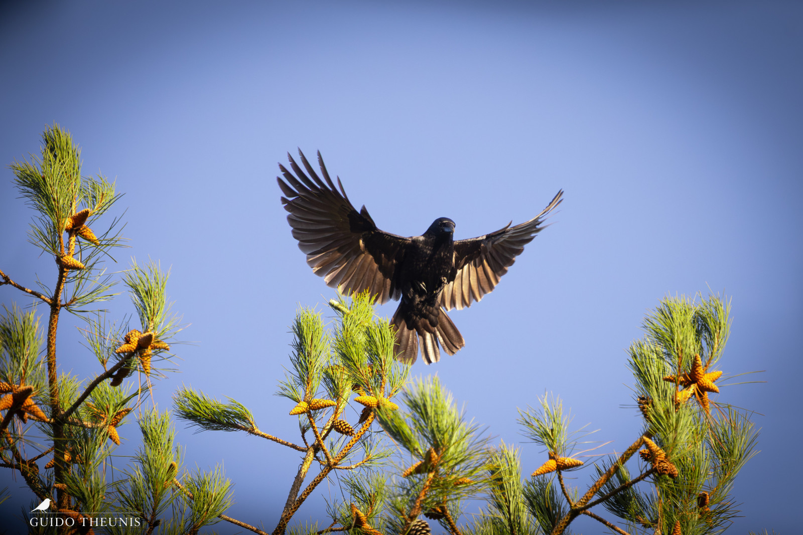
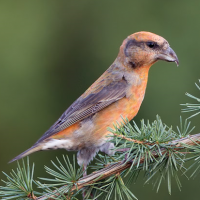
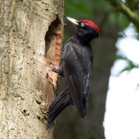
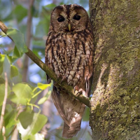
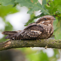
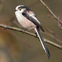
The Rucphense Bossen are a former production forest that is partly used for Defense exercises. The forest is fairly straightforward and you can determine the length of the route yourself or follow the marked walking routes. Birds that you can encounter in the area include lelek, kląskawka, kowalik, raniuszek zwyczajny, krzyżodziób świerkowy, kobuz, puszczyk zwyczajny, muchołówka żałobna and different species of woodpecker.
_________________________
Nederlands: De Rucphense Bossen bestaan uit gemengde bossen, heide, zandduinen en graslanden. Dit voormalige productiebos van ongeveer 1.200 hectare wordt voor een gedeelte gebruikt voor oefeningen van Defensie. Het bos is redelijk recht toe recht aan en je kunt de lengte van de route zelf bepalen of de gekleurde routes volgen. Vogels die je kunt tegenkomen in het gebied zijn onder meer lelek, kląskawka, kowalik, raniuszek zwyczajny, krzyżodziób świerkowy, kobuz, puszczyk zwyczajny, muchołówka żałobna en verschillende soorten spechten.
Szczegóły
Dostęp
The Rucphense Bossen are located between the towns of Rucphen and Roosendaal. You can park at the various car parks around the woods. Press a P on the map for directions to a car park. The best way to explore the area is on foot. There are also a number of cycle paths that run through the woods. The length of the colour-marked walking routes is approximately 4 km (Blue) 6 km (Green) 11.5 km (Yellow). The circular walk shown on the map is approximately 9 km.
_________________________
Nederlands: De Rucphense Bossen liggen tussen Rucphen en Roosendaal. Parkeren kan op de verschillende parkeerplaatsen rondom de bossen. Druk op een P in de kaart voor een routebeschrijving naar een parkeerplaats. Je kunt het gebied het best te voet verkennen. Ook zijn er een aantal fietspaden die door het bos lopen. De lengte van de met kleur gemarkeerde wandelroutes zijn ongeveer 4 km (Blauw) 6 km (Groen) 11,5 km (Geel). De rondwandeling die op de kaart is weergegeven is ongeveer 9 km.
Er loopt een verhard fietspad door het bos, hiermee kom je ook op de heide. Verder zijn het zandpaden. Met de auto kun je goed bij de centrale parkeerplaats komen. En anders is de route snel op te pikken vanuit de parkeerplaatsen aan de randen van het bos.
 ) aby wstawić nazwy ptaków w swoim języku ojczystym. Nazwy ptaków zostaną automatycznie przetłumaczone dla innych użytkowników!