Opis
Wadi Qelt is one of the most important desert wadis in the region, cutting deeply through the desert as it descends from the Jerusalem highlands toward Jericho city in the Jordan Valley. The wadi is characterized by towering limestone cliffs, steep rocky slopes, narrow gorges, and several permanent springs that support lush riparian vegetation and reedbeds.
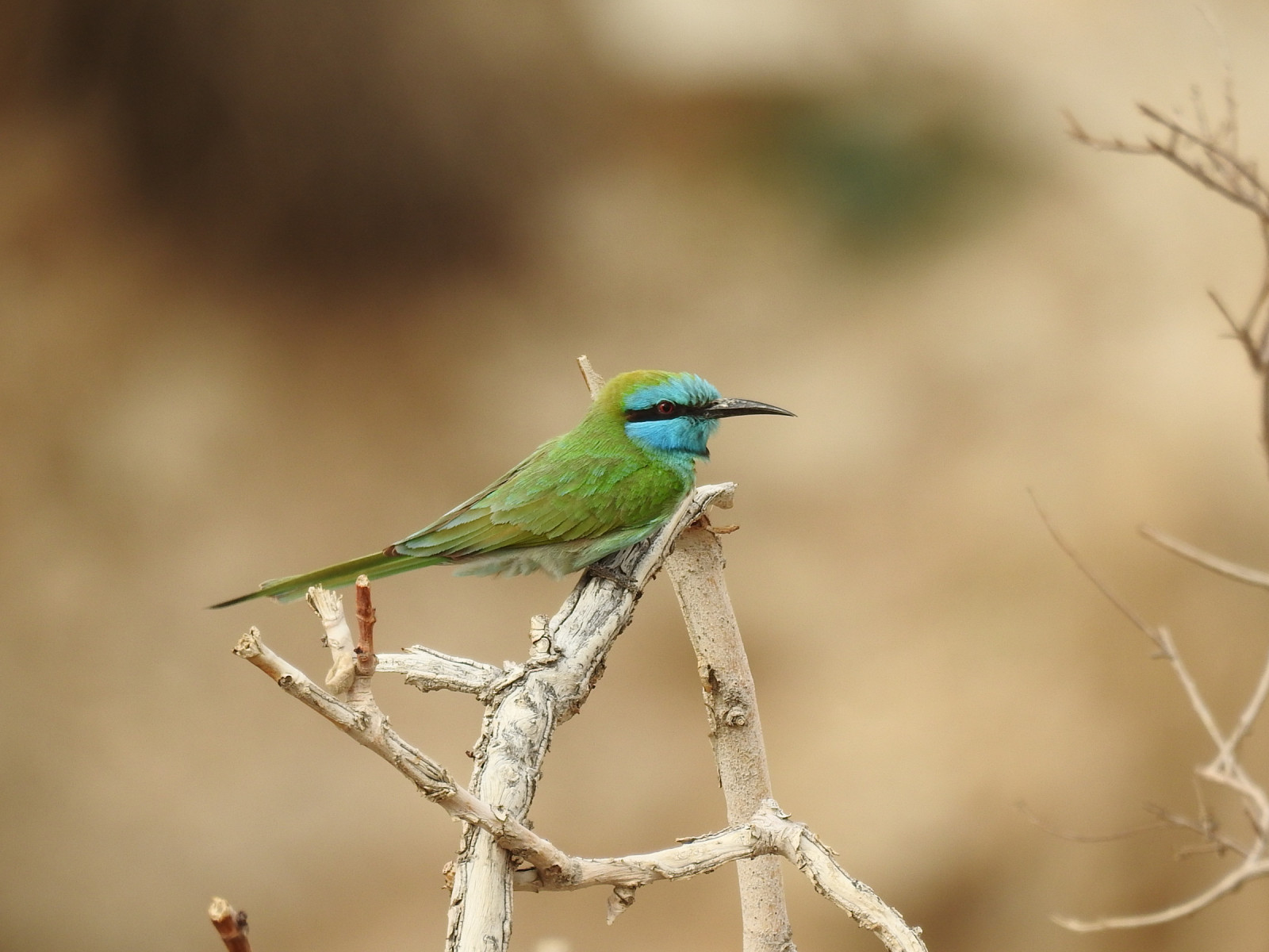
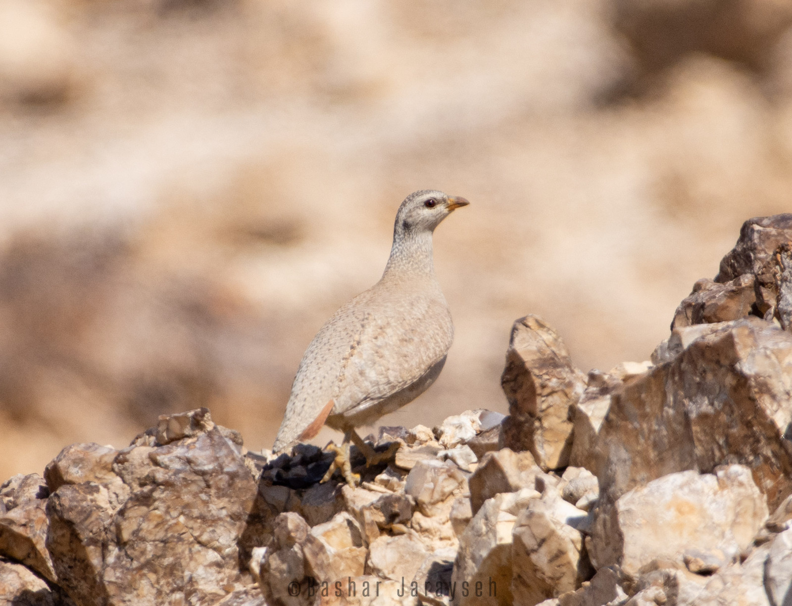
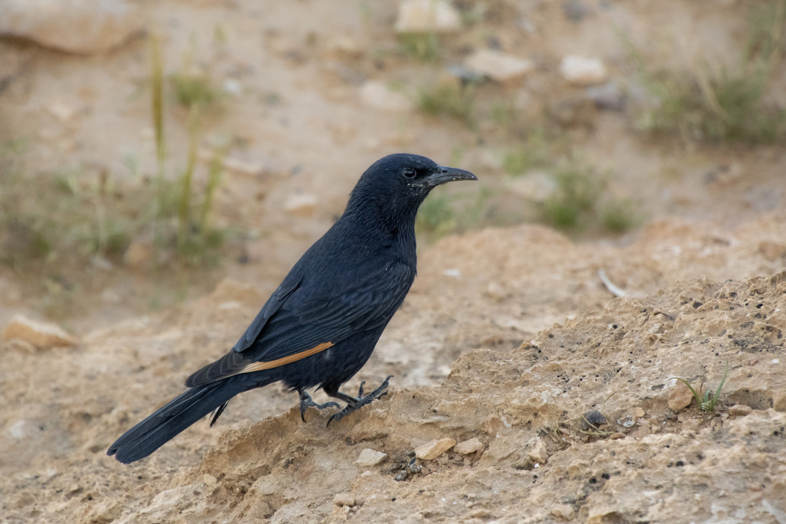
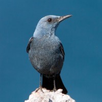
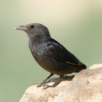
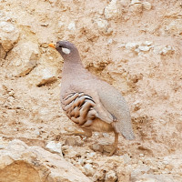
This combination of water, shade, and desert terrain creates excellent bird diversity. Cliffs and rock faces host breeding pustułeczka, pustułka (zwyczajna), puchacz, modrak, kruk pustynny, while the vegetated wadi floor supports species such as prinia zwyczajna, bilbil arabski, and nektarnik palestyński. Desert specialists including Desert Lark, Białorzytka czarnosterna, Tristram's Starling, and kuropatewka pustynna are regularly encountered on rocky slopes.
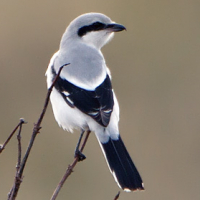
During spring and autumn migration, Wadi Qelt lies along a major flyway for soaring birds such as myszołów wschodniokaukaski, kania czarna, Trzmielojad, gadożer, and harriers, as well as many migrating passerines using the wadi as a stopover site. The contrast between barren desert and green oases makes birding here particularly productive. There are also good chances to see the Rock Hyrax in the wadi and the Mountain Gazelle in the surrounding hills.
In addition to its natural importance, Wadi Qelt has exceptional cultural and historical value. The landscape is home to St. George’s Monastery, which is well worth a visit.
Szczegóły
Dostęp
Wadi Qelt is located between Jerusalem and Jericho, descending eastward toward the Jordan Valley. The wadi can be accessed from several points along the Jerusalem–Jericho road (see map), where parking is available near main trailheads, viewpoints above the canyon, and access routes to the monastery. There is no direct public transport into the wadi.
Wadi Qelt is best explored on foot. Marked hiking trails descend into the canyon and follow the wadi floor past springs, pools, and monasteries. Car access is limited to parking areas along the rim of the canyon, and bicycles are not suitable due to steep and rocky terrain. For short visits, visitors can park at one of the access points, descend into the wadi, and explore upstream or downstream at their own pace. Several viewpoints along the canyon rim also provide excellent opportunities for scanning raptors and enjoying the landscape without committing to a long hike.
For longer hikes, a common route starts approximately 4.5 km upstream St. George’s Monastery, where parking is not available and a drop-off is recommended. From here, the trail follows the wadi downstream to the outskirts of Jericho, where pickup can be arranged; this route is approximately 10 km long and is the one shown on the map. Longer options include starting from Ayn al Fawwar (about 12 km) or further upstream from Ein Prat (Ein Fara), covering up to ~20 km within the wadi. The full length of Wadi Qelt, from Ein Prat to Jericho, is approximately 25 km, though it is usually completed in sections rather than as a single hike.
The trail is of moderate difficulty overall, following mostly rocky terrain with several narrow sections along cliff edges. In exposed areas, metal handles are installed to assist with short climbs or descents, and extra care is required, especially when carrying optics or camera equipment. As the trail descends, the canyon becomes progressively deeper, with small waterfalls and pools along the way. Water levels can be high in winter, and hiking should be avoided during storms due to the risk of flash floods. Allow 2–3 hours for short walks and birding near the springs and viewpoints, while a half-day visit is recommended for longer hikes. November to April is the best season for hiking; in summer, conditions are suitable mainly for short walks and swimming near the springs, with longer hikes not recommended due to high temperatures.
Teren i siedlisko
Kanion/klif , Pustynia , RzekaWarunki
Górzysty , Skalisty , Ślisko , Pylisty , Możliwy wysoki poziom wodyTrasa dookoła
NieCzy luneta będzie przydatna ?
NieUdany sezon obserwacyjny
Przez cały rokNajlepszy czas na wizytę
Wiosenne migracje , Wiosna , Jesienne migracje , ZimaTrasa
Wąski szlakPoziom trudności szlaku pieszego
Średnio wymagający spacerDostępne
PieszoCzatownia/platforma obserwacyjna
NieDodatkowe informacje
The wadi is active year-round, but spring and autumn offer the highest bird diversity due to migration. Summer temperatures can be extreme, so early morning visits are strongly recommended. Carry sufficient water, wear sun protection, and stay on marked trails due to steep cliffs and flash-flood risk after heavy rain. Access restrictions and security conditions may change, so checking local guidance before visiting is advised.
 by Artemy Voikhansky, CC BY-SA 4.0 httpscreativecommons.orglicensesby-sa4.0, via Wikimedia Commons.jpg)
 ) aby wstawić nazwy ptaków w swoim języku ojczystym. Nazwy ptaków zostaną automatycznie przetłumaczone dla innych użytkowników!