Opis
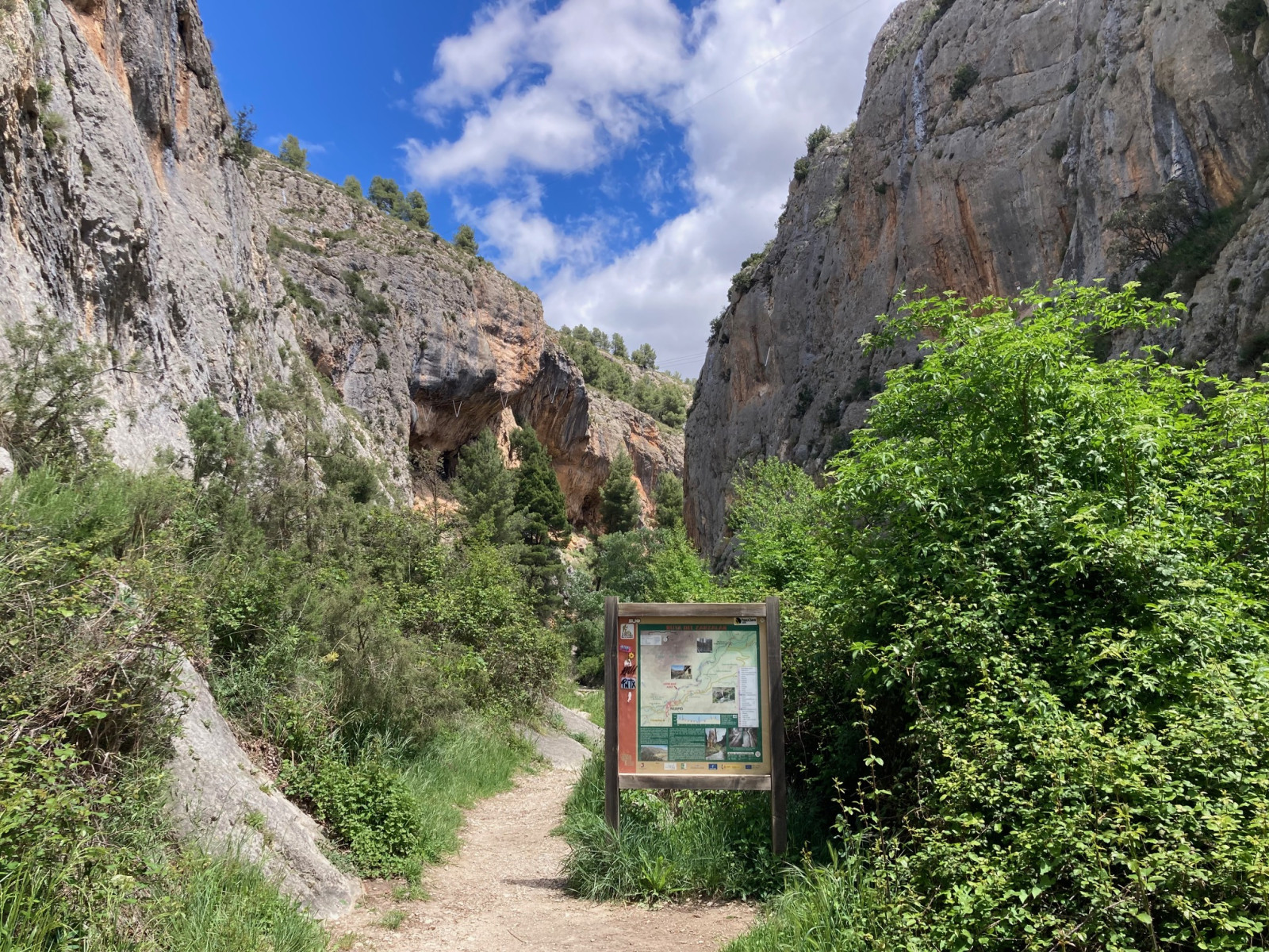
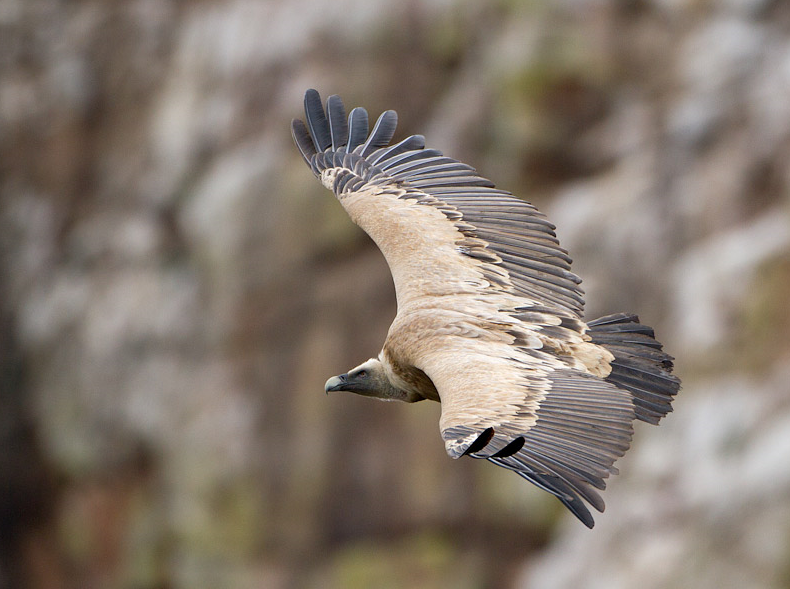
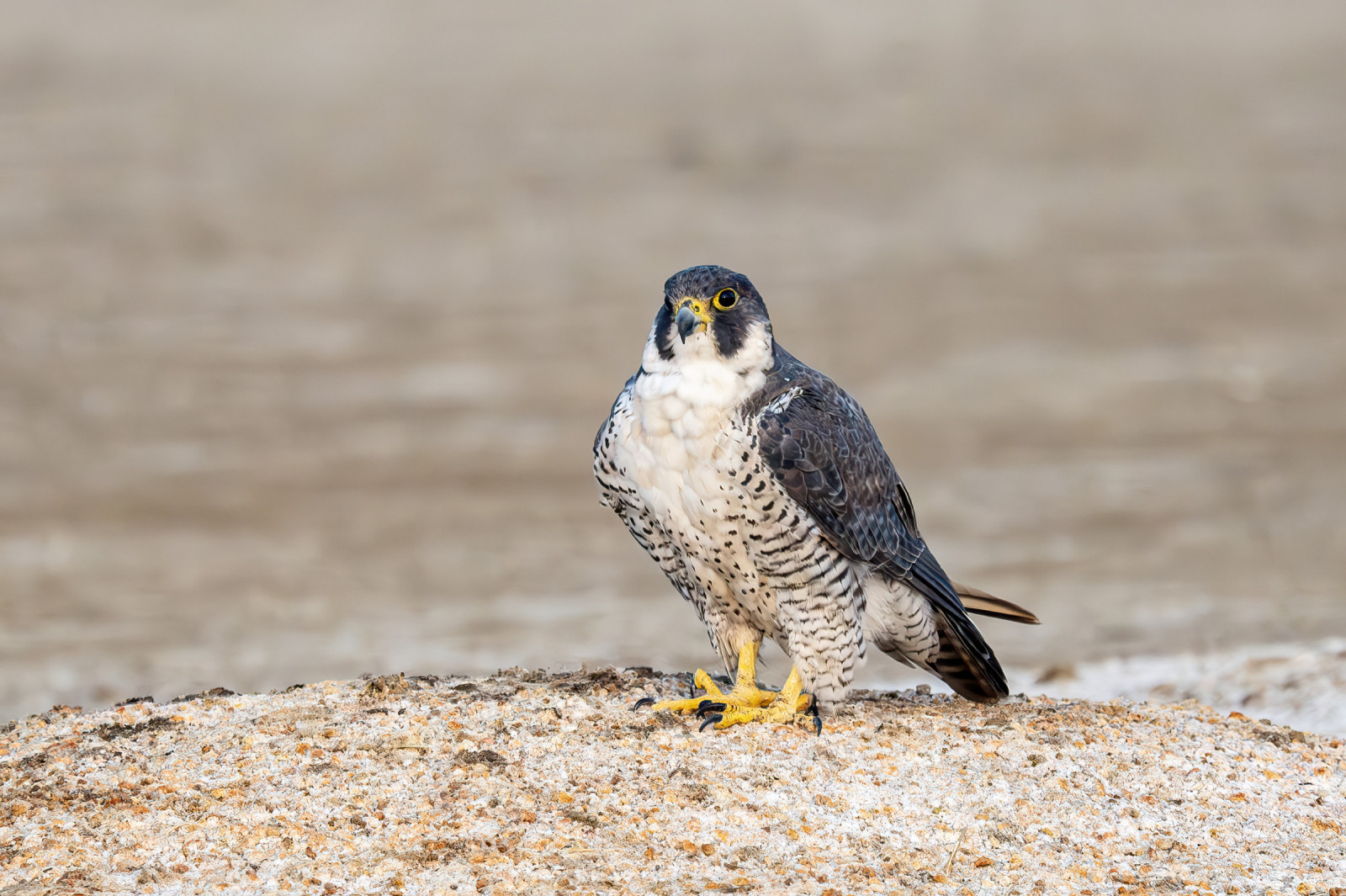
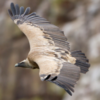
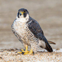
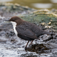
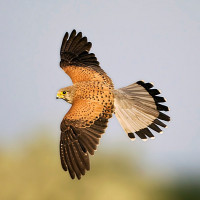
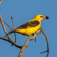
Ruta del Zarzalar is a river walk along the Taibilla River that continues through the base of a canyon, allowing you to see emblematic riverside birds along with rock birds and a wide variety of birds of prey. Among the birds you can encounter along the way are jerzyk alpejski, sęp płowy, sokół wędrowny, orzełek, gadożer, wilga (zwyczajna), pluszcz and modrak.
_________________________
Español: La ruta del zarzalar se trata de una ruta sencilla (6 km), que se realiza a pie, con un paisaje excelente y grandes oportunidades para pajarear. Se trata de un paseo fluvial por el rio Taibilla que continúa a través de la base de un cañon, por tanto permite avistar aves emblemáticas de ribera junto con aves rupículas y gran variedad de rapaces.
Szczegóły
Dostęp
Ruta del Zarzalar is accessed from the town of Nerpio.You can park your vehicle in a car park with a decent capacity for vehicles. Press P on the map for directions. If there is no space, you can park your vehicle in the town itself and you will be 5 minutes from the start of the route. The route can only be explored on foot.
_________________________
Español: Se accede a la ruta desde el mismo pueblo de Nerpio, y se puede estacionar el vehículo junto a un parking con una capacidad decente de vehículos. Si no hubiera espacio, se puede estacionar el vehículo en el mismo pueblo y se estará a 5 minutos del inicio de ruta. La ruta unicamente se puede explorar andando.
Teren i siedlisko
Las , Kanion/klif , Rzeka , Rzadkie drzewa i krzewyWarunki
Płaski , PagórkowatyTrasa dookoła
TakCzy luneta będzie przydatna ?
NieUdany sezon obserwacyjny
Wiosna , JesieńNajlepszy czas na wizytę
Wiosna , Wiosenne migracje , Jesienne migracjeTrasa
Szeroka ścieżka , Droga nieutwardzonaPoziom trudności szlaku pieszego
ŁatwyDostępne
PieszoCzatownia/platforma obserwacyjna
NieDodatkowe informacje
I am attaching a link to Wikiloc below with a track of the route in case you wish to do it through this platform, or as a guide to locate the place and see the possibilities.
_________________________
Español: Adjunto enlace a Wikiloc con track de la ruta por si se desea realizar a través de esta plataforma, o de manera orientativa para localizar el lugar y ver las posibilidades.
 ) aby wstawić nazwy ptaków w swoim języku ojczystym. Nazwy ptaków zostaną automatycznie przetłumaczone dla innych użytkowników!