Opis
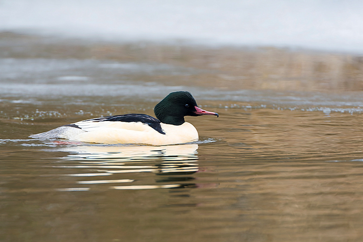
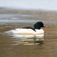
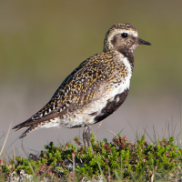
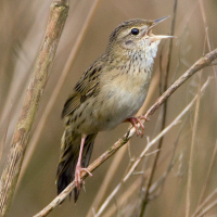
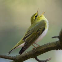
Avon Dam (sometimes called Avon Reservoir) is a relatively shallow reservoir built in 1957, best known by local birdwatchers as a nurogęś roost site. BE AWARE roosting nurogęś can depart for local rivers at sunrise. The walk from Shipley Bridge car park is on a good path right up to the dam, following the River Avon through woodland, the fruiting Rowan (Sorbus aucuparia) trees attract kos (zwyczajny), drozd obrożny, paszkot, śpiewak, droździk and kwiczoł sometimes at the same time in Autumn.
For those with more time a walk further onto open moorland can produce more species. BE WARNED weather can change quickly on Dartmoor, conditions such as mist and fog can descend without warning, a map/compass or GPS-device is advised along with protective clothing.
Press STARS on map for more information.
Szczegóły
Dostęp
The A38 - Devon Expressway runs between Exeter (to the East) and Plymouth (to the West). If traveling from Exeter leave on M5 motorway/A38 following signs to Plymouth, passing through Ashburton/Buckfastleigh. On approaching Marley Head interchange (in the shape of a large number eight), leave on slip road signed Paignton A385/South Brent/Avonwick (B3210), at roundabout take first exit signed South Brent/Avonwick, road goes over A38, at next roundabout take second exit signed Harbourneford/Didworthy/Avon Dam (*A). Note this road becomes narrow, at next crossroads (Harbourneford) continue straight ahead signed Didworthy/Avon Dam. At next junction road bends sharply to Left, at next crossroads (Gingaford) continue straight ahead signed Shipley Bridge/Didworthy. Road eventually passes through wooded section and goes over narrow Shipley Bridge, car park is immediately ahead on the Right. If traveling from Plymouth leave on A38 signed Exeter, on approaching Marley Head interchange leave A38 at sign for Paignton A385, at roundabout take third exit signed Harbourneford/Didworthy/Avon Dam and follow from (*A) above.
Teren i siedlisko
Rzadkie drzewa i krzewy , Tereny podmokłe , Wrzosowisko , Dolina , Łąka , Rzeka , JezioroWarunki
Pagórkowaty , Skalisty , Otwarty krajobraz , BagiennyTrasa dookoła
TakCzy luneta będzie przydatna ?
Może być przydatnaUdany sezon obserwacyjny
Przez cały rokNajlepszy czas na wizytę
Zima , Lato , Wiosenne migracje , Wiosna , Jesień , Jesienne migracjeTrasa
Droga utwardzona , Szeroka ścieżka , Droga nieutwardzona , Wąski szlakPoziom trudności szlaku pieszego
Średnio wymagający spacerDostępne
Pieszo , SamochódCzatownia/platforma obserwacyjna
NieDodatkowe informacje
The circular walking route indicated on the map is about 8 km.

 ) aby wstawić nazwy ptaków w swoim języku ojczystym. Nazwy ptaków zostaną automatycznie przetłumaczone dla innych użytkowników!