Opis
Comprising mainly of both wet and dry peatland and lowland heath, the area comprises of Goss Moor in the West and Tregoss Moor to the East with farmland in the North Middle section. The area is a Site of Special Scientific Interest (SSSI) and are part of a Special Area of Conservation (SAC). Much of the area was involved in 'Tin Streaming', a mining method of extracting tin from the ground by the use of streams and rivers, very much like gold mining in the Yukon. The use of 'Tin Streaming' over many hundreds of years has ecologically changed the environment, by physically changing the landscape or by contaminating the composition of water courses.
The source of the River Fal (eventually reaching the English Channel at Falmouth) can be found on Goss Moor and the area has many nationally scarce and rare plants and animals, such as Yellow Centaury (Cicendia filiformis), Marsh Clubmoss (Lycopodiella inundata), Odorata such as Small Red Damselfly (Ceriagrion tenellum), Variable Damselfly (Coenagrion pulchellum), Lepidoptera such as Silver Studded Blue (Plebejus argus), Small Pearl-bordered Fritillary (Boloria selene), Grizzled Skipper (Pyrgus malvae), Marsh Fritillary (Euphydryas aurinia), Narrow-bordered Bee Hawk-Moth (Hemaris tityus) and Double Line Moth (Mythimna turca), mammals such as Eurasian Otter (Lutra lutra), Hazel Dormouse (Muscardinus avellanarius) and the more common Roe Deer (Capreolus capreolus) can also be found. The narrow A30 road once ran through Goss Moor, but since the opening (2007) of the newer A30 duel carriageway further North the older road is now much less used.
The Par - Newquay 'Atlantic Line' rail bridge over this old A30 is probably more 'famous' for being the most hit rail bridge in the United Kingdom. Around the site is the Goss Moor Multi Use Trail (Horse riding/Cycling/Running) that is 7 miles long and mostly flat.
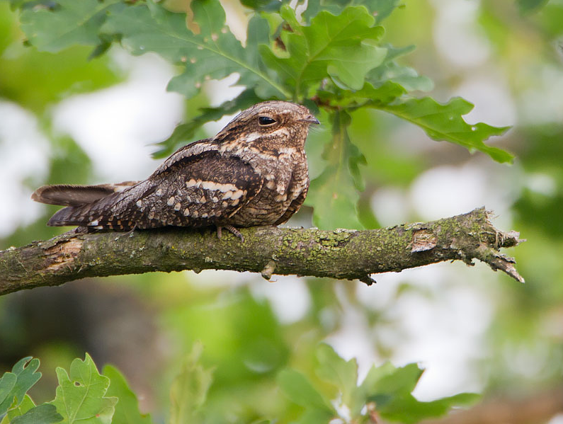
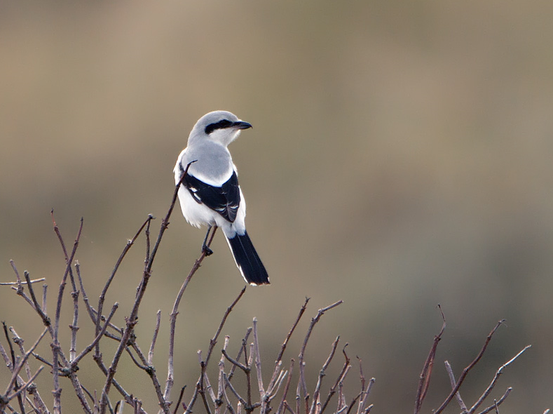
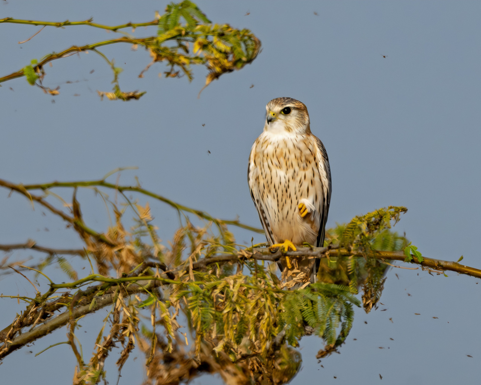
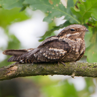
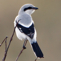
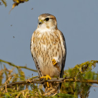
During Winter a srokosz is a distinct possibility, kruk are commonly seen, during summer. lelek, piecuszek, świerszczak and the once common but now increasingly rare muchołówka szara are likely. Amongst raptors pustułka (zwyczajna) and possibly drzemlik, or even kobuz checking out the numerous pools can also be possible.
Szczegóły
Dostęp
The 'new' A30 dual carriageway that runs from Bodmin (to the North East) and Indian Queens (just to the West) is just to the North of the site. From the Indian Queens direction leave the A30 at the Victoria Junction, on slip road signed Victoria/Roche B3274, at next roundabout follow signs to Roche/Victoria B3274/Services/Station taking third exit, this road now goes over the A30, at next roundabout take first exit signed Roche/Victoria B3274/Station, (***) continue on B3274 passing through Victoria, on passing under electricity power lines you soon pass under the Railbridge (with 4•3 metre/14'-3" Height Restriction sign). Continue on this road and take next Left turning (unsigned) on a sharp bend, continue on this road and car park is straight ahead. From Bodmin direction on A30 duel carriageway look for Roche/Victoria B3274 sign and take Left slip road, at next roundabout take first exit signed Roche/Victoria B3274/Station and follow from *** above.
Teren i siedlisko
Rzadkie drzewa i krzewy , Łąka , Dolina , Wrzosowisko , Rzeka , Rolnictwo/uprawy , Jezioro , Tereny podmokłeWarunki
Płaski , Bagienny , Ślisko , Suchy , Otwarty krajobrazTrasa dookoła
TakCzy luneta będzie przydatna ?
Może być przydatnaUdany sezon obserwacyjny
Przez cały rokNajlepszy czas na wizytę
WiosnaTrasa
Droga utwardzona , Szeroka ścieżka , Droga nieutwardzona , Wąski szlakPoziom trudności szlaku pieszego
ŁatwyDostępne
Pieszo , Rower , SamochódCzatownia/platforma obserwacyjna
NieDodatkowe informacje
DANGER. Be aware rail road crossings are unmanned and ungated. RED LIGHTS WARN OF APPROACHING TRAINS, PAY ATTENTION TO WARNING SIGNS.
WARNING, keep to paths in wet swampy areas, SOME AREAS ARE POTENTIALLY TREACHEROUS.
 ) aby wstawić nazwy ptaków w swoim języku ojczystym. Nazwy ptaków zostaną automatycznie przetłumaczone dla innych użytkowników!