Opis
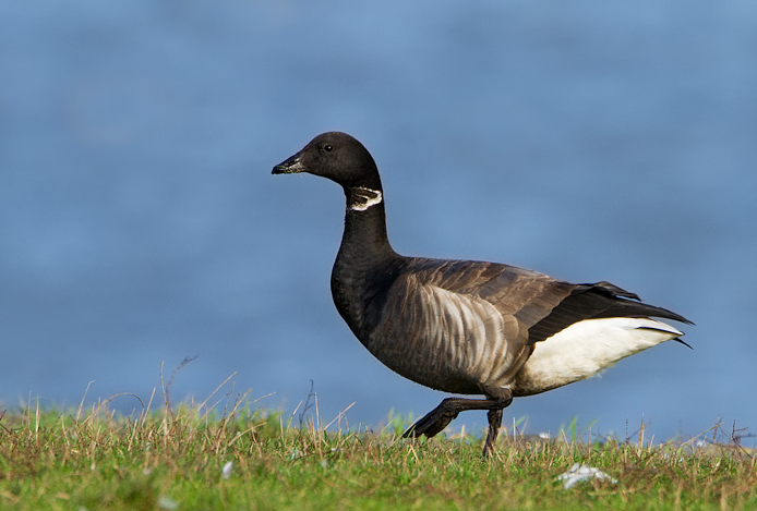
After you have walked from the car park and over the Lock Gates, you are now overlooking the estuary. It's always a good idea to time your arrival as the raised tide is on its way out (see a link to the tide table below. Scanning the water for szlachar, bernikla obrożna, świstun and gull species.
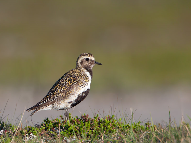
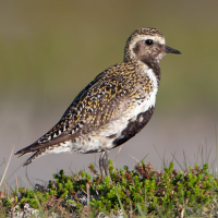
Even at high tide you will see waders moving up and down the estuary such as ostrygojad, krwawodziób, kulik wielki, czajka, biegus zmienny, siewka złota and rycyk.
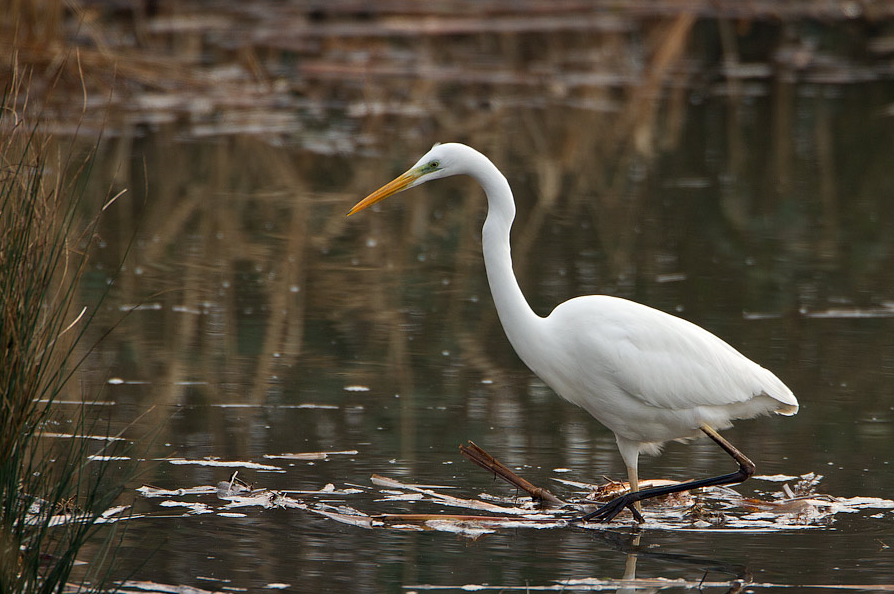
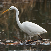
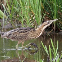
While watching the estuary, the other side of the sea wall offers a fresh water lake plus all the species that may be seen in that habitat. It is a large shallow expense, with the banks lined with reeds. Birds here can include, krzyżówka, cyraneczka, krakwa and Płaskonos. The reed beds around the fresh water lake are good places to see trzcinniczek (zwyczajny), rokitniczka, wąsatka, wierzbówka zwyczajna and potrzos. Regular sightings of czapla biała, czapla siwa and the odd bąk can over winter.
You can follow the raised walkway around the lake while still being able to view the estuary. Once the tide goes out, good numbers of waders can be seen all over the mudflats. ohar, siewnica, szablodziób, czapla nadobna and kamusznik. During spring migration waders such as kulik mniejszy and brodziec śniady can be observed.
Szczegóły
Dostęp
The main town in the area is Maldon, Essex, accessed from the A12. Head through Heybridge, then onto the village of Heybridge Basin on the B1026 Goldhanger Rd, now turn right, this is signposted. Follow the road until you see signs for the only car park , The Daisy Meadow car park. Press P on the map for directions. At the bottom of the car park a small set of steps leads up to the tow path of a canal. Turn left follow it to the Lock Gates, cross the Lock Gates on to the sea wall footpath. The circular walk indicated on the map is about 4 km.
Teren i siedlisko
Tereny podmokłe , Staw , Rzeka , Morze , Jezioro , Błota , TrzcinowiskaWarunki
Płaski , Ślisko , Otwarty krajobrazTrasa dookoła
TakCzy luneta będzie przydatna ?
Może być przydatnaUdany sezon obserwacyjny
Wiosna , JesieńNajlepszy czas na wizytę
Wiosenne migracje , Jesienne migracjeTrasa
Szeroka ścieżka , Droga nieutwardzonaPoziom trudności szlaku pieszego
Średnio wymagający spacerDostępne
Pieszo , RowerCzatownia/platforma obserwacyjna
NieDodatkowe informacje
There are two Pubs and a really nice Tea Room, Plus a little Coffee Kiosk on the Tow Path by the Car Park.
 ) aby wstawić nazwy ptaków w swoim języku ojczystym. Nazwy ptaków zostaną automatycznie przetłumaczone dla innych użytkowników!