Opis
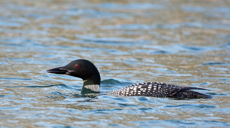
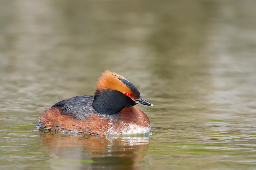
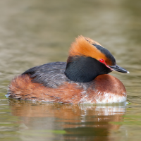
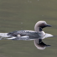
The twin villages of Higher Porthpean and Lower Porthpean now just called Porthpean and the headland of Black Head give views over the South facing sheltered St Austell Bay. Whilst there are landbirds throughout the year, the area comes into it's own during Spring/Autumn migration and especially during Winter when the bay can hold lodowiec, nur czarnoszyi, perkoz rogaty and occasionally nur rdzawoszyi. NOTE: due to having to look East, an afternoon visit to prevent low Winter sun 'glare' is best, overcast skies and calm water helps with identifying birds on the water.
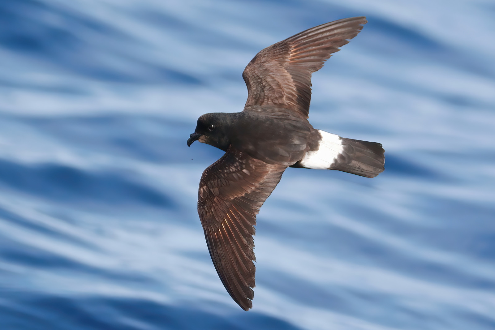
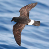
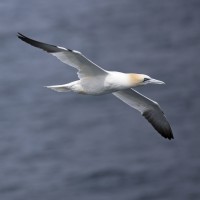
For those with more time a walk further South to Black Head, possibly calling in at Ropehaven Cliffs Nature Reserve (Cornwall Wildlife Trust), at Black Head (seawatching) look for passing głuptak, fulmar, nurzyk, alka, rybitwa popielata, rybitwa rzeczna and possibly maskonur.
This area is always worth checking out, in the past nur białodzioby, płatkonóg płaskodzioby, alczyk and uhla pstrodzioba have been seen.
Szczegóły
Dostęp
The main A390 road runs from Dobwalls (A38) near Liskeard (far to the North East) and Truro (further to the South West). If traveling from Dobwalls/Liskeard direction on A390, pass through the town of Lostwithiel, at the town of St Austell pass through the town (onA390), on reaching large roundabout at Mount Charles take second exit signed Truro A390 (A39)/Newquay (A3058). Continue on A390 and take Left turn at traffic lights signed Tregorrick Leisure Center/Little Harbour/Porthpean Golf Course/Mount Edgecumbe Hospice, (*A) continue on this road (Porthpean Road). At next roundabout take first exit, on leaving built up area turn Left signed Porthpean Beach, this road now called Porthpean Beach Road (Press STAR on map) soon narrows, eventually arriving at Porthpean Beach car park (Fee Payable) on the Right.
If traveling from Truro direction on A390, on entering St Austell pass through double roundabout staying on A390, at next roundabout take second exit signed Liskeard (A390), get in middle lane and turn Right at traffic lights signed Porthpean/Duporth/Mount Edgecumbe Hospice, and follow from (*A) above.
Teren i siedlisko
Rzadkie drzewa i krzewy , Łąka , Morze , Miasto/wieś , Rolnictwo/uprawy , Plaża , Kanion/klif , LasWarunki
Pagórkowaty , Skalisty , Otwarty krajobraz , Możliwy wysoki poziom wody , Ślisko , Bagienny , PłaskiTrasa dookoła
NieCzy luneta będzie przydatna ?
TakUdany sezon obserwacyjny
Zima , Jesień , WiosnaNajlepszy czas na wizytę
Zima , Wiosenne migracje , Wiosna , Jesień , Jesienne migracjeTrasa
Droga utwardzona , Szeroka ścieżka , Droga nieutwardzona , Wąski szlakPoziom trudności szlaku pieszego
Średnio wymagający spacerDostępne
Pieszo , Rower , SamochódCzatownia/platforma obserwacyjna
NieDodatkowe informacje
The route indicated on the map is about 5 km one way.
 ) aby wstawić nazwy ptaków w swoim języku ojczystym. Nazwy ptaków zostaną automatycznie przetłumaczone dla innych użytkowników!