
Opis
Once mainly known as a site just for wading birds, is now known, since the building of a major sewage works (NOTE: NO ENTRY to this site) and the creation of three nature reserves, is a site of more diverse species.
1. Uphill Hill Nature Reserve, owned and managed by North Somerset Council, is a good site for pójdźka and pustułka (zwyczajna) (check high cliff face), this high piece of land marks the southern end of the Mendip Hills.
2. Walborough Nature Reserve is a Avon Wildlife Trust site, comprising of open grassland and adjacent saltmarsh, where on extreme high tides birds roost/continue to feed.
3. Bleadon Levels Nature Reserve managed by Wessex Water, is a series of pools and reedbeds with a bird hide and 'blind'.
Because of the tidal range of the Bristol Channel (second biggest in the world) at low to medium tide birds can be at very long distance, a visit close to high tide is best, forcing birds to high tide roosts (press STAR on map) on fields/saltmarsh and offshore island. As tide recedes birds quickly leave these roosts and move over a wide area, sometimes out of sight. See a link to the tide table below.
Birds to be found all year round are sokół wędrowny, myszołów, pustułka (zwyczajna), czapla nadobna, łyska, wodnik (zwyczajny) and skowronek.
During Summer trzcinniczek (zwyczajny), rokitniczka, piegża and cierniówka are present.
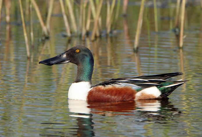
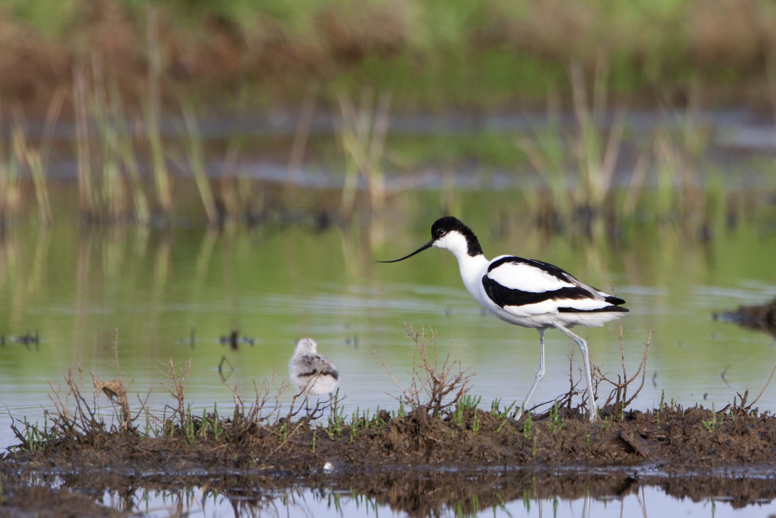
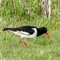
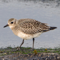
During Winter cyraneczka, Płaskonos, krzyżówka, świstun, głowienka, czernica and the occasional gągoł, ogorzałka and nurogęś with biegus zmienny, ostrygojad, krwawodziób, kulik wielki, kszyk, bekasik, siewka złota, czajka can be found in various numbers.
During Spring/Autumn kulik mniejszy, piaskowiec, białorzytka, cyranka, batalion, samotnik and biegus malutki can occasionally be found.
Szczegóły
Dostęp
The large town of Weston-Super-Mare (also called Weston) is immediately to the North. Leave Weston South on A370, just after passing sign to M5 South/Taunton A38, on approaching sharp Left hand bend, turn Right onto Uphill Road S (poorly signed). Turn next Right into Old Church Road, continue on this road to next junction and turn Right onto Uphill Way, almost immediately Uphill Village (roadside) Car Park (free-25 spaces) is on the Left. As well as this car park there is another (free-6 spaces) car park at entrance to site. If traveling from the South on A370, pass sign to Uphill Hospital/Bleadon Hill and turn Left into Uphill Road S, at next roundabout follow signs to Uphill Village and Sands, turn Left into Uphill Way (signed St Nicholas' Church), car park is further along this road on the Left.
Teren i siedlisko
Rzadkie drzewa i krzewy , Łąka , Rzeka , Morze , Trzcinowiska , Miasto/wieś , Rolnictwo/uprawy , Błota , Plaża , Jezioro , Kanion/klif , Tereny podmokłeWarunki
Płaski , Pagórkowaty , Skalisty , Otwarty krajobraz , Możliwy wysoki poziom wody , Ślisko , Bagienny , PiaszczystyTrasa dookoła
TakCzy luneta będzie przydatna ?
TakUdany sezon obserwacyjny
Przez cały rokNajlepszy czas na wizytę
Zima , Wiosna , Jesień , Jesienne migracje , Wiosenne migracjeTrasa
Droga utwardzona , Szeroka ścieżka , Droga nieutwardzona , Wąski szlakPoziom trudności szlaku pieszego
Średnio wymagający spacerDostępne
Pieszo , Rower , SamochódCzatownia/platforma obserwacyjna
TakDodatkowe informacje
NOTE, this area is prone to flooding, by small 6 space car park at entrance to site you pass through a FLOOD PREVENTION GATE (press STAR on map) that closes during extreme high tides, take note of FLASHING WARNING LIGHT that warns of GATE CLOSING.
As you can see by map routes there are numerous short cuts you can make.
Nearest other birding place is Brean Down Nature Reserve and Brean Beach (see separate entry).

 ) aby wstawić nazwy ptaków w swoim języku ojczystym. Nazwy ptaków zostaną automatycznie przetłumaczone dla innych użytkowników!