Opis
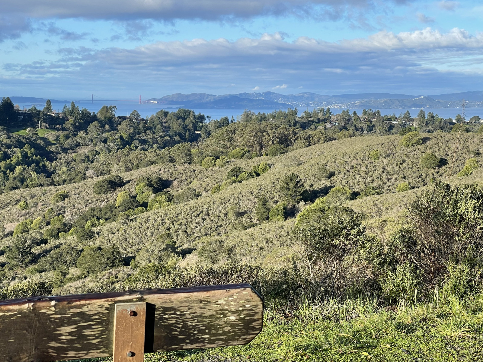
Starting at the Inspiration Point parking lot, the Nimitz Way Trail follows the ridge of the East Bay hills, offering periodic vistas of the San Francisco bay, bridges, reservoirs and peaks such as Mount Tamalpais and Mount Diablo. Popular with dog walkers, hikers, runners and bikers, the Nimitz Way paved path is suitable for those of various abilities, including those in wheelchairs (though note that there are several hills). The first 1-1.5 miles of this path are best for birding either early in the morning or on weekdays, but at any day or time, you generally encounter fewer and fewer people the further you walk past that point. The ridge can be quite foggy and sometimes windy at certain times of year.
The path crosses through grassland, coastal scrub, mixed Coast Live Oak and California Bay Laurel woodlands, as well as planted groves of pines and redwoods, as well Blue Gum Eucalyptus. This mix of habitats, plus the ridge location means that a wide variety of bird species can be seen here, including seasonal migrants that move along the ridgeline. The trail is a wide asphalt path, which winds along the ridge, eventually turning into the San Pablo Ridge Trail. The path generally is either flat or with a gentle slope, though there are several moderate hills. The trail also connects to several other trails such as the Meadow Canyons Trail, Curran Trail, Laurel Canyon Trail and the Conlon Trail, all of which also offer good birding. It's possible to do a loop nearby, along the Curran Trail, the Wildcat Gorge Trail and the Meadows Canyon Trail.
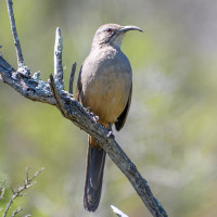
At 2 miles from the parking lot, after walking through a large grove of Eucalyptus, there is a cattle grate across Nimitz Way. From this point to the junction with the Conlon Trail (at 2.3 miles), is an especially productive area to find species like California Thrasher, Wrentit and Lazuli Bunting, though these species can also be found much closer to the parking lot. [See tips for finding California Thrashers further below] Walking a short ways along the Conlon trail from the junction with Nimitz Way, brings you to a hilltop with scattered pine trees, which is an especially good birding spot for migrating birds, raptors, quail and coastal scrub species.
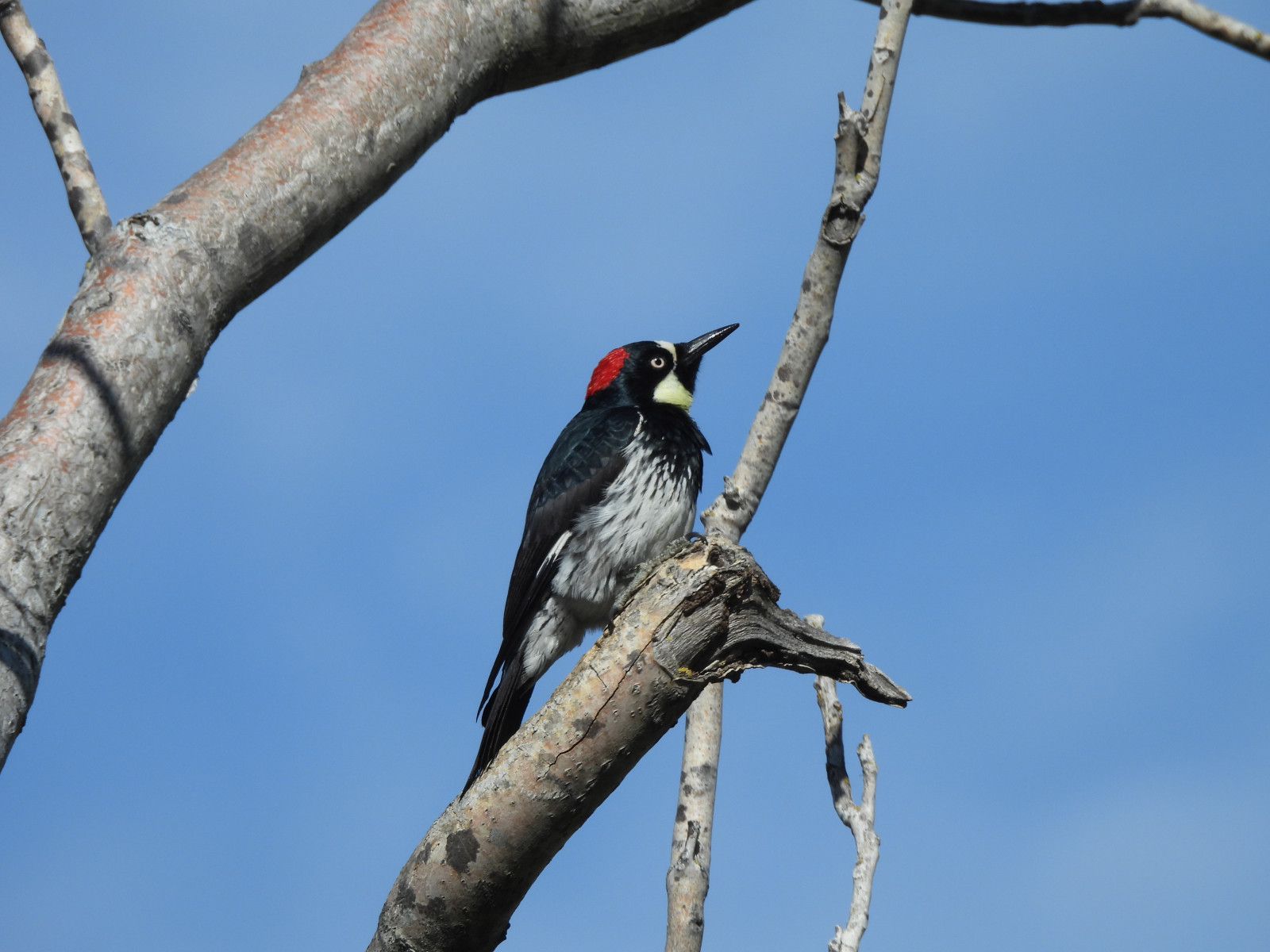
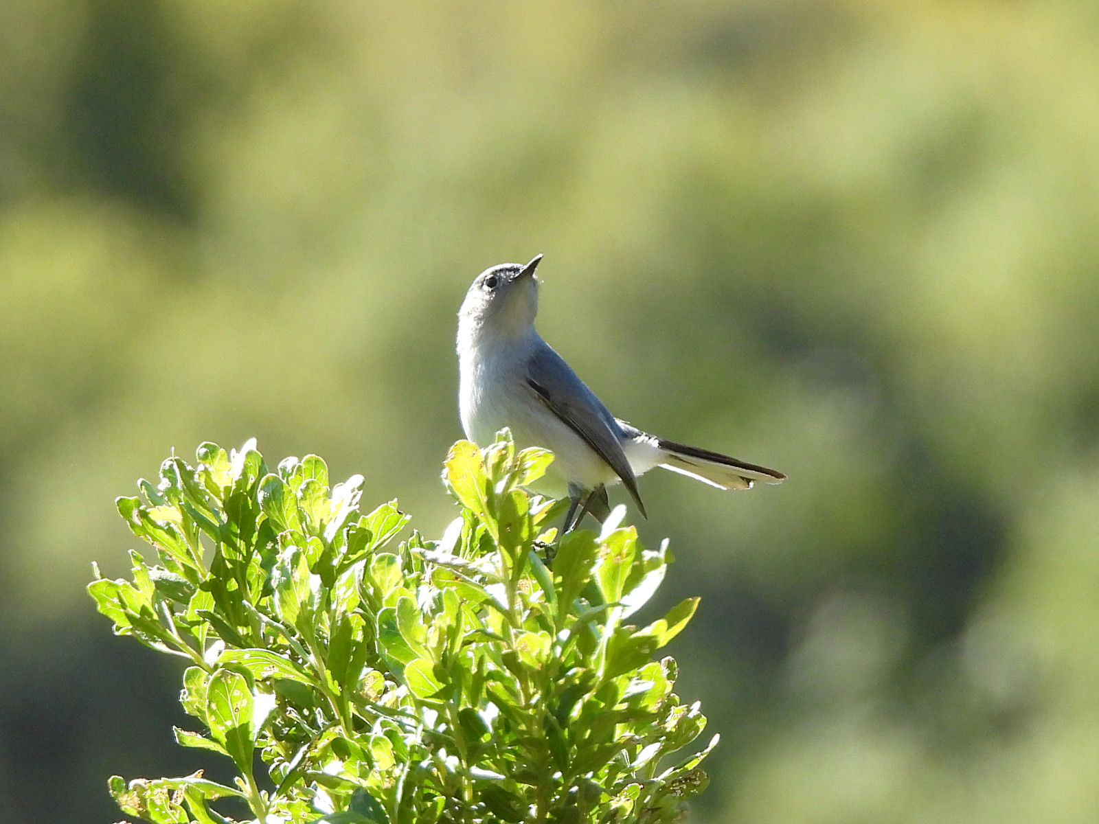
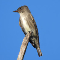
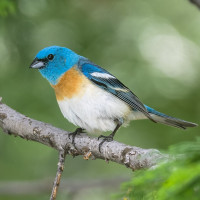
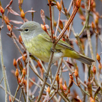
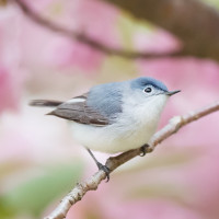
Notably, this is one of the better places in the East Bay to hear (and sometimes see) California Thrashers, as well as other California coastal scrub and mixed scrub-woodlands species such as Wrentit, Hutton's Vireo, Blue-grey Gnatcatcher, and California Quail. Raptors can often be spotted soaring or perched on power poles , and several swallow species nest in dead trees along the trail. During the Spring and Summer, species such as Wilson's Warbler, Warbling Vireo, Black-headed Grosbeak, Lazuli Bunting, Purple Finch, Spotted Towhee, Song Sparrow and Western Wood-Pewee can be heard singing. Several groves of conifers host Pygmy Nuthatch and Red-breasted Nuthatch. Olive-sided Flycatchers can often be heard singing or giving their pip-pip call from the tops of tall eucalyptus or pine trees.
Raptors including Red-tailed Hawk, Red-shouldered Hawk, American Kestrel, Merlin, White-tailed Kite, Northern Harrier and occasionally Golden Eagle can be seen flying along the ridge or perched on tall trees or power poles along the trail. Sea birds such as Caspian Tern and Double-crested Cormorant sometimes fly overhead, moving between the bay and inland reservoirs.
When looking for California Thrasher, it's best to arrive in the areas marked on the map by at least 8am and to listen for their complex song from areas of dense coastal scrub habitat. California Thrashers are often shy and retiring, tending to stay low in dense cover. They prefer hillsides covered in dense mature stands of plants like Coyote Brush, California Sagebrush, sometimes interspersed with small trees like Coast Live Oak and California Bay Laurel. They tend to sing most actively before 9am, and may be less vocal or silent when there is dense fog or wind. They also sing at dusk, especially in the breeding season. To locate them, it helps to be still and quiet, and to patiently scan they coastal scrub at a time when the trail isn't too crowded. On a good day in Spring, up to 3 males can sometimes be heard counter-singing in some spots along Nimitz Way. They sometimes perch at the top of a tall shrub or low tree to sing, though they can be surprisingly difficult to locate, due to their muted coloration. They occasionally fly low across the trail (looking a lot like a California Towhee, but with a longer tail that's slightly elongated / spade shaped at the center, versus the shorter, more rounded tail of the towhee).
Szczegóły
Dostęp
The Inspiration Point parking lot can be reached from the West Side (the Berkeley hills) via Grizzly Peak Blvd, turning West on Shasta Rd. Shasta Rd then turns right and turns into Wildcat Canyon Rd. As of March, 2024, Wildcat Canyon Rd is closed east of Inspiration Point due to a mud slide.
Grizzly Peak Blvd can be reached from either Highway 24, using the Fish Ranch Rd exit, or from Highway 80, using the Buchanan St. exit (with Buchanan St turning into Marin Ave, which traverses a traffic circle, then climbs very steeply before meeting with Grizzly Peak Blvd).
Teren i siedlisko
Las , Rzadkie drzewa i krzewy , Łąka , Dolina , GóryWarunki
PagórkowatyTrasa dookoła
NieCzy luneta będzie przydatna ?
NieUdany sezon obserwacyjny
Przez cały rokNajlepszy czas na wizytę
Jesienne migracje , Wiosenne migracjeTrasa
Szeroka ścieżkaPoziom trudności szlaku pieszego
Średnio wymagający spacerDostępne
Pieszo , Wózek inwalidzkiCzatownia/platforma obserwacyjna
NieLinki
- Inspiration Point Ebird Hotspot
- Ebird Bar Charts Showing Bird Species Occurrence by Season at Inspiration Point
 ) aby wstawić nazwy ptaków w swoim języku ojczystym. Nazwy ptaków zostaną automatycznie przetłumaczone dla innych użytkowników!