Descrição
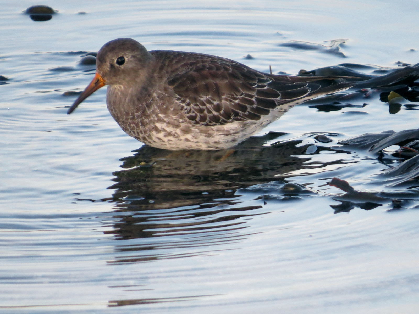
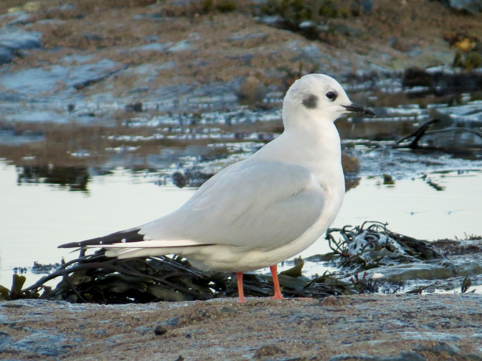
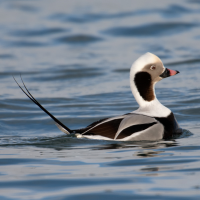
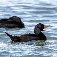
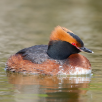
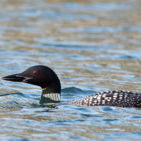
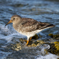
In Bamburgh wintering waders and sea ducks are a speciality, best seen from Stag Rocks, a low rocky promontory 1 km northwest of the village. Regular sightings include Pato-preto, Pato-fusco, Pato-de-cauda-afilada, Mobêlha-grande, and Mergulhão-de-pescoço-castanho. A large flock of Pilrito-escuro is also regular there, and single vagrant Black Scoter and Gaivota de Bonaparte have been returning visitors in late autumn and winter for the last 12 years (the Gaivota de Bonaparte has returned for its 12th season in October 2024). Sea-watching is also excellent, for ducks, gulls and divers in particular. Another 2 km further on is the tidal Budle Bay, attracting wintering waders and wildfowl. In winter the fields surrounding Budle Bay attract wildfowl, especially Ganso-de-bico-curto, Ganso-de-faces-brancas, and Cisne-bravo. Raptors and owls are seen regularly.
Detalhes
Acesso
Main car parking at east end of village, with smaller parking available off lane west, towards Bamburgh Golf Club. Parking for Budle Bay is at Waren Mill, on the B1342. Bamburgh is accessible by bus - services X18 (Newcastle to Berwick, via a coastal route) and 418 (Alnwick to Belford). Nearest rail station is at Berwick, 20km north, from where it is possible to cycle, but advisable to avoid using the A1 trunk road.
When using the coastal public footpath north from Stag Rocks, beware of golf balls; keep an eye out for golfers and respect their play.
Terreno e Habitat
Árvores e arbustos dispersos , Campina , Mar , Dunas , Praia , LamaçaisCondições
Plano , Paisagem aberta , Possível na maré cheia , Arenoso , RochosoCaminho circular
Nãoé útil um telescópio?
SimBoa temporada de observação de aves
Durante todo o anoMelhor hora para visitar
Inverno , Migração da primavera , OutonoRota
Caminho estreito , Caminho largo , Estrada pavimentada , Estrada não pavimentadaCaminho dificil
Caminhada médiaAcessível por
Bicicleta , Carro , PéAbrigo/plataforma deobservação de aves
NãoInformação extra
The name Stag Rocks derives from a white painting of a stag on the rocks just above the high water mark, southeast of the lighthouse.
 ) para inserir nomes de aves no seu idioma. Os nomes das aves serão traduzidos automaticamente para outros utilizadores!