Descrição
Braunton Burrows is designated as a UNESCO Biosphere Reserve. During the Second World War Americans used the area to rehearse the Normandy landings on Omaha beach. A number of rare species of plants and animals can be found in the area. Braunton Barrows can have Coruja-do-nabal and Escrevedeira-das-neves depending on weather and season.
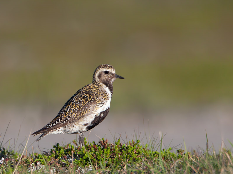
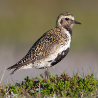
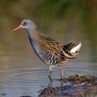
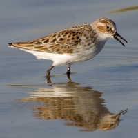
A good place for birds is Horsey Island (not to be confused with Horsey Island in Essex). This is not really an island but former farmland surrounded by a high embankment. The site is owned and managed by Devon Wildlife Trust (Note No Access To Reserve), the embankment was breached in 2017 and now floods on every high tide. Be sure to check carefully Tarambola-dourada flocks for Tarambola-dourada-pequena and Batuirucu.
Just North West of Horsey Island (across Toll Road) is Braunton Marsh, a collection of wet fields that drain by gravity, on high tides birds roost or continue to feed in this area.
The River Caen (running North to South) forms the sites Eastern boundary, check this river for waterbirds.
To the South is Crow Point, overlooking the mouth of the Taw/Torridge estuary, NOTE part of the road to Crow Point and car park (FREE) is a TOLL ROAD ONLY OPEN 0800-2200hrs - £2•00 FEE.
The Western boundary is the long beach at Saunton Sands.
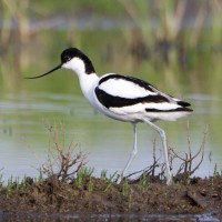
Some other birds you can expect on site are Águia-pesqueira, Colhereiro, Íbis-preta, alvéola-branca
Detalhes
Acesso
Leave the large town of Barnstaple on the A361, on approaching Braunton turn Left at roundabout and follow signs to Velator Industrial Estate/Braunton Burrows/Crow Point (Toll Rd).
Terreno e Habitat
Árvores e arbustos dispersos , Campina , Rio , Mar , Dunas , Camas de junco , Cidade/Vila , Agricultura , Lamaçais , Praia , Terras húmidasCondições
Plano , Arenoso , Pantanoso , Possível na maré cheia , Poeirento , Paisagem aberta , SecoCaminho circular
Simé útil um telescópio?
SimBoa temporada de observação de aves
Durante todo o anoMelhor hora para visitar
Primavera , Outono , Migração de outono , Migração da primavera , InvernoRota
Estrada pavimentada , Caminho largo , Estrada não pavimentada , Caminho estreitoCaminho dificil
FácilAcessível por
Pé , Bicicleta , CarroAbrigo/plataforma deobservação de aves
NãoInformação extra
Because of the long distance to walk you can of course choose to park in any of the three car parks (see the map) and search the immediate area before moving to next car park. For Horsey Island use car 'pull ins' and climb up the embankment for good views.
There are numerous paths to follow throughout the area other than the marked routes. The route that is indicated on the map is about 11 km long.
NOTE: PRESS STARS ON MAP FOR MORE INFORMATION.
Sites nearby on South side of Taw/Torridge Estuary are Fremington Quay and Pill; Home Farm Marsh; RSPB Isley Marsh, Yelland Quay and Instow; River Torridge - Instow Signal Box - Bideford - Beam Bridge; The Skern and Northam Burrows Country Park: all excellent and worth exploring if you have time.
 ) para inserir nomes de aves no seu idioma. Os nomes das aves serão traduzidos automaticamente para outros utilizadores!