Description
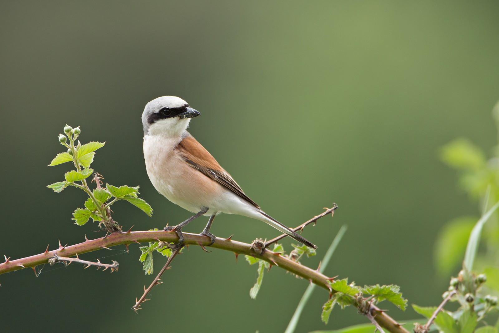
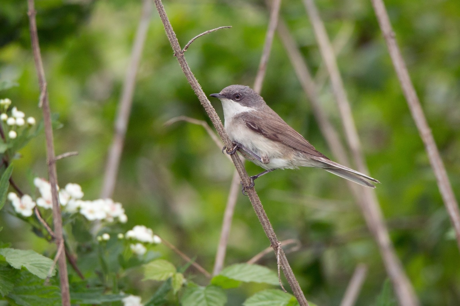
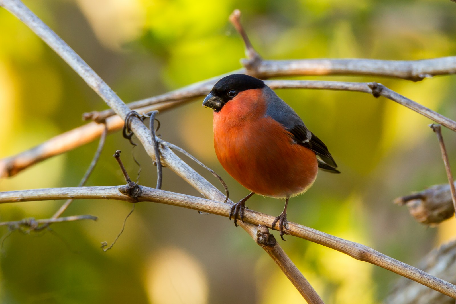
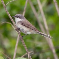
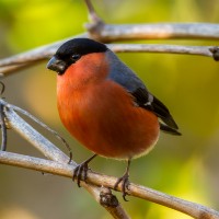
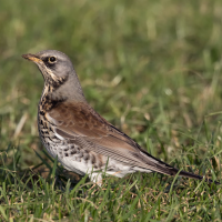
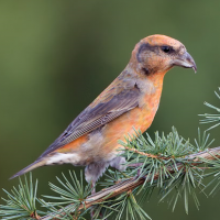
At the south end of Champoluc a trail starts and enters a large grassy meadow, bordered on one side by the forest and on the other by the river Evancon, covered by a thick scrub of alders. This place is great for trasochvost biely, feeding around the horses, and for kanárik poľný, žľtochvost domový, jastrab krahulec and oriešok obyčajný. Going further down, the trail enters the forest and gets closer to the river, arriving in a little fishing lake, called Green Lake (indicated with star on the map). This section is great for sýkorka čiernohlavá, sýkorka chochlatá, hýľ obyčajný, kôrovník dlhoprstý, vodnár potočný, králik ohnivohlavý and drozd plavý. Then after crossing the road the trail gets back in an open meadow and continues heading South towards a little chapel. This section is more bushy then the first one, with a more scattered tree cover on the west side. Here it's great for strakoš obyčajný, žlna zelená, ľabtuška hôrna, drozd čvíkota, drozd trskota and strnádka obyčajná. During migration, the best period is late April/May in spring and August/early September in autumn, there are many interesting species to be found like muchárik čiernohlavý, trasochvost žltý, krutohlav hnedý, penica popolavá (which also breeds here), kolibiarik spevavý and kolibiarik horský.
_________________________
Italiano: Questi prati aperti, circondati dal bosco, sono ideali per molti uccelli montani e migratori. All'estremità meridionale di Champoluc inizia un sentiero che si immette in un ampio prato, delimitato su un lato dal bosco e sull'altro dal fiume Evançon, quest'ultimo costeggiato da una fitta boscaglia di ontani. Proseguendo più a valle, il sentiero si addentra nel bosco e si avvicina al fiume, arrivando a un piccolo laghetto per la pesca chiamato Lago Verde (indicato con una stella sulla mappa). Dopo aver attraversato la strada, il sentiero rientra in un prato aperto e prosegue verso sud in direzione di una piccola cappella. Questa sezione è più ricca di cespugli rispetto alla prima, con una copertura arborea più rada sul lato occidentale.
Durante la migrazione - i periodi migliori sono fine aprile/maggio in primavera e agosto/inizio settembre in autunno - è possibile avvistare molte specie interessanti.
Details
Access
The best way to get there is to park at the free parking Route Dondeynaz in Champoluc (click on the P in the map for directions) and then follow the road on foot on the other side of the bridge, heading South to Pratone di Varasc (indicated with star on the map). The best way to explore the area is definitely on foot, but it's also possible on mountain bike. It takes around 1.30/2 hours to properly cover the place, but it can be done in less time.
_________________________
Italiano: Il modo migliore per arrivare è parcheggiare nel parcheggio gratuito di Route Dondeynaz a Champoluc (clicca sulla 'P' nella mappa per le indicazioni) e poi proseguire a piedi lungo la strada oltre il ponte, andando verso sud in direzione del Pratone di Varasc (indicato con una stella sulla mappa). Il modo ideale per esplorare l'area è sicuramente a piedi, ma è possibile farlo anche in mountain bike. Per visitare bene il posto occorrono circa un'ora e mezza o due, ma è fattibile anche in meno tempo.
 ) to insert bird names in your own language. The birdnames will automatically be translated for other users!