Description
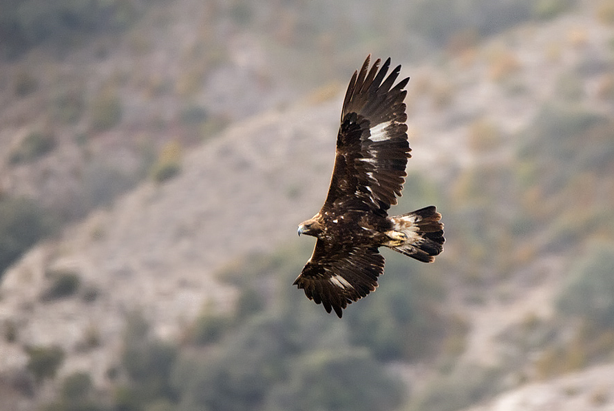
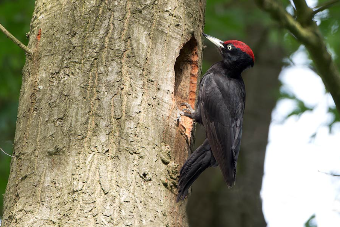
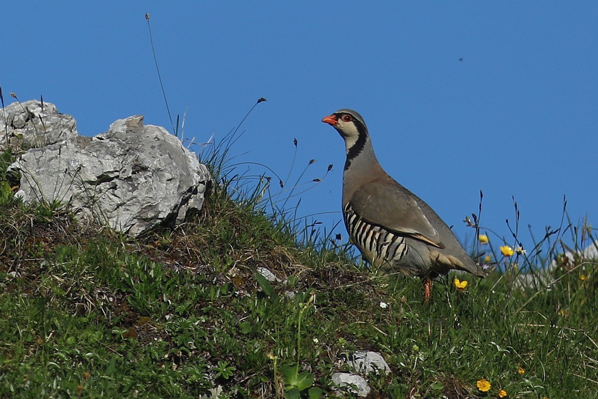
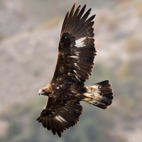
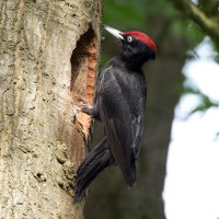
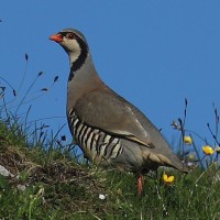
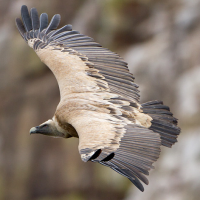
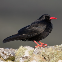
In the wild heart of the Pollino region, between Basilicata and Calabria, the plateau of the Pollino National Park is a unique ecosystem situated between 1,800 and 2,000 meters above sea level. The landscape, shaped by ancient glacial eras, preserves a millennial biodiversity of rare beauty. The undisputed symbol of these summits is the Loricato Pine, which reaches its peak here with Italus, a tree of about 1,230 years, officially recognized as the oldest in Europe. Thanks to its vast high-altitude plateaus and diverse habitats, the area is also one of the most evocative and rewarding locations for birdwatching, offering the chance to spot rare and spectacular species. The area is especially famous for its large raptors and high-altitude birdlife. Among the species that can be observed are: Suri orao, Bela kanja (very rare), Beloglavi sup (reintroduced to the park), Zmijar, Sivi soko, Buljina, Šumska sova, Kukumavka, Crna žuna, Kamenjarka and various passerines typical of open and rocky environments.
_________________________
Italiano: Nel cuore selvaggio del Pollino tra Basilicata e Calabria l’altopiano del Parco Nazionale del Pollino è un ecosistema unico posto tra i 1800 e i 2000 metri di altitudine. Il paesaggio, modellato da antiche ere glaciali, custodisce una biodiversità millenaria di rara bellezza. Simbolo indiscusso di queste vette è il Pino Loricato, che qui trova la sua massima espressione con Italus, un esemplare di circa 1230 anni, ufficialmente riconosciuto come l'albero più antico d'Europa. Grazie alla vastità dei suoi pianori d'alta quota e alla varietà degli habitat, l'area rappresenta inoltre uno dei luoghi più suggestivi e proficui per il birdwatching, offrendo la possibilità di avvistare specie rare e spettacolari. L'area è celebre soprattutto per i grandi rapaci e per l'avifauna di alta quota.
Details
Access
The main and most convenient access point to reach the Plateaus is Colle dell'Impiso (1,560 m a.s.l.), located in the municipality of Viggianello (PZ). From the A2 Motorway (Salerno-Reggio Calabria) take the Campotenese exit. Follow the signs for Rotonda and then for Viggianello/Piano Ruggio. Continue along the mountain road until you reach the parking area at Colle dell'Impiso.
Once you have parked your car at Colle dell'Impiso, the hike toward the Pollino Plateaus begins (Difficulty: Moderate E - Hiking - 2.5/3 hours one way). Take the trail that initially descends toward Piani di Vacquarro (approx. 1,450 m). Continue along the path (often identified as trail 901 or the 'Sentiero dei Carbonai') which climbs through a dense beech forest. Pass the junction for Piano di Rummo and keep climbing until you emerge onto the vast expanse of the Pollino Plateaus (approx. 1,900 m).
_________________________
Italiano: Il punto di accesso principale e più comodo per raggiungere i Piani è Colle dell'Impiso (1.560 m s.l.m.), situato nel comune di Viggianello (PZ). Dall'Autostrada A2 (Salerno-Reggio Calabria) esci allo svincolo di Campotenese. Segui le indicazioni per Rotonda e successivamente per Viggianello/Piano Ruggio. Continua sulla strada di montagna fino a raggiungere il parcheggio di Colle dell'Impiso.
Una volta parcheggiata l'auto a Colle dell'Impiso, inizia l'escursione verso i Piani del Pollino (Difficoltà: Media E - Escursionistico - 2,5/3 ore sola andata). Imbocca il sentiero che scende inizialmente verso i Piani di Vacquarro (circa 1.450 m). Prosegui lungo il sentiero (spesso identificato come 901 o "Sentiero dei Carbonai") che risale attraverso una fitta faggeta. Supera il bivio per il Piano di Rummo e continua la salita fino a sbucare sull'ampio pianoro dei Piani del Pollino (circa 1.900 m).
Terrain and Habitat
Forest , Mountain , PlateauConditions
MountainousCircular trail
NoIs a telescope useful?
Can be usefulGood birding season
All year round , Spring , AutumnBest time to visit
Spring migration , Autumn migrationRoute
Unpaved roadDifficulty walking trail
Average walkAccessible by
FootBirdwatching hide / platform
NoExtra info
Spring (April - June) is the best time of year due to the breeding season and birdsong, which make species much easier to identify. Autumn (September - October) is ideal for observing the passage of migratory species as they cross the massif heading south. In the early morning hours (dawn) and late afternoon are the peak activity periods for passerines, while the middle of the day is perfect for raptors, as they take advantage of warm rising thermals.
NOTE: Since this is a high-altitude environment, it is essential to check the weather forecast before setting out, wear trekking boots, and carry plenty of water and appropriate clothing (even in summer, temperatures can drop rapidly).
_________________________
Italiano: La primavera (Aprile - Giugno) è il periodo migliore per via della stagione riproduttiva e dei canti, che rendono più facile l'individuazione delle specie. L' autunno (Settembre - Ottobre) è ideale per osservare il passaggio delle specie migratrici che attraversano il massiccio verso sud. Le prime ore del mattino (alba) e il tardo pomeriggio sono i momenti di massima attività per i passeriformi, mentre le ore centrali della giornata sono perfette per i rapaci che sfruttano le correnti ascensionali calde.
NOTA: Trattandosi di un ambiente d'alta quota, è fondamentale consultare il meteo prima di partire, indossare scarponi da trekking e portare con sé acqua e abbigliamento adeguato (anche in estate le temperature possono scendere rapidamente).
 ) to insert bird names in your own language. The birdnames will automatically be translated for other users!