Description
NOTE! In 2023 a huge renovation of the reservoir started. The work will last until 2034. So read the comments on the bottom of this page for up-to-date information about the current situation. And great if you could leve a comment yourself with an update.
_________________________
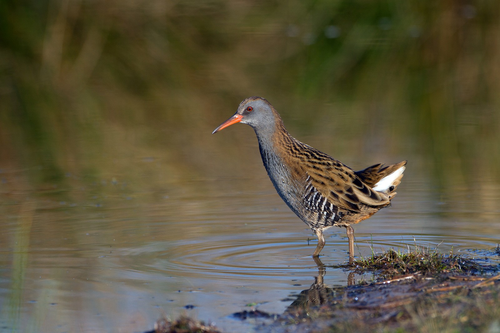
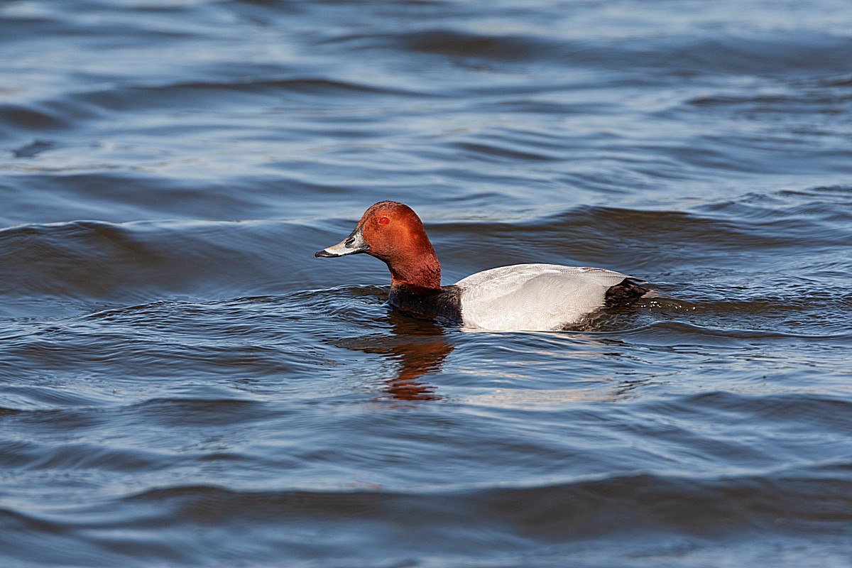
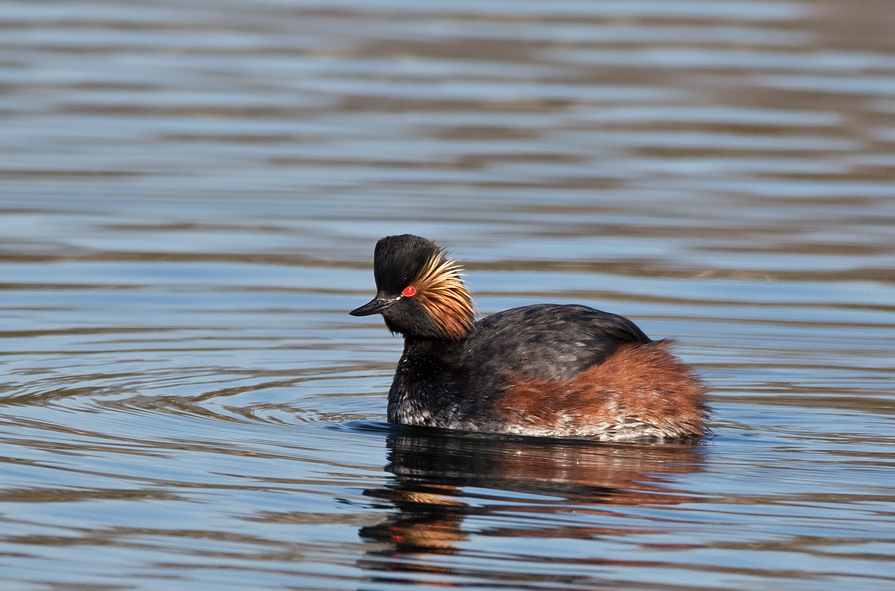
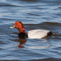
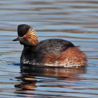
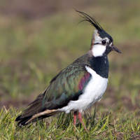
The Straussfurt retention basin in the middle of the Thuringian Basin is located on the western edge of the village of Straussfurt. In 1952 the construction of this retention basin of the river Unstrut began to protect Straussfurt and the areas downstream from the floods that have been occurring for centuries. With the construction a unique meadow landscape was created. These areas and the bank zones of the retention basin, but also the old river arm (Altarm) of the Unstrut, serve as nesting and breeding areas for herons, swans, grebes, gulls and ducks. In spring and autumn, the retention basin serves as a resting place for migratory birds. During this migration, especially in the autumn Common Crane can often be seen in the area. Among the other birds you can see are Little Grebe, Great Crested Grebe, Black-necked Grebe, Northern Lapwing, Ruff, Spotted Redshank, Common Greenshank, Black Tern, Water Rail, Reed Bunting, Common Pochard, Common Kingfisher, Red Kite, Reed Warbler and Common Snipe.
The observation conditions at the retention basin change significantly over the course of the year. Responsible are the seasonally regularly fluctuating water levels, which have a very large influence on the bird species bound to water. In spring, the lake is drained and offers very good resting conditions, especially for waders. These are attracted all the more because there are hardly any other rest areas in the vicinity. With the discharge of the reservoir in October, resting geese, ducks and loons, which previously regularly formed large accumulations, gradually disappear. For this, , late-moving waders find good resting conditions in the large shallow water areas available from mid-October.
Details
Access
Straussfurt has no motorway exit. It is located 20 km north of Erfurt and can be reached from there via the B 4 or the L 2142. Public transport: Straussfurt is well connected to the Deutsche Bahn network and the station is located in walking distance to the retention basin. A circular walk of the area on foot is possible (about 9 km). However, because east and west dams are not allowed to be entered, you have to walk a small section on the main road between Straussfurt and Henschleben (about 2.5 km). That's why it's worth taking a bike with you or you can take the bus to Henschleben and start your hike there.
There are a number of accessible points that allow an overview of the lake. If you drive on the B 4 from Erfurt towards Straussfurt , you can turn left south of Straussfurt into the village of Henschleben. The "Road of Unity" leads to the village to end after 300 m at a T-junction. Here you turn left into the "main street" and after 50 m before the church keep to the right. A small road leads to a dam, from which you have a first very good view over the basin and the estuary area of the Unstrut. This is a good place for observing reed-inhabiting bird species. You can continue to follow the dam, but you have to park at the latest in a right turn (pumping station). The west dam may not be entered, but it is worthwhile to search the foot of the dam for limicoles with the spotting scope. Especially in autumn you can be lucky here. The path to the left of the closed dam leads into and around the polder. During the breeding season, this hike is quite rewarding. If you are on foot, you can walk along the northern edge of the polder and later on the northern edge of the partial dam basin to Straussfurt . By car you drive back to the village of Henschleben and can then follow the "main road" to the east after almost 300 m to reach another overview point over the basin.
A good overview point is located on the north side of the retention basin on the outskirts of Straussfurt . Take the B 4 from Henschleben to Straussfurt and turn left 100 m north of the entrance to the village onto the B 176. Shortly thereafter, the road passes under the railway line. After 800 m, directly behind the bus stop "Straussfurt , Schwerstedter Straße", turn left into the street "Am Staudamm" and after 100 m you will reach a collection point for used glass, where you can park and observe well. Ducks and limicoles like to stay here. Another good overview point opens up if you follow the dirt road leading to the west from the parking lot for 900 m and then take the small footpath to the left. It leads in 600 m to the lake shore and to another good overview point.
Terrain and Habitat
Wetland , Lake , Agriculture , Grassland , ReedbedsConditions
Open landscapeCircular trail
YesIs a telescope useful?
Can be usefulGood birding season
All year roundBest time to visit
Spring migration , Autumn migration , SpringRoute
Paved road , Wide pathDifficulty walking trail
Average walkAccessible by
Foot , Bicycle , CarBirdwatching hide / platform
NoExtra info
The Straussfurt retention basin was initially designed as a green basin, which is only flooded during floods. Today it is a shallow body of water at normal dam height. In July and August, algae carpets are regularly forming due to warming and nutrient richness. The size of the water surface is about 250 ha. The east and west sides consist of fortified dams, while the north and south banks are designed to be more natural. Above all, the inlet of the Unstrut on the southwest side has large reeds. During extreme flood events, the basin can be dammed on an area of up to 700 ha. Then the areas west of the regular water surfaces are flooded. They are usually used as mowing meadows, cattle pastures and arable land. Along the river Unstrut there are rows of trees.
 ) to insert bird names in your own language. The birdnames will automatically be translated for other users!