Description
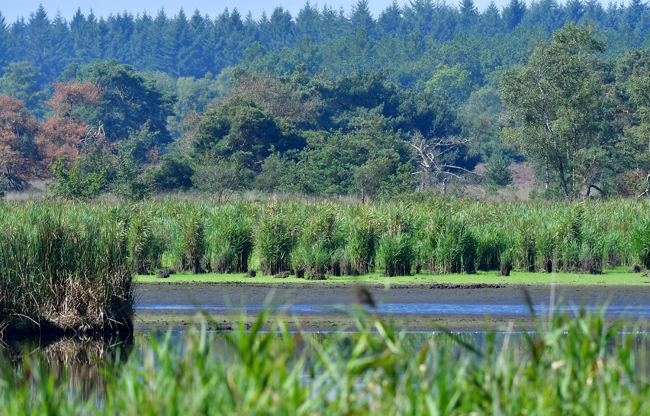
The Cartierheide and Hapertse heide are part of Forestry de Kempen. The boundaries are formed by forest areas on both the east and west sides. The central part of the area is the lowest and the wettest. Part of the original marsh was converted into a pond in the 1920s and surrounded by a small dike. This area is known as the Pannegoor.
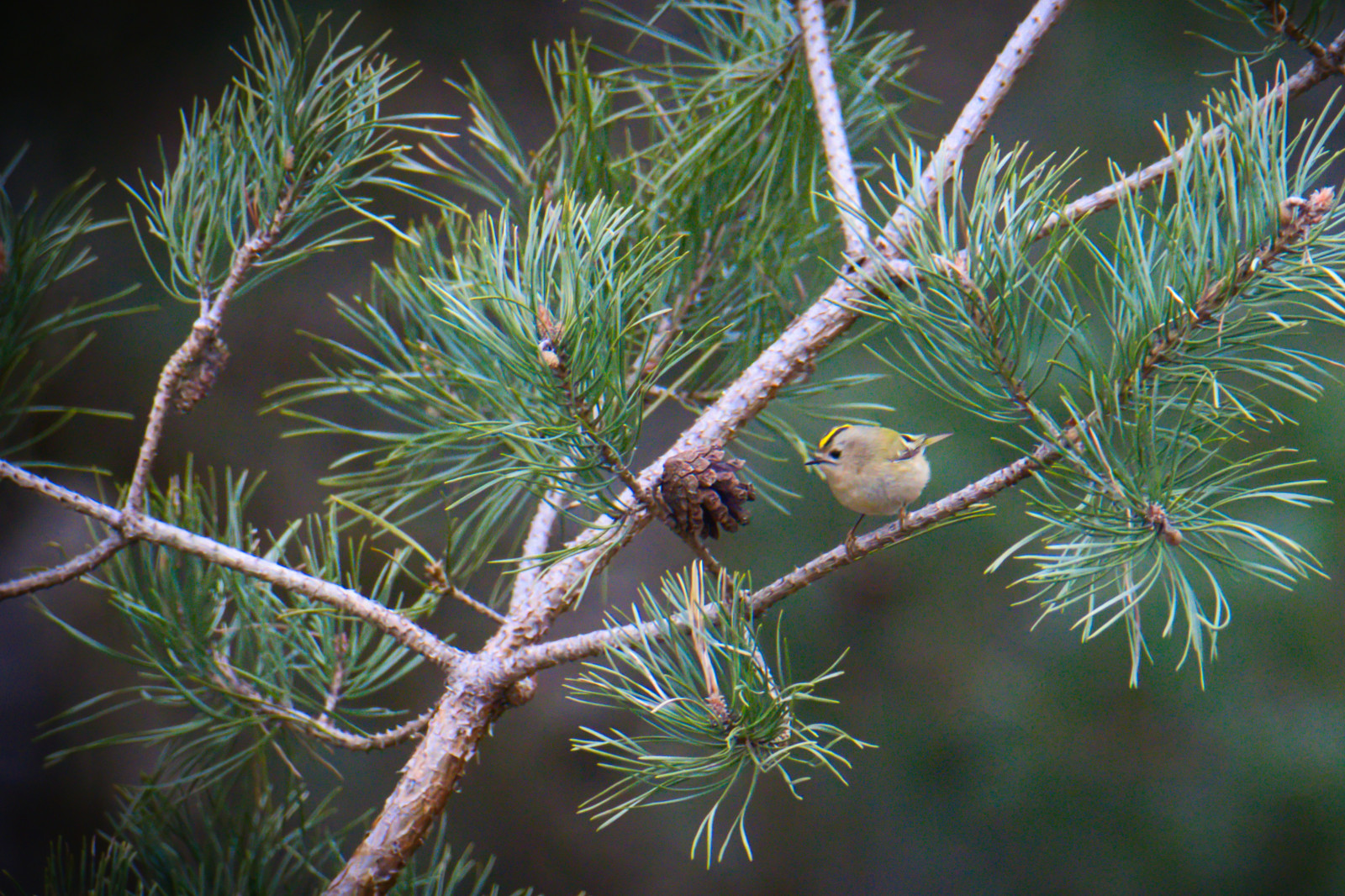
The vegetation here is mainly heather. At the transitions from wet to dry, there are sometimes extensive heaths with creeping willow, peat rush and bell-gentian. The northern part of the area is forested. Along the stream there is a forest with lots of willow and birch; in the drier parts relatively old deciduous forest with oak, birch, Scots pine and sometimes hornbeam and holly.
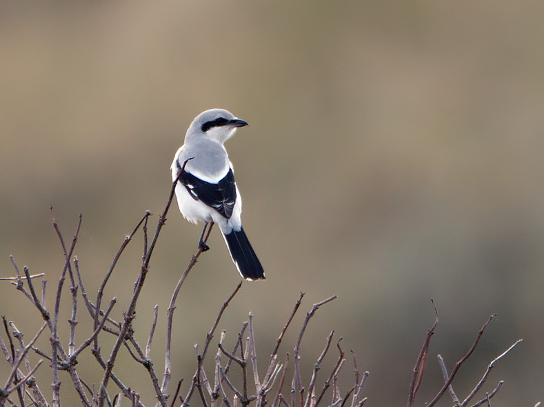
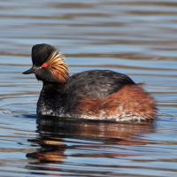
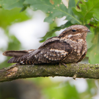
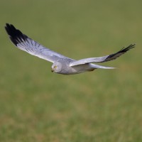
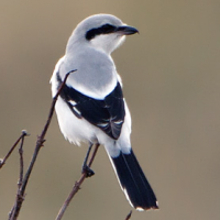
Among the birds you can see in summer are Eurasian Nightjar and Black-necked Grebe, in winter Great Grey Shrike and Hen Harrier.
_________________________
Nederlands: De Cartierheide en Hapertse heide liggen grotendeels in de gemeente Bladel, een klein stukje in de zuidoost hoek ligt in de gemeente Eersel. Het gebied maakt onderdeel uit van Boswachterij de Kempen. Zowel aan de oost als de westzijde wordt de begrenzing gevormd door bosgebieden. Van zuid naar noord wordt het gebied doorsneden door het deels gegraven Dalems Stroomke. Dit centrale deel van het gebied ligt het laagst en is dan ook het natste. Een deel van het oorspronkelijke moeras is in de jaren twintig van vorige eeuw als vijver ingericht en omringd door een dijkje. Dit gebied staat bekend als het Pannegoor.
De begroeiing is hier vooral struikheide. Op de overgangen van nat naar droog zijn soms uitgestrekte dopheidevelden aanwezig met kruipwilg, veenbies en klokjesgentiaan. Het noordelijk deel van het gebied is bebost. Langs de beek broekbos met veel wilg en berk; op de drogere delen relatief oud loofbos met eik, berk, grove den en soms haagbeuk en hulst.
Vogels te zien: Eurasian Nightjar Black-necked Grebe in zomer, in winter Great Grey Shrike en Hen Harrier.
Details
Access
There is a parking lot on the Postelseweg on the edge of the area. Coming from Eersel, turn right onto Bredaasebaan. Zandpad, immediately right after the parking lot exit. The circular walk marked on the map is approximately 5 km long.
_________________________
Nederlands: Aan rand van het gebied is een parkeerplaats aan de Postelseweg komend vanuit Eersel rechtaf Bredaase baan opdraaien. Zandpad, meteen rechts na afslag parkeerplaats. De rondwandeling die is aangegeven op de kaart is ongeveer 5 km lang.
 ) to insert bird names in your own language. The birdnames will automatically be translated for other users!