Description
The 6,5 km long-Coastal Path follows the coastline from the Pilons area to the lighthouse in Cap Salou. The path consists of 2 stretches: one, from Pilons to Replanells, 2 km long, already set up and from Replanells to the lighthouse; and the second one, 4,5 km long, natural path (not fully set up).
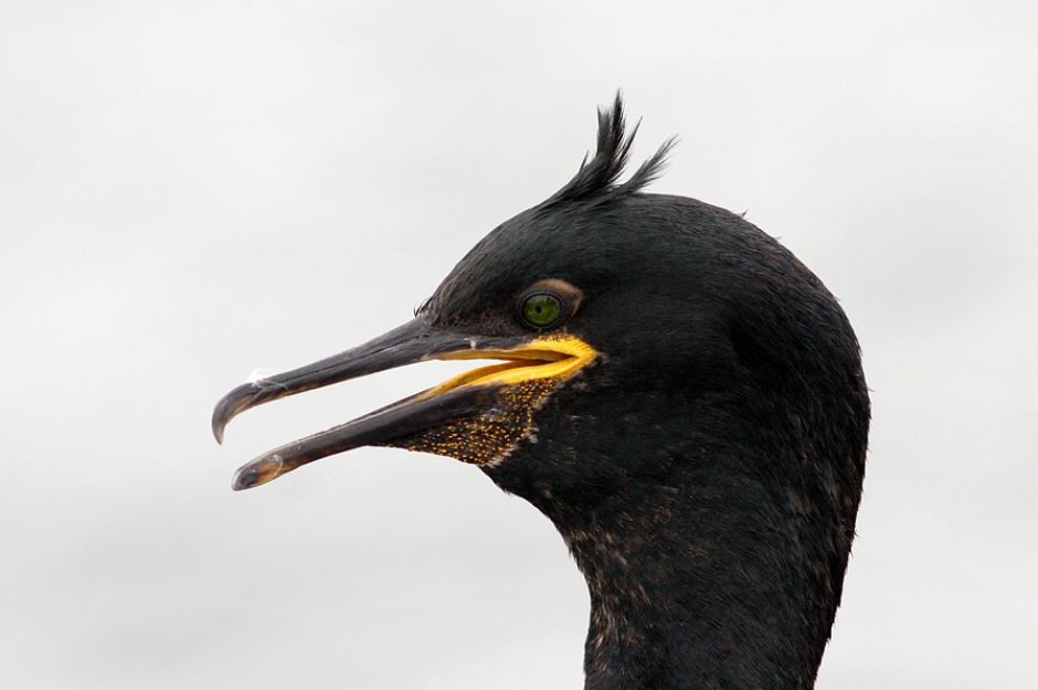
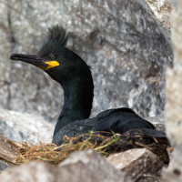
Once you have arrived to the lighthouse you can return back on foot or by bus or continue to a more adventureous excursion with sometimes no obvious path. Maybe you won't see new species, but different habitats. From the lighthouse you can continue to the right across the "carrer de la roca falconera" until they finish and you can turn left "Carrer de la Roca Peixera" or right "Carrer del Reguerot del Clavegar" where you can swim and see a nearby European Shag fishing.
But if you want continue you can go straight following up one small dry sand river until you reach the top. If you did this you meanwhile you are in the middle of one small pine forest on the sand dunes can forget for a moment that you are in one busy touristic city. During migration this place is good for passerines. Once you get the top you can follow different ways, but basically you must go to the right following the hill.
You will arrive to a quarry and you will follow the path to the quarry cliffs on your right. After some meters, you will have the quarry on your right and an Iberian village on your left. You can continue the tarred road until it is with cement. If you follow all the way at the end you will arrive a door, difficult to jump .
How to arrive to the end? You have two options. After the Iberian village you can turn left to the buildings and eventually you will arrive to the road and one bus stop. But if you continue on the cement, when it go left you must go right to the sea across the rocks and you will arrive to a beach where on 2020 nested Mediterranean turtles! Once there you can take the bus to return back to Salou.
Historically, these paths followed the coastline and were used for sea surveillance and by the fishermen. The complete revamping of this path now makes it possible to stroll along the coast and see sites that were impossible to get to for many years.
The Camí de Ronda winds through stunningly beautiful landscapes. Besides the amazing views, the path passes by beaches and coves, making it a unique way to get to know Cap Salou. From Pilons, the path heads south and goes past Capellans Beach, where you can see the remains of the former quarantine station, which was built in 1829. Next is Llenguadets Cove, where you can see the bunkers built during the Spanish Civil War. The last section takes you past Llarga Beach, a natural setting, now far from the tourist area.
The path reaches a maximum height above sea level of 77 metres, with sections that are a bit difficult, although the majority of the route can be done by everyone.
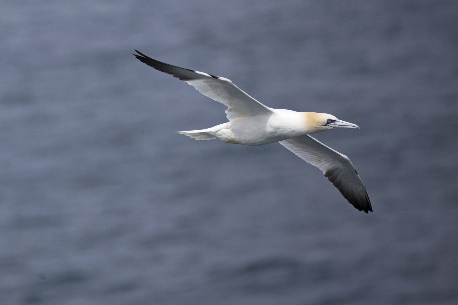
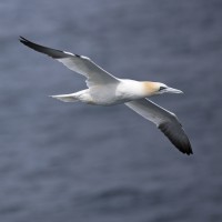
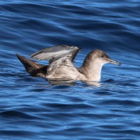
Cap Salou offers another possibility. Due to its location, you can see sea birds that are difficult to spot from the beach. With a telescope or binoculars, you may catch a glimpse of Balearic Shearwater, Great Skua (rare) Arctic Skua (rare),Pomarine Skua (very rare), Northern Gannet, Atlantic Puffin (very rare), Razorbill (uncommon), loons, different migrating birds and sea ducks, such as Red-breasted Merganser , Common Scoter and Velvet Scoter. Different species of gulls can also be spotted, including the Audouin's Gull, which is quite abundant and easy to see in the spring and autumn.
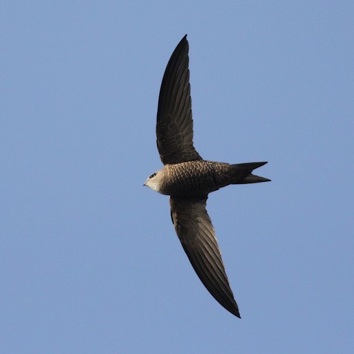
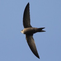
On the way you will see many of the típical birds of the Mediterranean coast. Sardinian Warbler are singing everywhere, and Pallid Swift nest on the cliffs.
For more info see the weblinks below.
Details
Access
This is a path to walk and you can park easily except in Summer or Eastern. There is a bus stop near the beginning, and in case that you continue the walk to La Pineda you can return back by bus. Timetables are quite different among the year. In winter there are on every hour, in summer one every few minutes.
Terrain and Habitat
Beach , Scattered trees and bushes , SeaConditions
Rocky , Dry , Open landscapeCircular trail
YesIs a telescope useful?
NoGood birding season
Spring , Winter , AutumnBest time to visit
Winter , Spring migration , Autumn migrationRoute
Wide path , Narrow trail , Unpaved roadDifficulty walking trail
Average walkAccessible by
FootBirdwatching hide / platform
YesLinks
- Catalan: www.visitsalou.eu/cami-de-ronda
- English: https://www.visitsalou.eu/coastal-path
- Castellano: https://www.visitsalou.eu/camino-de-ronda
- Français: https://www.visitsalou.eu/chemin-cotier
- Deutsch: https://www.visitsalou.eu/der-weg-cami-de-ronda

 ) to insert bird names in your own language. The birdnames will automatically be translated for other users!