Description
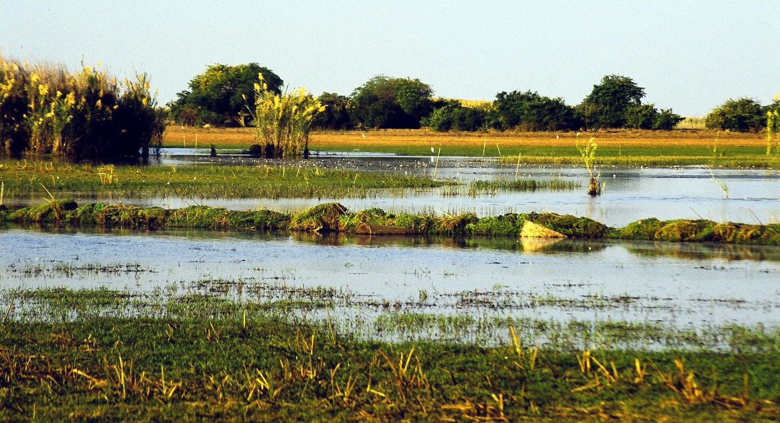
Bangweulu Wetlands is a huge wetland in northeastern Zambia, covering roughly 6,000 km². It’s a mosaic of floodplains, seasonally inundated grasslands, permanent marshes, and miombo woodlands. Birdwatching here is great with over 400 bird species that have been recorded.
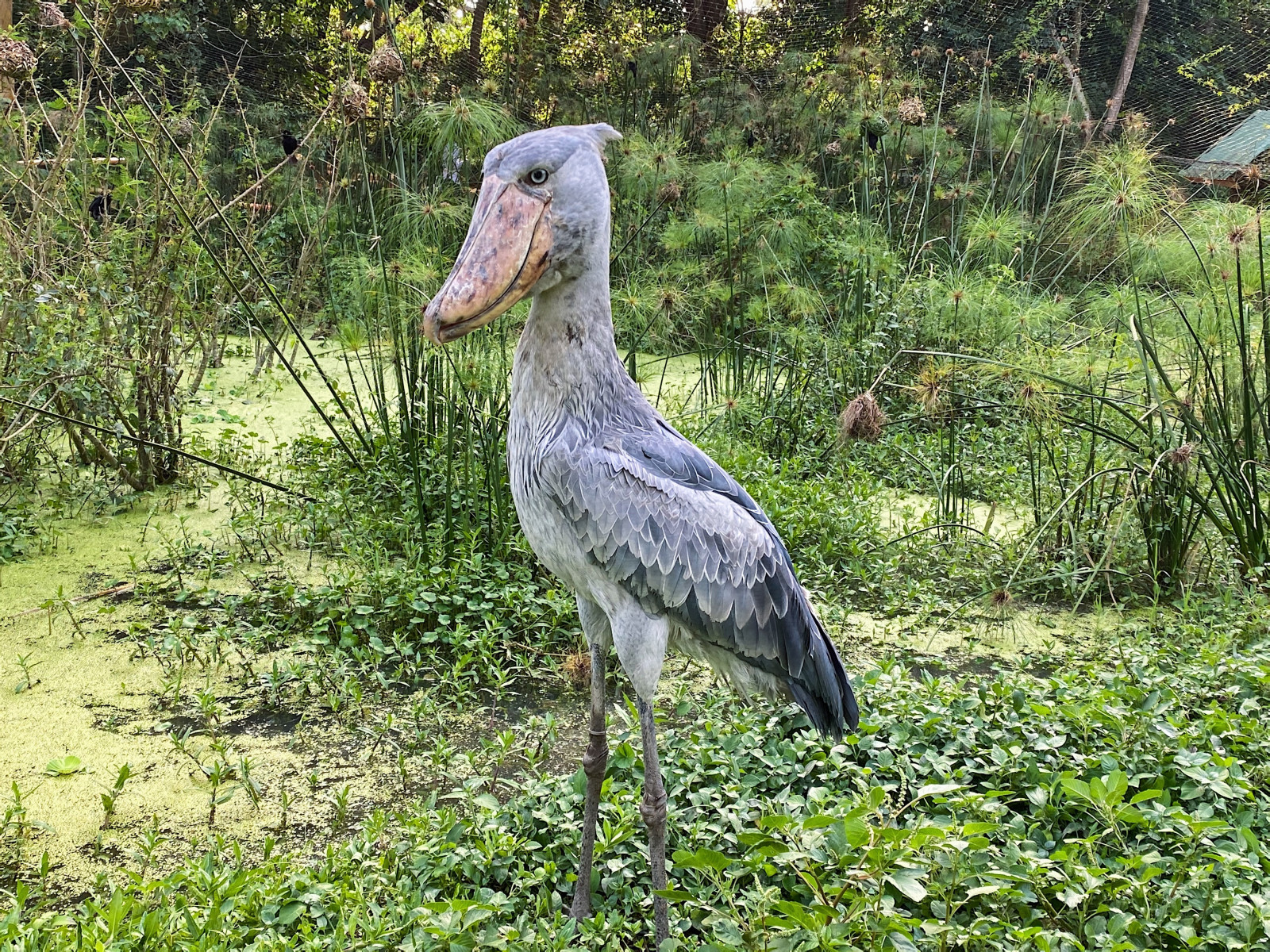
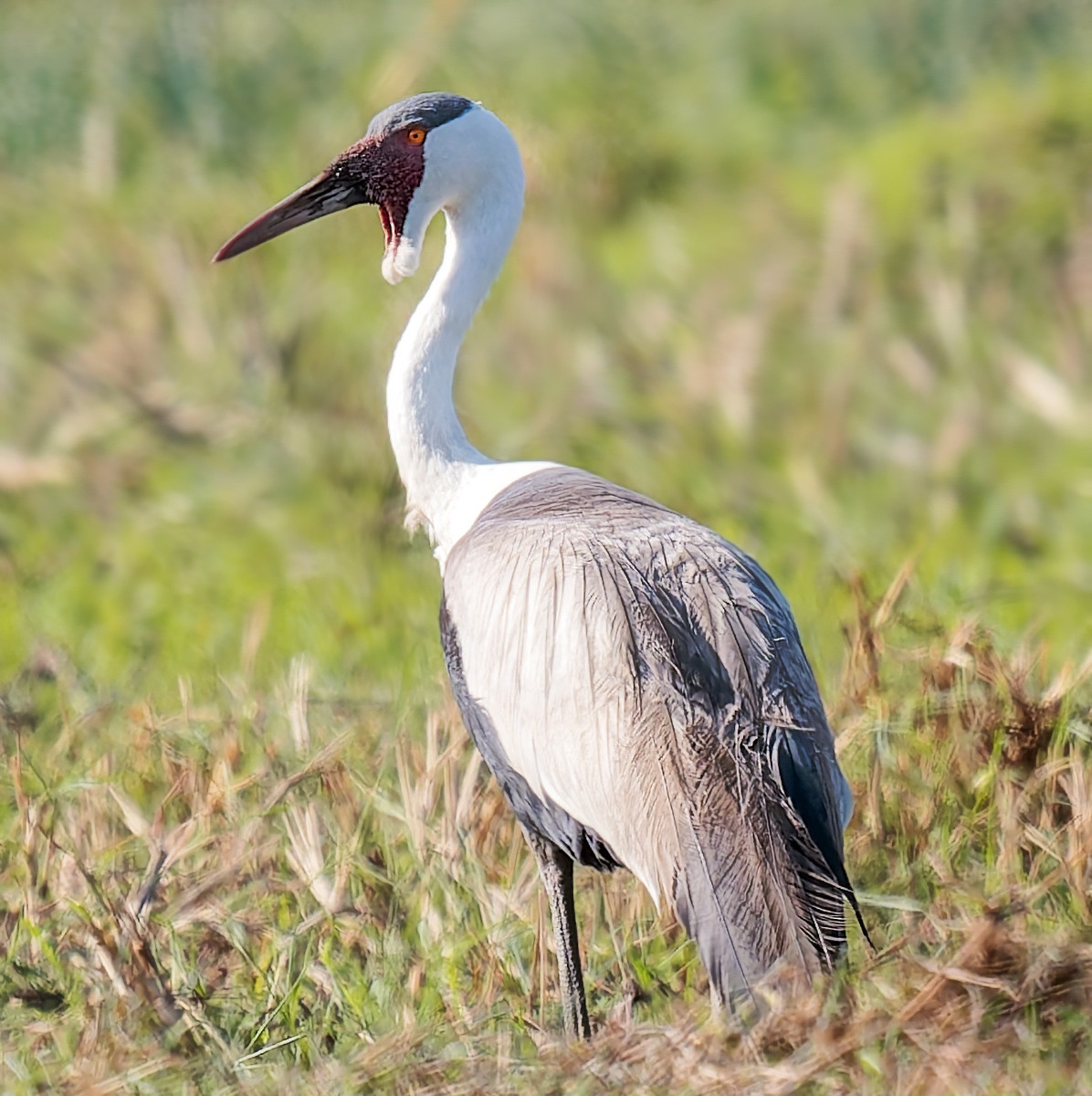
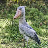
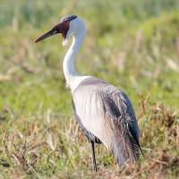
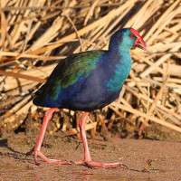
The wetlands are home to cormorants, ducks, egrets, geese, herons, ibises, and waders and many other birds. Most notable is the Shoebill. Bangweulu is home to between 300 and 500 Shoebills, the most southerly population of Shoebills in the world. Another special bird is the Wattled Crane, the rarest of Africa's cranes. Bangweulu hosts 10% of the world's population of Wattled Cranes.
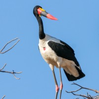
Other species recorded in Bangweulu include the Great White Pelican, African Pygmy-Goose, Collared Pratincole, Saddle-billed Stork, African Spoonbill, African Fish-eagle, African Marsh-Harrier, Lesser Jacana, African Jacana, Blue-breasted Bee-eater, Lesser Swamp Warbler, Little Rush-Warbler and Swamp Flycatcher.
Details
Access
Bangweulu is located in northeastern Zambia. In the dry season (May to October), you can drive in with a high-clearance 4x4, but note that the route from Lusaka is long (about 700 km) and remote and involves navigating dirt tracks and seasonal floodplains.
Using the Great North Road via Lavushi Manda National Park, travel north from Lusaka, until reaching 12 km north of the Kalonje railway (70 km south of Mpika). Turn left at the Bangweulu Wetlands signpost, through Lavushi Manda National Park for 66 km. If heading to Nkondo headquarters and tented camp, follow the sign-posted turnoff to your left after 57 km.
If heading to the swamps, continue for 9 km to the entrance gate of the GMA. From the barrier, it is 35 km to Muwele (the last village), approximately 1hr30. The road has villages and houses on either side its whole length; please drive carefully and watch out for children! After 35 km turn left at the radio tower and school and follow the road for another 7.5 km. Take the left turn signposted to Nsobe Camp.
If travelling onwards to Shoebill Camp, continue for 7 km across the floodplain following the causeway to Chikuni. Parking is at the small thatched Nsaka, to the left of the trees and buildings as you approach. Request specific directions for the road to the camp. During the wet season, a boat transfer should be organised from Nsobe or Chikuni.
The second option is arriving by flight. There are two airstrips nearby - Inja and Chimbwi - used by Shoebill Island Camp and other operators.
You can stay at Shoebill Island Camp, Nsobe Campsite, or Nkondo Tented Camp depending on the season and water levels. Shoebill Island Camp is the main base for visitors. From here, you can take mokoro (dugout canoe) or boat trips into the wetland or do walking safaris. For more info and bookings you can reach out via bangweulu@africanparks.org
Terrain and Habitat
Wetland , Scattered trees and bushes , Grassland , Reedbeds , PondConditions
Flat , WetCircular trail
YesIs a telescope useful?
Can be usefulGood birding season
Winter , SpringRoute
Unpaved roadDifficulty walking trail
EasyAccessible by
Foot , BoatBirdwatching hide / platform
NoExtra info
The Bangweulu Wetlands are best accessible during the dry season, which extends from May to August. During this time, the water levels recede, providing easier access for wildlife viewing and exploration. The wet season, from December to March, transforms the wetlands into a birdwatcher’s paradise, with abundant migratory and resident species. However, accessibility can be challenging due to high water levels, so November might be a suitable compromise for birders. For Shoebill sightings May–July is the best time to visit Bangweulu Wetlands.

 ) to insert bird names in your own language. The birdnames will automatically be translated for other users!