
Description
This route through the municipality of 1800 inhabitants connects the most important points and offers a cross-section of different habitats and their associated birdlife. Visitors with enough time will enjoy “losing their way” in this little town with its alleyways, gardens, green spaces, and ponds, and the surrounding pastures, meadows, hedges, and patches of forest.
Details
Access
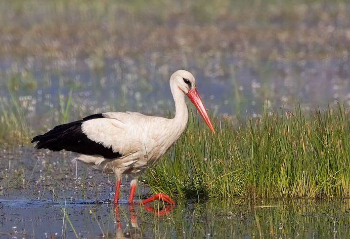
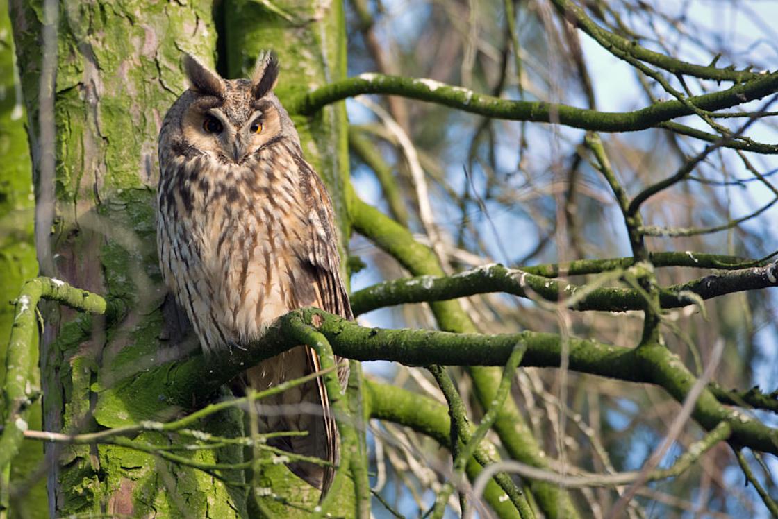
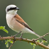
The starting point is the municipal office of Apetlon, where one can also pick up a detailed map of the town during opening hours. From here, head east into Quergasse. Before the road becomes narrower, the landmark of Apetlon, the Hufnaglhaus , appears behind an old draw-well. Almost every year, a pair of White Stork nests on the chimney of this approximately 250-year-old light blue house with a Baroque gable. After passing the inn “Zum fröhlichen Arbeiter” (“the cheerful worker”), turn into Rosengasse, the second road on the left. In this quiet side road with overgrown barns, gardens, and patches of fallow land, bird density appears to be particularly high – the songs of many passerines are heard from all directions in spring. Where Rosengasse merges into Söllnergasse, one passes an organic winery with the next storks’ nest, this time on a robinia. Following the course of Söllnergasse for 150 m, one reaches Apetlon’s village pond, which was formerly used as a watering place for horses and as a firewater reservoir (reed roofs!). Though it is mainly used by wild and semi-domesticated Mallard, one can sometimes encounter other visitors from the National Park here as well, such as Black-headed Gull, Yellow-legged Gull, or Common Tern. After circling the pond and maybe stopping off at the little island, the route continues west on Wallernerstraße to the Apetlon cemetery, shortly before the roundabout. In late autumn and winter, the line of thuja trees in the cemetery can be searched for Long-eared Owl, which roost in these dense trees during the day and give themselves away by their regurgitated pellets under the occupied trees. Up to 70 Long-eared Owl have been counted here in particularly harsh winters – in normal winters there are around 20 individuals. The birds should be approached with utmost caution because they can take flight when disturbed and experience stress a lot sooner, even though it may not appear so. Naturally, visitors observing in the cemetery should also be considerate of the town’s inhabitants, who tend to the graves here and come to remember their deceased. Syrian Woodpecker can also be expected around the cemetery, as can Spotted Flycatcher in spring. The route continues across the roundabout into Seeufergasse, where it pays to make a quick detour into the surrounding agricultural landscape: the little patch of forest south of the road out of town hosts Golden Oriole and Eurasian Hoopoe in spring, and the paddocks, meadows, and hedges beyond can be searched for Greylag Goose, meadow-breeding waders, Crested Lark, Eurasian Skylark, European Turtle Dove, and Red-backed Shrike.
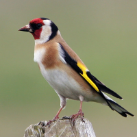
Back in Apetlon, one takes the first turn south along the line of rear entrances to the farms and wineries. The little gardens, hedges, fences, and the patch of forest in the background form a diverse habitat where the typical village species such as Great Spotted Woodpecker, Syrian Woodpecker, White Wagtail, Black Redstart, Song Thrush, Blackcap, Spotted Flycatcher, Golden Oriole, House Sparrow, Eurasian Tree Sparrow, European Serin, Greenfinch, European Goldfinch, and Linnet feel right at home. Now one can either return to the starting point via Quergasse, or one can continue to stroll around the diverse south-east of Apetlon, with its interesting road names such as Krotzengasse and Krotzen.
Terrain and Habitat
City/village , Wetland , Grassland , Steppe , Scattered trees and bushesConditions
Flat , Open landscapeCircular trail
YesIs a telescope useful?
Can be usefulGood birding season
All year roundBest time to visit
SummerRoute
Paved roadDifficulty walking trail
EasyAccessible by
Foot , Bicycle , CarBirdwatching hide / platform
NoExtra info
You can’t get any lower! A little more than 2 km south of Apetlon lies the Tegeluferlacke. Beside this saline lake, at the intersection of two dirt roads, is the lowest measured point in Austria, at 114 m above sea level. In wet years this overgrown body of water is a breeding place for Northern Lapwing, Black-tailed Godwit and Common Redshank.


 ) to insert bird names in your own language. The birdnames will automatically be translated for other users!