
Description
Aggol Lake national park in western-central Azerbaijan, near the town of Agjabadi, comprises a vast lake surrounded by steppe and semi-desert. The lake formed as a result of flooding of the Kura and Araz, Azerbaijan’s two major rivers, and is a haven for birds all year round. Home to over 140 bird species, the park’s global significance is highlighted by its inclusion on the Ramsar List of the Convention on Wetlands of International Importance in 2001. The name Aggol, which means “White Lake” in Azerbaijani, comes from the white plumage of birds found all along the shoreline. Besides birds, there are gazelles, wolves, reed cats, foxes, wild boar, snakes, turtles and various other interesting animals.
Aggol is a little far from main attractions, however about 50km north of nearby Agjabadi town is the small city of Barda, famous as the former capital of the ancient state of Caucasian Albania. Located on the Terter river, Barda today is a much quieter place but you can visit several historical attractions, including the elegant Juma Mosque, 19th-century Imamzadeh religious complex and the ornately tiled Barda Mausoleum built in 1322.
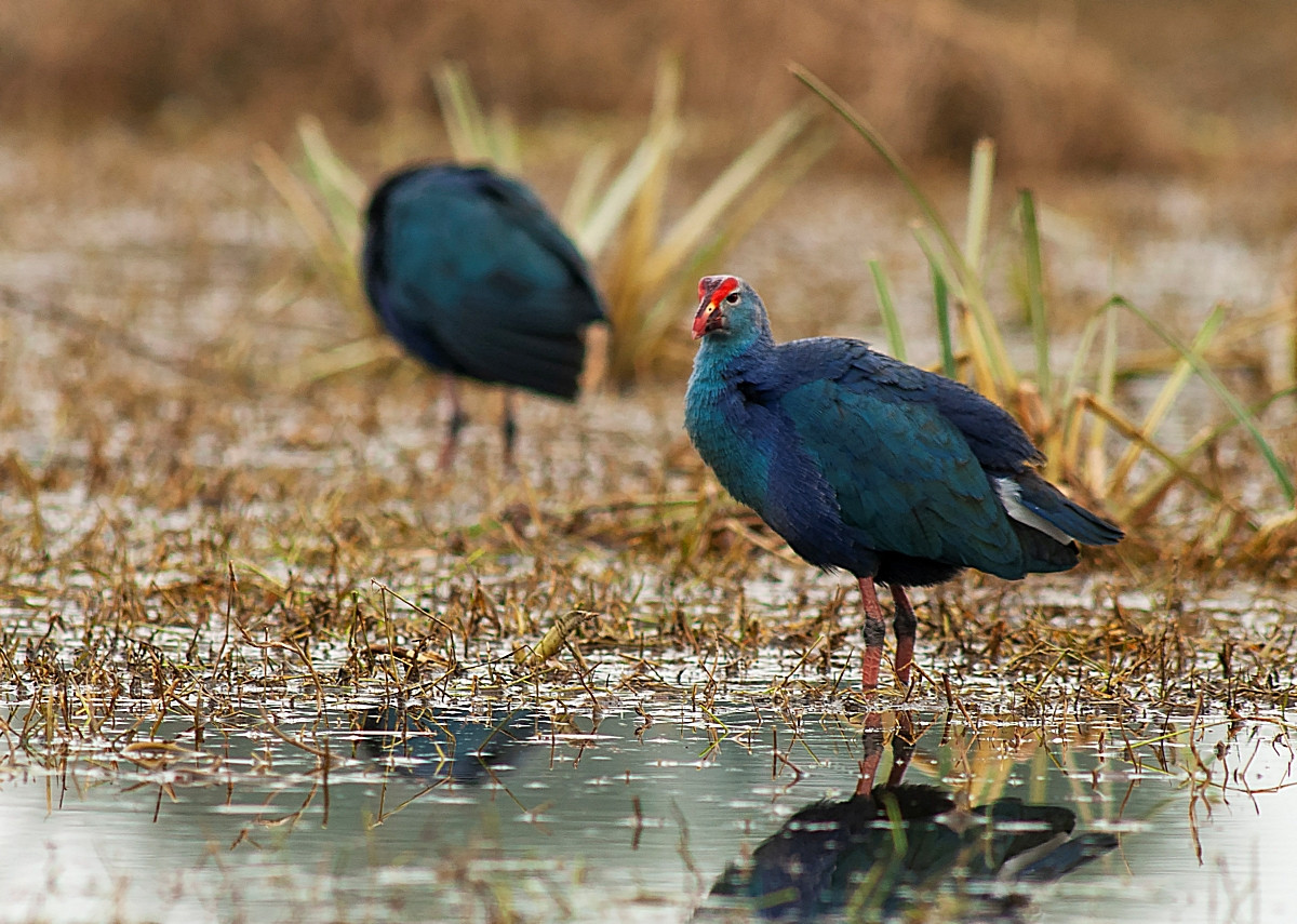
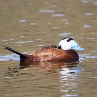
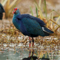
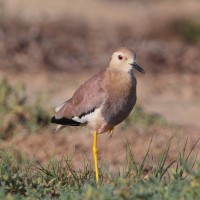
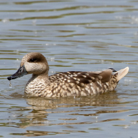
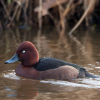
Target species in winter: Purple Swamphen, White-headed Duck, White-tailed Lapwing and European Golden Plover. In summer: Marbled Teal, Ferruginous Duck and Pallid Harrier. Best time to visit: Late autumn to late spring.
Details
Access
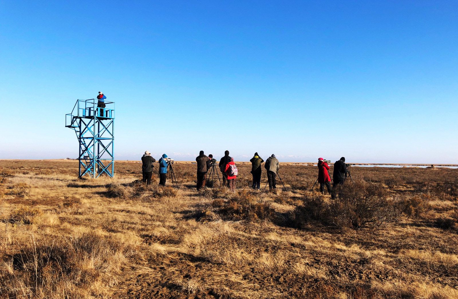
The National Park is located a few km from the road from Agjabadi to Beylagan. The entrance is located 22 km from the center of Agjabadi District. To get to the lake, after passing the entrance of Garadolag village on the Mingachevir-Bahramtepe (R18) highway (in the direction of Bahramtepe) for 1.6 km, it is necessary to go 7 km to the left by road. A signboard has been placed on the main highway at the point of the turnoff to the National Park. Visitors can join a walking tour to explore the area.
Terrain and Habitat
City/village , River , Grassland , Scattered trees and bushes , Steppe , Lake , Wetland , ReedbedsConditions
Wet , Open landscapeCircular trail
NoIs a telescope useful?
Can be usefulGood birding season
Spring , AutumnBest time to visit
Autumn , SpringRoute
Unpaved road , Narrow trailDifficulty walking trail
Average walkAccessible by
Foot , CarBirdwatching hide / platform
YesExtra info
Aggol is located below sea level. It was formed mainly as a result of regular floods of the Kura and Araz rivers. The territory of the National Park includes dry semi-desert and wetland ecosystems. White Lake is one of the most important places for nesting and wintering of waterfowl.
 ) to insert bird names in your own language. The birdnames will automatically be translated for other users!