Description
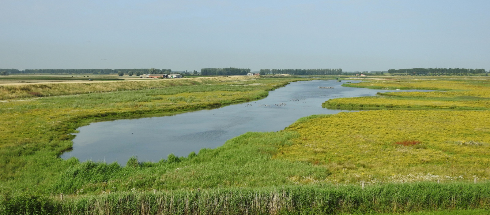
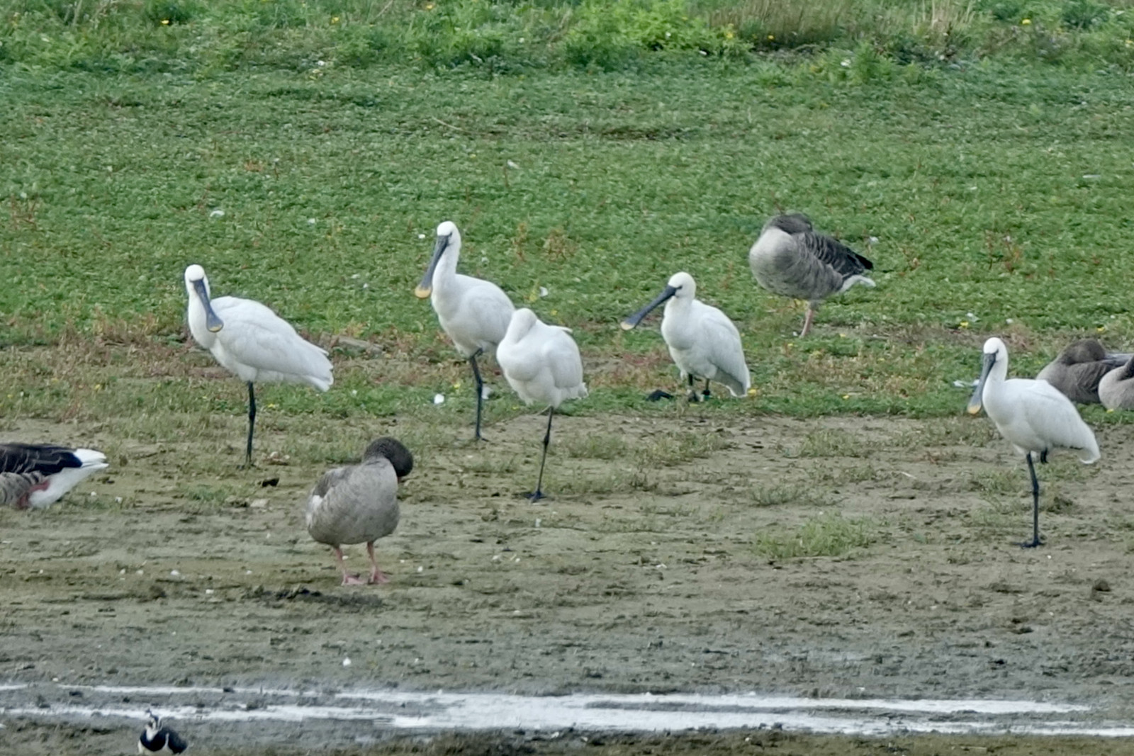
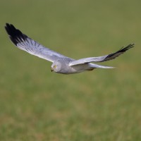
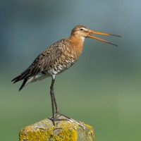
The Doelpolder is a wetland with open water, breeding islands and is primarily a nature reserve for meadow birds and water birds. A lock in the Scheldedijk allows a limited amount of brackish water in the Doelpolder, creating a light-salt tidal creek of 36 hectares. Countless meadow birds such as the Black-tailed Godwit, Garganey and the Common Redshank find a suitable breeding area here. In the winter you can see waders, ducks and geese perching for food. From the dyke you have a good view of this salt marsh area. Nice birds you can see here are Eurasian Spoonbill, Spotted Redshank, Peregrine Falcon, Western Marsh Harrier, Hen Harrier, Mediterranean Gull and Eurasian Curlew.
_________________________
Nederlands: De Doelpolder is een waterrijk gebied met open water, broedeilanden en is vooral een natuurgebied voor weidevogels en watervogels. Een sluis in de Scheldedijk laat een beperkte hoeveelheid brak water in de Doelpolder toe, waardoor een lichtzoute getijdenkreek van 36 hectare ontstaat. Talloze weidevogels zoals de Black-tailed Godwit, Garganey en de Common Redshank vinden hier een geschikt broedgebied. In de winter zie je steltlopers, eenden en ganzen neerstrijken. Vanaf de dijk heb je goed zicht op dit kweldergebied. Leuke vogels die je hier kunt zien zijn Eurasian Spoonbill, Spotted Redshank, Peregrine Falcon, Western Marsh Harrier, Hen Harrier, Mediterranean Gull en Eurasian Curlew.
Details
Access
The Doelpolder is located approximately 20 km north of Antwerp on the border with the Netherlands. A handy parking is the small parking lot (which can be muddy and wet) on the Oostlangeweg on the south side of the polder between the two bird watching screens. From there you can quickly walk to the bird watching screens and you can also view the area beautifully from the Oostlangeweg itself. Parking is also possible at the Prosperpolder information point. Click on a P on the map for directions to a parking lot.
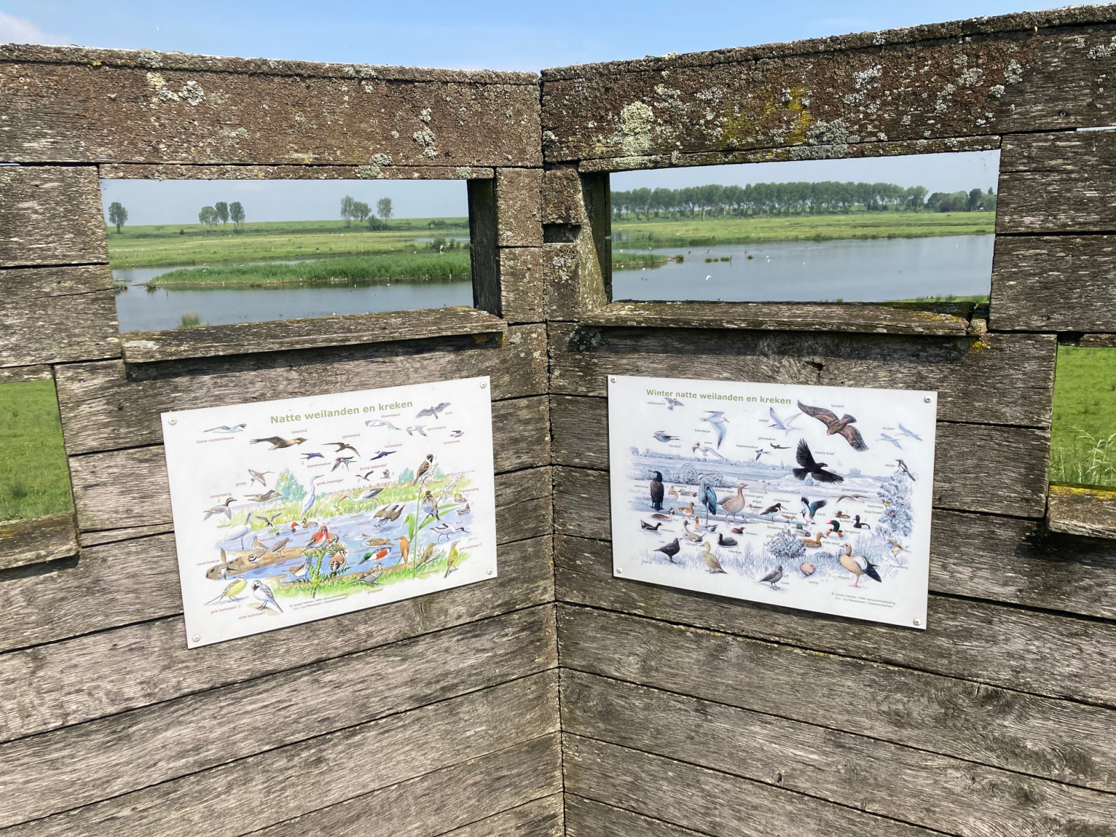
From the dikes surrounding the area you have a good view of the polder. Except from the path on the south side of the area that runs underneath the dike. The advantage of this is that when you walk up the stairs to the bird watching screen, the birds are not disturbed and can be viewed beautifully. The best light at the bird watching screens is in the morning when you have the sun at your back. A circular walk around the entire polder is approximately 5 km. You can also shorten the walk by half by walking via the Oostlangeweg.
_________________________
Nederlands: De Doelpolder ligt ongeveer 20 km ten noorden van Antwerpen tegen de grens met Nederland. Handige parkeerplaats is de kleine parkeerplaats (die modderig en nat kan zijn) aan de Oostlangeweg aan de zuidkant van de polder tussen de twee vogelkijkschermen. Van daaruit loop je snel naar de vogelkijkschermen en kun je het gebied ook mooi bekijken vanaf de Oostlangeweg zelf. Parkeren kan ook bij het infopunt Prosperpolder. Klik op een P in de kaart voor een routebeschrijving naar een parkeerplaats.
Vanaf de dijken rondom het gebied heb je zicht op de polder. Behalve dan vanaf het pad aan de zuidkant van het gebied dat onderlangs de dijk langs vogelkijkschermen loopt en waar je tegen de dijk aankijkt. Voordeel daarvan is wel dat als je dan het trapje op loopt naar het vogelkijkscherm, de vogels niet zijn verstoord en mooi zijn te bekijken. Het beste licht bij de vogelkijkschermen heb je in de ochtend als je de zon in de rug hebt. Een rondwandeling rondom de hele polder is ongeveer 5 km. Je kunt ook de wandeling ook met de helft inkorten door via de Oostlangeweg te lopen.
Terrain and Habitat
WetlandConditions
FlatCircular trail
YesIs a telescope useful?
Can be usefulGood birding season
All year roundBest time to visit
SpringRoute
Paved road , Unpaved roadDifficulty walking trail
Average walkAccessible by
FootBirdwatching hide / platform
YesExtra info
A visit to the Doelpolder can easily be combined with a visit to the adjacent Prosperpolder, and the Hedwigepolder just across the border in the Netherlands, both described on Birdingplaces.
_________________________
Nederlands: Een bezoek aan de Doelpolder is gemakkelijk te combineren met een bezoek aan de aangrenzende Prosperpolder, en de net over de grens in Nederland gelegen Hedwigepolder, allebei beschreven op Birdingplaces.
.jpg)
 ) to insert bird names in your own language. The birdnames will automatically be translated for other users!