
Description
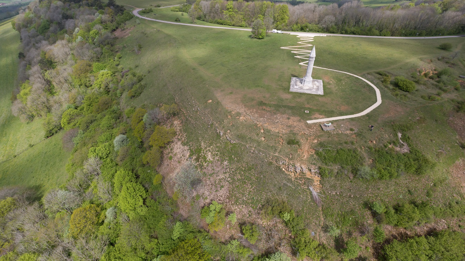
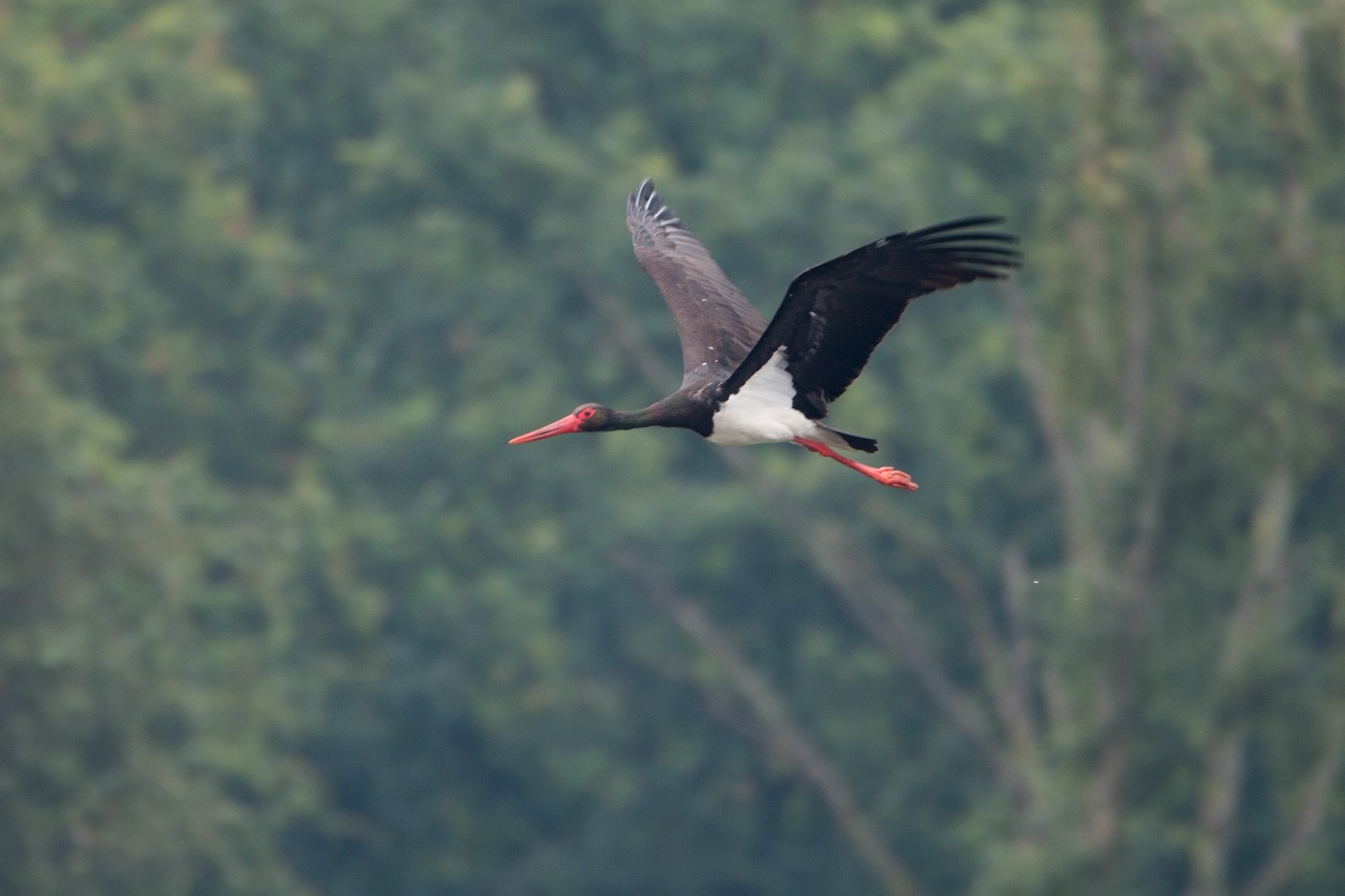
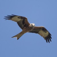
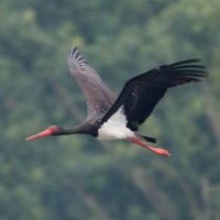
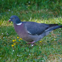
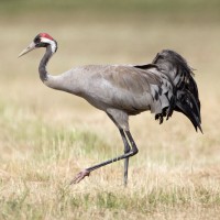
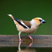
The hill of Colline de Sion rises to an altitude of 540 meters, making it the highest point in the area. Because of its geographical location on an important migratory axis, the hill is an ideal point to observe the migration of birds. From the end of summer and throughout autumn, many bird species cross Lorraine. Most numerous species in autumn are Common Chaffinch, Brambling, Hawfinch, Eurasian Siskin and especially Common Wood Pigeon. Also good chances on Common Crane, Red Kite, Black Stork and many other bird species in lower numbers.
_________________________
Français: La colline de Sion, ou colline de Sion-Vaudémont, est une colline située dans le pays du Saintois, dans le sud du département de Meurthe-et-Moselle, en région Grand Est. Elle culmine à une altitude de 540 mètres, ce qui en fait le point le plus élevé du relief des côtes de Moselle. A partir de la fin de l’été et durant tout l’automne, ce sont de nombreuses espèces, pinsons, pigeons ramiers, rapaces et autres cigognes noires qui traversent la Lorraine, un axe migratoire important. La colline de Sion, par sa situation géographique, est un observatoire idéal pour découvrir la migration des oiseaux.
Details
Access
The hill of Sion (Meurthe-et-Moselle) is located 30 km south of Nancy. Access to the hill from Praye and Forcelles-Saint-Gorgon is provided by the D50E departmental road, a narrow and winding road down the hill to the east. From the south-west and the village of Vaudémont, the D53 departmental road accesses Saxon-Sion. Finally, to the northwest, a communal road of Chaouilley allows access to the hill. Click on the P in the map to get directions.
_________________________
Français: L'accès à la colline depuis Praye et Forcelles-Saint-Gorgon est assuré par la route départementale D50E, voie étroite et sinueuse descendant la colline vers l'est. Par le sud-ouest et le village de Vaudémont, la route départementale D53 accède à Saxon-Sion. Enfin, au nord-ouest, une voie communale de Chaouilley permet l'accès à la colline. Cliquez sur le P sur la carte pour obtenir les directions.
 ) to insert bird names in your own language. The birdnames will automatically be translated for other users!