Description
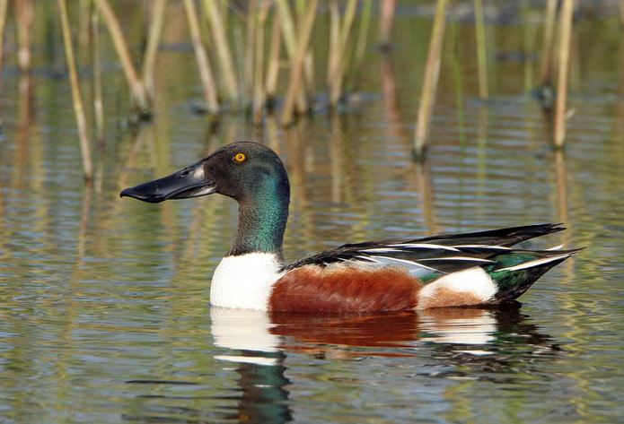
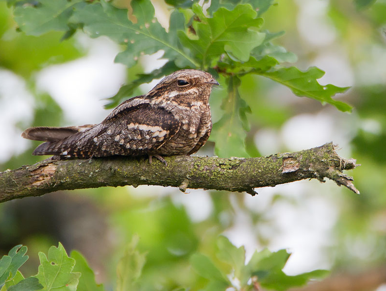
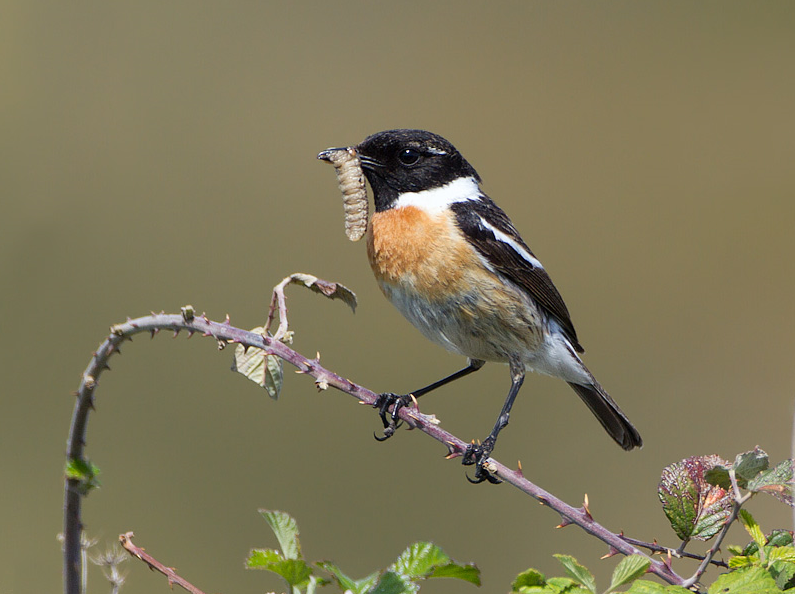
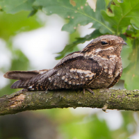
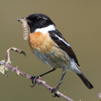
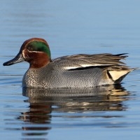
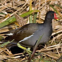
Former sand quarry Lac des Bruyères has two trails (including one accessible to people with reduced mobility) that allow you to discover the area. In addition to landscapes and rich flora, this site has many wintering birds. Among the birds you can encounter are Common Shelduck, Northern Shoveler, Eurasian Teal, Eurasian Coot, Eurasian Moorhen, Great Crested Grebe, Common Cuckoo and Great Cormorant. In the heather and gorse European Stonechat, Linnet, Yellowhammer and Eurasian Nightjar can be observed.
_________________________
Français: Ce site de 30 hectares de landes de bruyères et d'ajoncs, dont 10 hectares de plan d'eau, est parfait pour prendre l'air et observer quelques oiseaux. 2 sentiers s'offrent à vous (dont un accessible aux personnes à mobilité réduite) et permettent de découvrir les senteurs de la flore, les bruits et traces de la faune locale à l'aide de pupitres ludiques. En plus de paysages et d'une flore riche, ce site permet d'apercevoir des oiseaux hivernant et autres oiseaux d'eau. On y trouve également des engoulevents.
Details
Access
The lake is located 5 km to the east of Lessay. Click on the P in the map for directions to the parking of Lac des Bruyères. You will arrive at a very well laid out car park. Access by bike from Lessay can be done for the bravest. The use of other means of transport is complicated. The circular walking route indicated on the map is about 2 km.
_________________________
Français: Le lac est situé à 5 km à l'est de Lessay. Cliquez sur le P de la carte pour vous rendre au stationnement du Lac des Bruyères. En suivant votre GPS jusqu'au Lac des Bruyères, vous arriverez sur un parking très bien aménagé. L'accès à vélo depuis Lessay peut se faire pour les plus courageaux. L'utilisation d'autre moyen de locomotion est compliquée. L'itinéraire pédestre circulaire indiqué sur la carte est d'environ 2 km.
 ) to insert bird names in your own language. The birdnames will automatically be translated for other users!