Beskrivning
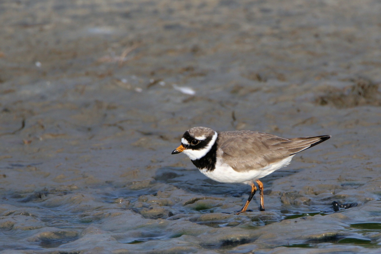
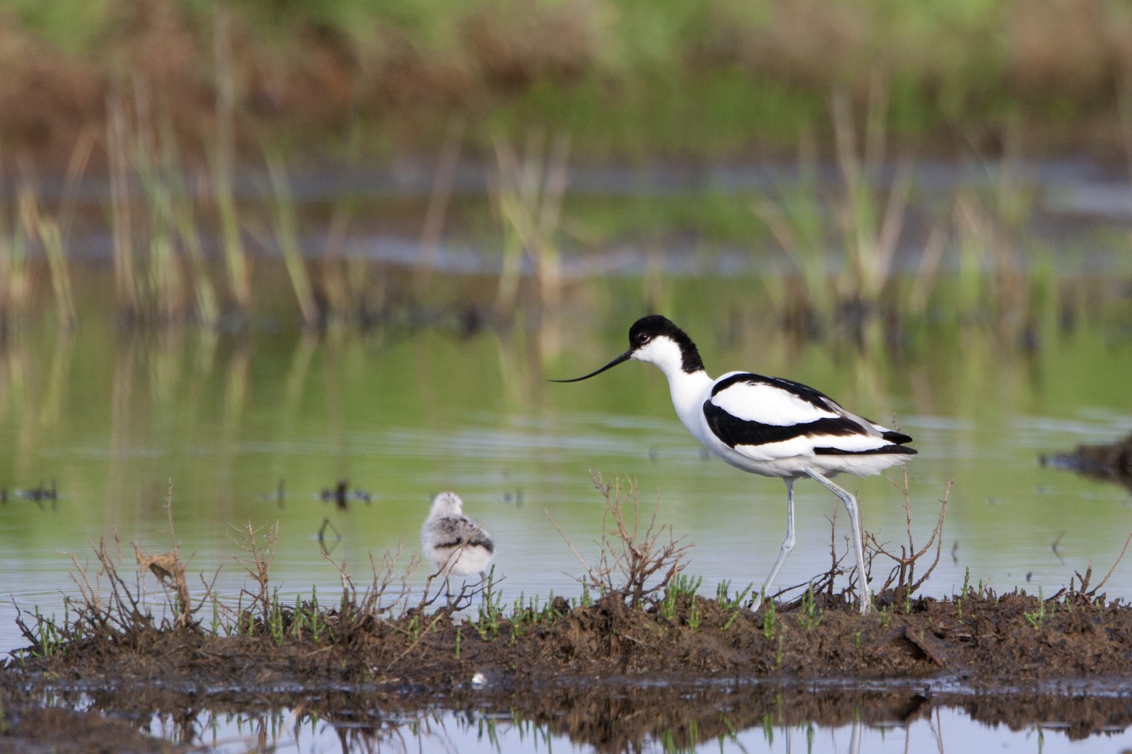
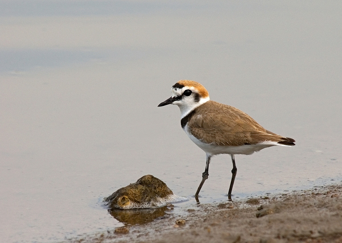
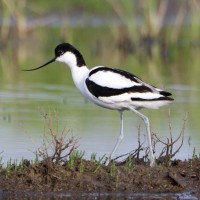
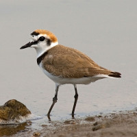
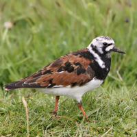
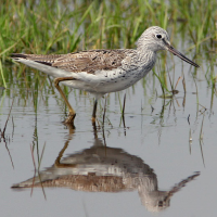
At low tide, the La Mer Blanche area becomes very muddy, attracting numerous birds such as roskarl, drillsnäppa, strandskata, större strandpipare, svartbent strandpipare, skärfläcka and storspov. The beginning of the La Mer Blanche, on the other hand, is a wide area of marshland covered with lush grasses and dotted with small streams, attracting skedstork, ägretthäger, Silkeshägerand gråhäger. It should be noted that La Mer Blanche is partially protected by fencing in the muddy section, but not at the beginning of the path. It is therefore less common to observe birds there during peak periods due to dogs often running off-leash.
_________________________
Français: Long bras de mer s'enfonçant dans les terres en de multiples cours d'eau. L'ensemble est accessible par une bande de sable reliée à la terre à l'ouest. À marée basse, le secteur devient très vaseux, attirant alors de nombreux oiseaux comme des roskarl, drillsnäppa, strandskata, större strandpipare, svartbent strandpipare, skärfläcka ou encore des storspov. Le début de la mer blanche est, en revanche, une large zone de marais recouerts d'herbes grases et parsemé de petits cours d'eau ce qui attire skedstork, ägretthäger, Silkeshäger et autres gråhäger. Enfin, un accès direct à la mer est possible et donc aux oiseaux adaptés, bien qu'ils soient au final assez peu nombreux compte tenu de la fréquentation du lieu.
À noter que la mer blanche est en partie protégée par des ganivelles, sur le secteur vaseux mais ne l'est pas pour le début du cheminement. Il est donc moins fréquent d'y observer des oiseaux en période de haute fréquentation en raison des chiens souvent sans laisses.
Detaljer
Tillgänglighet
La Mer Blanche is located between the towns of Fouesnant and Bénodet in southern Brittany. Multiple parking areas are available in the western part of the site. Press P on the map for directions to a parking. The site is only accessible on foot. Be aware that parking spaces can be difficult to find, as it's a fairly popular spot, even in winter. The walking route shown on the map is about 3 km one way.
_________________________
Français: De multiples parkings existent dans la partie ouest de la zone mais il est aussi possible de se garer en ville bien que la zone vraiment intéressante soit alors plus loin (environ 15 minutes de marche). Le site est accessible uniquement à pied. Attention car les places peuvent être plus difficiles a obtenir etant donné que c'est un lieu assez fréquenté, même en hiver. L'itinéraire pédestre indiqué sur la carte fait environ 3 km aller simple.
 ) Lägg till fågelnamen på ditt egna språk, namnen kommer automatiskt översättas till andra användare.