Beskrivning
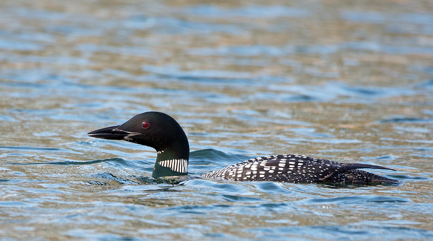
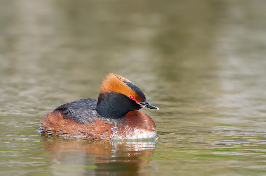
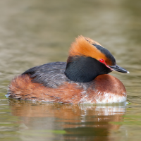
The twin villages of Higher Porthpean and Lower Porthpean now just called Porthpean and the headland of Black Head give views over the South facing sheltered St Austell Bay. Whilst there are landbirds throughout the year, the area comes into it's own during Spring/Autumn migration and especially during Winter when the bay can hold svartnäbbad islom, storlom, svarthakedopping and occasionally smålom. NOTE: due to having to look East, an afternoon visit to prevent low Winter sun 'glare' is best, overcast skies and calm water helps with identifying birds on the water.
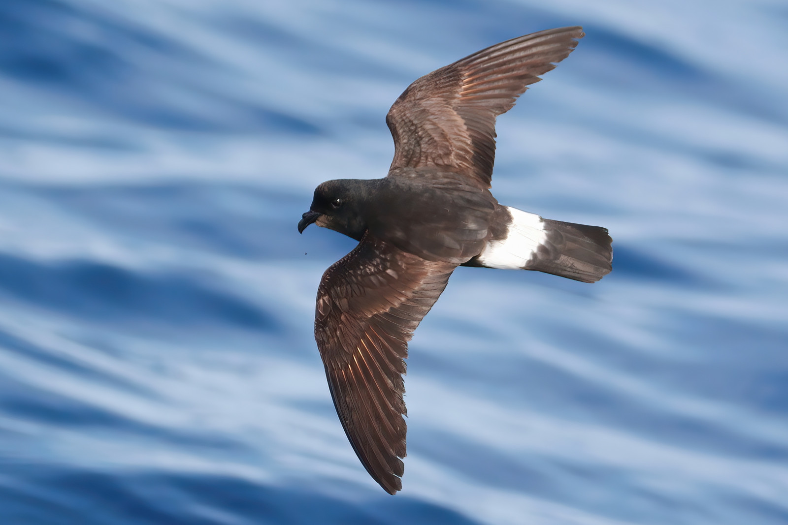
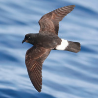
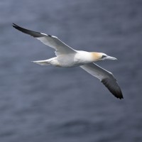
For those with more time a walk further South to Black Head, possibly calling in at Ropehaven Cliffs Nature Reserve (Cornwall Wildlife Trust), at Black Head (seawatching) look for passing havssula, stormfågel, sillgrissla, tordmule, silvertärna, fisktärna and possibly lunnefågel.
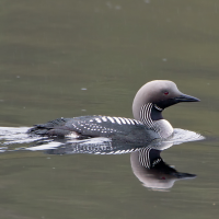
This area is always worth checking out, in the past vitnäbbad islom, brednäbbad simsnäppa, alkekung and vitnackad svärta have been seen.
Detaljer
Tillgänglighet
The main A390 road runs from Dobwalls (A38) near Liskeard (far to the North East) and Truro (further to the South West). If traveling from Dobwalls/Liskeard direction on A390, pass through the town of Lostwithiel, at the town of St Austell pass through the town (onA390), on reaching large roundabout at Mount Charles take second exit signed Truro A390 (A39)/Newquay (A3058). Continue on A390 and take Left turn at traffic lights signed Tregorrick Leisure Center/Little Harbour/Porthpean Golf Course/Mount Edgecumbe Hospice, (*A) continue on this road (Porthpean Road). At next roundabout take first exit, on leaving built up area turn Left signed Porthpean Beach, this road now called Porthpean Beach Road (Press STAR on map) soon narrows, eventually arriving at Porthpean Beach car park (Fee Payable) on the Right.
If traveling from Truro direction on A390, on entering St Austell pass through double roundabout staying on A390, at next roundabout take second exit signed Liskeard (A390), get in middle lane and turn Right at traffic lights signed Porthpean/Duporth/Mount Edgecumbe Hospice, and follow from (*A) above.
Terräng och habitat
Spridda träd och buskar , Slätt , Hav / ocean , Stad/by , Jordbruk , Strand , Kanjon/klippa , SkogFörhållanden
Kulligt , Klippigt , Öppet landskap , Risk för högvattten , Halt , Sumpigt , PlattRundtur
NejTubkikare behövs?
JaBästa säsong för skådning
Vinter , Höst , VårBästa tid för ett besök
Vinter , Vårsträck , Vår , Höst , HöststräckRutt
Asfalterad väg , Bred stig , Grusväg , Smal stigHur ansträngande vandring
Genomsnittlig vandringNås
Till fots , Cykel , BilFågeltorn / plattform
NejExtra information
The route indicated on the map is about 5 km one way.
 ) Lägg till fågelnamen på ditt egna språk, namnen kommer automatiskt översättas till andra användare.